Category:Maps of Bayreuth
Jump to navigation
Jump to search
Urban districts (cities): Amberg · Ansbach · Aschaffenburg · Augsburg · Bamberg · Bayreuth · Coburg · Erlangen · Fürth · Hof · Ingolstadt · Kaufbeuren · Kempten · Landshut · Memmingen · Munich · Nuremberg · Passau · Regensburg · Rosenheim · Schweinfurt · Straubing · Weiden in der Oberpfalz · Würzburg
Deutsch: Karten und Pläne der Stadt Bayreuth
Wikimedia category | |||||
| Upload media | |||||
| Instance of | |||||
|---|---|---|---|---|---|
| Category combines topics | |||||
| Bayreuth | |||||
medium-sized town in northern Bavaria, Germany | |||||
| Instance of |
| ||||
| Part of |
| ||||
| Location | |||||
| Located in or next to body of water | |||||
| Street address |
| ||||
| Head of government |
| ||||
| Population |
| ||||
| Area |
| ||||
| Elevation above sea level |
| ||||
| Different from | |||||
| official website | |||||
 | |||||
Media in category "Maps of Bayreuth"
The following 44 files are in this category, out of 44 total.
-
111 of 'Die Hohenzollern und das Reich, etc' (11169059014).jpg 2,592 × 1,697; 1.1 MB
-
Die fraenkischen Fuerstenthuemer.jpg 1,414 × 1,435; 827 KB
-
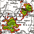
Ansbach-Bayreuth 1792.png 1,180 × 825; 590 KB
-
Ansbach-Bayreuth 1805.png 1,180 × 825; 498 KB
-
Ansbach-Bayreuth.png 361 × 359; 44 KB
-
Bayreuth - Hofgarten (Karte 01).jpg 1,576 × 990; 307 KB
-
Bayreuth - Hofgarten (Karte 02, Legende).jpg 392 × 870; 85 KB
-
Bayreuth 11.09.09 Stadtentwicklungskarte, Spitalhof.jpg 4,616 × 2,870; 1.93 MB
-
Bayreuth auf Deutschlandkarte.png 140 × 175; 10 KB
-
Bayreuth Juedischer Friedhof Uraufnahme Bayern.jpg 1,080 × 720; 707 KB
-
Bayreuth Kreuz map12.PNG 994 × 625; 359 KB
-
Bayreuth Kreuzstein map before 1864.png 1,037 × 704; 285 KB
-
Bayreuth um 1875.JPG 1,006 × 1,184; 602 KB
-
Bayreuth Wandern.jpg 3,324 × 3,028; 2.95 MB
-
Bayreuth Zerstörung.jpeg 2,544 × 3,340; 2.6 MB
-
Bayreuth-Thiergarten.png 597 × 529; 245 KB
-
BayreuthMap.png 2,997 × 2,395; 1.59 MB
-
BayreuthMap.svg 1,715 × 1,216; 244 KB
-
BayreuthPlan.png 784 × 529; 180 KB
-
BT (St) in Bayern.svg 1,227 × 1,236; 311 KB
-
Dürschnitz map before 1864.PNG 706 × 486; 361 KB
-
Dürschnitz map.PNG 716 × 560; 195 KB
-
Flurkarte Oberpreuschwitz (1850).png 935 × 639; 186 KB
-
Fsm-Bayreuth 1791.png 1,180 × 825; 448 KB
-
Fsm-Bt-Oberland 1791.png 1,180 × 825; 464 KB
-
Fsm-Bt-Unterland 1791.png 1,180 × 825; 463 KB
-
Hohe Warte Bayreuth.PNG 836 × 562; 208 KB
-
Hugo49-lageplan-2021-stand-1024x537-1.jpg 1,024 × 537; 34 KB
-
Höhenzug Hohe Warte.png 1,200 × 911; 2.2 MB
-
Karte bayreuth in deutschland.png 188 × 235; 5 KB
-
Karte Forst Sankt Georgen.png 1,200 × 911; 2.19 MB
-
Karte von und um Bayreuth 20230627 HOF03256 RAW-Export.png 9,504 × 6,336; 84.11 MB
-
Kasernenviertel Bayreuth Karte.PNG 817 × 561; 296 KB
-
Kreuzstein Map 06.PNG 707 × 539; 217 KB
-
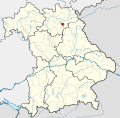
Locator map BT (town) in Bavaria.svg 867 × 855; 1,000 KB
-
Moritzhöfen 1854 map 08.PNG 2,140 × 1,881; 3.94 MB
-
Moritzhöfen map 04.PNG 705 × 561; 145 KB
-
Oberpreuschwitz Map 03.JPG 885 × 484; 77 KB
-
Principado de Bayreuth.png 1,180 × 825; 443 KB
-
Principality of Bayreuth.png 1,180 × 825; 450 KB
-
Principato di Bayreuth.png 1,180 × 825; 447 KB
-
Principaute de Bayreuth.png 1,180 × 825; 451 KB
-
Sendelbach Verlauf 12.PNG 642 × 563; 249 KB
-
Vorstendom Bayreuth.png 1,180 × 825; 449 KB


