Category:Maps of 7th-century Italy
Jump to navigation
Jump to search
Countries of Europe: Bulgaria · France‡ · Greece · Italy · Portugal‡ · Spain‡
‡: partly located in Europe
‡: partly located in Europe
| Preceded by: Maps of 6th-century Italy |
Maps of 7th-century Italy 601 AD-700 AD |
Succeeded by: Maps of 8th-century Italy |
Media in category "Maps of 7th-century Italy"
The following 4 files are in this category, out of 4 total.
-
 194 of '(Italy and her Invaders, Vol. 1-4.)' (11215808445).jpg 2,375 × 2,204; 1.18 MB
-
 394 of '(Italy and her Invaders, Vol. 1-4.)' (11219010023).jpg 1,498 × 2,460; 1.2 MB
-
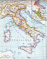 Italien zur Langobardenzeit.jpg 2,036 × 2,584; 1.31 MB
-
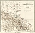
 Maritime Venetia c 600 AD.jpg 1,280 × 823; 335 KB
%27_(11215808445).jpg)
%27_(11219010023).jpg)

