Category:Maps of 7th-century France
Jump to navigation
Jump to search
![]() France 601-700 CE: Maps showing all or a substantial part of the territory of France as it was in the 7th century.
France 601-700 CE: Maps showing all or a substantial part of the territory of France as it was in the 7th century.
| Preceded by: Maps of 6th-century France |
Maps of 7th-century France 601 - 700 CE |
Succeeded by: Maps of 8th-century France |
Media in category "Maps of 7th-century France"
The following 3 files are in this category, out of 3 total.
-
 C. 650 Europe.jpg 1,611 × 1,206; 703 KB
-
 C. 768 Frankish Dominions (486-768).jpg 3,890 × 3,010; 3.66 MB
-
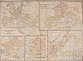 Atlas of European history (1909) (14597297739).jpg 2,170 × 1,600; 832 KB

.jpg)
_(14597297739).jpg)