Category:Maps of 5th-century Scotland
Jump to navigation
Jump to search
![]() Scotland 401-500 CE: Maps showing all or a substantial part of the territory of Scotland as it was in the 5th century.
Scotland 401-500 CE: Maps showing all or a substantial part of the territory of Scotland as it was in the 5th century.
| Preceded by: Maps of 4th-century Scotland |
Maps of 5th-century Scotland 401 - 500 CE |
Succeeded by: Maps of 6th-century Scotland |
Media in category "Maps of 5th-century Scotland"
The following 4 files are in this category, out of 4 total.
-
 Britain.5th.cen.AS.cemeteries.jpg 2,982 × 3,302; 918 KB
-
 C. 410 Britannia.jpg 1,025 × 1,358; 1.56 MB
-
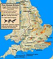
 End.of.Roman.rule.in.Britain.383.410.jpg 2,582 × 3,220; 1,010 KB
-
 North.Sea.Periphery.250.500.jpg 2,031 × 2,463; 820 KB


