Category:Maps of 3rd-century Scotland
Jump to navigation
Jump to search
![]() Scotland 201-300 CE: Maps showing all or a substantial part of the territory of Scotland as it was in the 3rd century.
Scotland 201-300 CE: Maps showing all or a substantial part of the territory of Scotland as it was in the 3rd century.
| Preceded by: Maps of 2nd-century Scotland |
Maps of 3rd-century Scotland 201 - 300 CE |
Succeeded by: Maps of 4th-century Scotland |
Media in category "Maps of 3rd-century Scotland"
The following 5 files are in this category, out of 5 total.
-
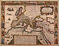 A New Map of The Roman Empire, 1651.jpg 6,230 × 4,867; 5.73 MB
-
 Butler Britania.jpg 2,022 × 2,506; 1.69 MB
-
 North.Sea.Periphery.250.500.jpg 2,031 × 2,463; 820 KB
-
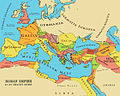 Roman Empire full - Referenced.jpg 1,116 × 893; 303 KB
-
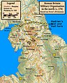 Roman.Britain.north.270.jpg 1,715 × 2,132; 594 KB


