Category:Maps of 2nd-century Europe
Jump to navigation
Jump to search
| Preceded by: Maps of 1st century Europe |
Maps of 2nd century Europe 101 AD-200 AD |
Succeeded by: Maps of 3rd century Europe |
Subcategories
This category has only the following subcategory.
Media in category "Maps of 2nd-century Europe"
The following 6 files are in this category, out of 6 total.
-
 02019 1242 (2) Map of Europe in the 2nd century, Ptolomy by Vana, Gąssowski, 1988.jpg 2,331 × 1,535; 632 KB
-
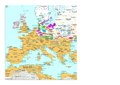 Europe en 100.pdf 1,752 × 1,239; 563 KB
-
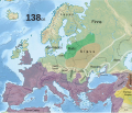 138 CE, Europe.svg 512 × 438; 1.74 MB
-
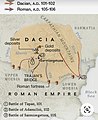 Dacia after 100 AD..jpg 1,080 × 1,324; 290 KB
-
 Imperium Romanum Germania.png 700 × 491; 203 KB
-
 Roemischeprovinzentrajan.png 1,218 × 730; 307 KB
_Map_of_Europe_in_the_2nd_century,_Ptolomy_by_Vana,_G%C4%85ssowski,_1988.jpg)


