Category:Maps showing 2nd-century history
Jump to navigation
Jump to search
| Preceded by: 1st century maps |
2nd century maps 101 AD-200 AD |
Succeeded by: 3rd century maps |
Subcategories
This category has the following 5 subcategories, out of 5 total.
Media in category "Maps showing 2nd-century history"
The following 25 files are in this category, out of 25 total.
-
Alter Orient 0200AD.svg 2,102 × 1,510; 4.73 MB
-
Anatolia 264.jpg 823 × 513; 191 KB
-
Antonine.Wall.Roman.forts.jpg 1,513 × 778; 257 KB
-
Arsacid (Arshakouni) Armenia, 63-299 A.D..png 700 × 473; 63 KB
-
Asia 200ad.jpg 1,910 × 1,209; 758 KB
-
Britain.north.peoples.Ptolemy.jpg 1,899 × 2,758; 630 KB
-
Britain.south.peoples.Ptolemy.jpg 2,760 × 3,035; 996 KB
-
Caereni. Carte-os-rb.jpg 567 × 263; 75 KB
-
Carte monde Maya +100+200 HD.jpg 3,072 × 2,287; 834 KB
-
Eastern Mediterranean 125 political map eastern med.svg 1,101 × 1,000; 3.24 MB
-
Eurasia in 2nd Century.png 1,096 × 689; 330 KB
-
Heinrich Kiepert. Imperia Persarum et Macedonum. 1903 (CA).jpg 1,283 × 653; 666 KB
-
Imperium Romanum Germania-ar.png 700 × 491; 182 KB
-
Karte Rom unter Augustus MKL1888.png 713 × 549; 121 KB
-
Roemischeprovinzentrajan.png 1,218 × 730; 307 KB
-
Roman Empire Trajan 116AD.png 2,534 × 1,540; 266 KB
-
Roman.Britain.north.130.jpg 1,553 × 2,275; 587 KB
-
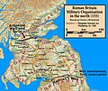
Roman.Britain.north.155.jpg 1,719 × 1,564; 424 KB
-
Roman.Britain.north.180.jpg 1,697 × 2,132; 599 KB
-
Roman.Scotland.north.130.jpg 2,203 × 1,913; 532 KB
-
Roman.Scotland.north.155.jpg 2,223 × 1,865; 562 KB
-
Roman.Scotland.north.180.jpg 2,203 × 1,881; 535 KB
-
Transcaucasia 2nd BC-ar.png 982 × 772; 445 KB
-
Transcaucasia 2nd BC.jpg 982 × 772; 232 KB


