Category:Maps of 20th-century Poland
Jump to navigation
Jump to search
Subcategories
This category has only the following subcategory.
M
Media in category "Maps of 20th-century Poland"
The following 8 files are in this category, out of 8 total.
-
 1920 Belarus Borders.jpg 800 × 604; 225 KB
-
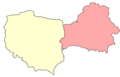 Borders of Poland and Belarus after August 1945.png 1,000 × 638; 47 KB
-
 Borders of Poland and Belarus before August 1945.png 1,000 × 638; 50 KB
-
 Krolpolskie1919kzo.png 782 × 736; 36 KB
-
 Poland administrative division 1975 literki.png 474 × 437; 16 KB
-
 Poland administrative division 1975.png 474 × 437; 16 KB
-
 Territorial changes of Poland 1975.jpg 850 × 700; 172 KB
-
 Varianty Curzonovy linie, tedy východní hranice Polska.png 800 × 880; 250 KB


