Category:Maps of 20th-century Greece
Jump to navigation
Jump to search
| Preceded by: Maps of 19th-century Greece |
Maps of 20th-century Greece 1801 AD-1900 AD |
Succeeded by: |
Subcategories
This category has the following 5 subcategories, out of 5 total.
M
- Maps of the Greek Civil War (2 F)
W
- Maps of World War II in Greece (1 P, 107 F)
Media in category "Maps of 20th-century Greece"
The following 6 files are in this category, out of 6 total.
-
 Albania and Greece, 1967.jpg 4,047 × 2,888; 2.29 MB
-
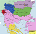 Bałkany 1912.svg 969 × 925; 380 KB
-
 GuerrasBalcánicasLondresYBucarest.svg 1,027 × 1,242; 901 KB
-
 GuerrasBalcánicasLondresYBucarest2 de.svg 965 × 1,455; 1,008 KB
-
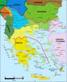
 GuerrasBalcánicasSituaciónPrebélica1912.svg 1,027 × 1,242; 888 KB
-
 Територіальна експансія Греції в 1832-1947рр.png 868 × 624; 228 KB


