Category:Maps of 18th-century India
Jump to navigation
Jump to search
Media in category "Maps of 18th-century India"
The following 13 files are in this category, out of 13 total.
-
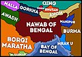 AD 1750 MAP OF NAWABS OF BENGAL.jpg 4,096 × 2,819; 3.65 MB
-
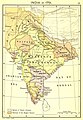 1751 map of India from "Historical Atlas of India", by Charles Joppen.jpg 1,259 × 1,824; 689 KB
-
 India 1760-es.svg 2,151 × 2,546; 2.32 MB
-
 The Collegiate Atlas 1876 (73060544).jpg 4,852 × 6,721; 5.41 MB
-
 Hyder's Dominions in 1780.jpg 320 × 458; 26 KB
-
 NORTHERN INDIA 1780 by hellbat.jpg 669 × 473; 281 KB
-
 Historical atlas of modern Europe 1903 (135895484).jpg 9,177 × 7,160; 61.5 MB
-
 423 of 'Britain and her Rivals in the eighteenth century, 1713-1789' (11231613176).jpg 2,969 × 2,290; 983 KB
-
 425 of 'Britain and her Rivals in the eighteenth century, 1713-1789' (11231254393).jpg 3,027 × 2,310; 1.06 MB
-
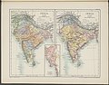
 India in 1700 from "Historical Atlas of India," by Charles Joppen.jpg 600 × 867; 105 KB
-
 Map of First Sikh State.png 1,080 × 1,144; 198 KB
-
 Map of the Maratha Empire 1760.svg 1,486 × 1,734; 170 KB
-
 Maratha Confederacy.svg 1,639 × 1,852; 552 KB


.jpg)


.jpg)
.jpg)
.jpg)


