Category:Maps of 18th-century Asia
Jump to navigation
Jump to search
Subcategories
This category has the following 2 subcategories, out of 2 total.
A
- Maps of 18th-century India (14 F)
P
Media in category "Maps of 18th-century Asia"
The following 24 files are in this category, out of 24 total.
-
 Qing Dynasty 1760.jpg 2,702 × 2,400; 1.08 MB
-
 Zunghar Khanate at 1760.jpg 495 × 553; 99 KB
-
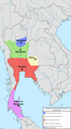 1767 Separate Factions of Siam.png 665 × 1,197; 386 KB
-
 1768 Separate Factions of Siam.png 1,000 × 1,800; 346 KB
-
 1769 Separate Factions of Siam.png 1,000 × 1,800; 336 KB
-
 1770 Separate Factions of Siam.png 1,000 × 1,800; 325 KB
-
 AthiWungyiWar.jpg 562 × 927; 178 KB
-
 Bangkaeofinal.jpg 632 × 1,003; 206 KB
-
 Chiangmai1774.jpg 674 × 1,005; 245 KB
-
 Siam in 1774.png 1,000 × 1,800; 368 KB
-
 Thonburi Kingdom in 1774.png 1,000 × 1,800; 345 KB
-
 Siam in 1777.png 1,000 × 1,800; 368 KB
-
 Thonburi Kingdom in 1777.png 1,000 × 1,800; 345 KB
-
 Siam in 1778.png 1,000 × 1,800; 367 KB
-
 Thonburi Kingdom in 1778.png 1,000 × 1,800; 323 KB
-
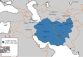
 Caucasus map 1799.png 3,919 × 3,253; 5.85 MB
-
 Burmese-Siamese War (1759-1760).png 1,000 × 1,800; 403 KB
-
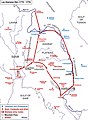
 Burmese-Siamese War (1775-1776).png 1,000 × 1,800; 369 KB
-
 Burmese-Siamese War (1797-1798).png 2,000 × 3,600; 911 KB
-
 Hotakid-Dynasty-1728.png 620 × 429; 232 KB
-
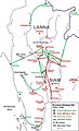
 Laosiam2.jpg 696 × 950; 280 KB
-
 Map of Bushire 1750s.png 2,000 × 2,091; 214 KB
-
 Ninearmieswar.jpg 421 × 931; 129 KB
-
 Tavoywars.jpg 602 × 918; 157 KB


.png)
.png)
.png)


