Category:Maps of 13th-century Scotland
Jump to navigation
Jump to search
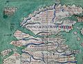
![]() Scotland 1201-1300 CE: Maps showing all or a substantial part of the territory of Scotland as it was in the 13th century.
Scotland 1201-1300 CE: Maps showing all or a substantial part of the territory of Scotland as it was in the 13th century.
| Preceded by: Maps of 12th-century Scotland |
Maps of 13th-century Scotland 1201 - 1300 CE |
Succeeded by: Maps of 14th-century Scotland |
Media in category "Maps of 13th-century Scotland"
The following 4 files are in this category, out of 4 total.
-

-
 Putz82.jpg 741 × 681; 103 KB
-
 Scotland from the Matthew Paris map, c.1250.jpg 522 × 399; 103 KB
-
 Scotland.south.c1200.regions.languages.jpg 2,243 × 2,169; 541 KB
%27_(11126605176).jpg)


