Category:Maps of 12th-century France
Jump to navigation
Jump to search
![]() France 1101-1200 CE: Maps showing all or a substantial part of the territory of France as it was in the 12th century.
France 1101-1200 CE: Maps showing all or a substantial part of the territory of France as it was in the 12th century.
| Preceded by: Maps of 11th-century France |
Maps of 12th-century France 1101- 1200 CE |
Succeeded by: Maps of 13th-century France |
Subcategories
This category has only the following subcategory.
*
Media in category "Maps of 12th-century France"
The following 62 files are in this category, out of 62 total.
-
 The Normans in Europe (1877) (14588061457).jpg 1,563 × 1,977; 603 KB
-
 C. 1150 France, Lotharingia and Burgundy.jpg 2,979 × 3,931; 4.77 MB
-
 Atlas of European history (1909) (14783970095).jpg 2,282 × 3,638; 1.57 MB
-
 France 1154 Eng.jpg 1,225 × 1,547; 711 KB
-
 France 1154-fr.png 1,226 × 1,551; 68 KB
-
 France 1154-fr.svg 1,405 × 1,675; 529 KB
-
 France 1154.jpg 1,241 × 1,755; 547 KB
-
 France 12thC.jpg 968 × 1,541; 497 KB
-
 Bourbonnais 12. Jh.png 557 × 494; 141 KB
-
 Burgund 12. Jh.png 1,792 × 1,471; 1,006 KB
-
 Frankreich 12. Jh (ohne Süd).png 2,607 × 2,640; 2.41 MB
-
 Frankreich 12. Jh 2021-08-03.png 2,607 × 2,640; 2.47 MB
-
 Frankrike och england 1180.jpg 952 × 1,785; 695 KB
-
 Krondomäne 12. Jh.png 1,054 × 1,017; 481 KB
-
 La France en 1180 (section).png 3,449 × 3,376; 6.88 MB
-
 Map France 1180-fr.svg 988 × 1,124; 1.88 MB
-
 C. 1184 France and English Possesions.jpg 1,328 × 1,305; 2.25 MB
-
 The Plantagenet Dominions in France, 1185 A.D..jpg 628 × 900; 152 KB
-
 A short history of England and the British Empire (1915) (14767184775).jpg 1,888 × 2,668; 953 KB
-
 1200년대 앙주 제국 내 프랑스 영지 (간략화).png 990 × 1,241; 187 KB
-
 Angevin empire in France c. 1200 (he).png 990 × 1,241; 185 KB
-
 387 of 'La France Illustrée- géographie générale ... Par F. J' (11291562536).jpg 1,170 × 1,275; 395 KB
-

-
 Conquetes Philippe Auguste.png 800 × 600; 101 KB
-
 Conquistas de Felipe Augusto ca.svg 10,072 × 7,059; 324 KB
-
 Conquistas de Felipe Augusto es.svg 9,442 × 6,618; 304 KB
-
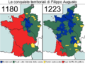 Conquiste territoriali Filippo Augusto.png 796 × 596; 75 KB
-
 County of Soissons (1180).png 427 × 398; 107 KB
-
 Dux Wasconum 1150-es.svg 2,000 × 1,360; 571 KB
-
 Dux Wasconum 1150.png 1,984 × 1,344; 362 KB
-
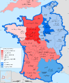
 English and French holdings 1180-1223.png 800 × 515; 93 KB
-
 France 1154 Eng-ar.png 827 × 1,170; 565 KB
-
 France 1154-ar.svg 1,405 × 1,675; 555 KB
-
 France 1154-en (Angevin Empire).svg 1,405 × 1,675; 849 KB
-
 France 1154-en.svg 1,405 × 1,675; 527 KB
-
 France 1154-es.svg 1,405 × 1,675; 1.14 MB
-
 France 1154-hu.svg 1,405 × 1,675; 542 KB
-
 France 1154-it.svg 1,499 × 1,787; 567 KB
-
 France 1154-ko.svg 1,405 × 1,675; 536 KB
-
 France 1154-nl.svg 1,405 × 1,675; 797 KB
-
 France 1154-ru.svg 1,405 × 1,675; 528 KB
-
 France 1154-zh.svg 1,405 × 1,675; 527 KB
-
 France 1154.svg 1,405 × 1,675; 560 KB
-
 Frankreich 1154-DE.svg 1,405 × 1,675; 676 KB
-
 Frañs 1154-br.svg 1,405 × 1,675; 526 KB
-
 Kornôg frañs 1154.svg 872 × 770; 136 KB
-

-
 Locator map royal domain France 1180.svg 988 × 1,124; 1.52 MB
-
 Map fr duchy of Gascony 1150-es.svg 713 × 590; 332 KB
-
 Map fr duchy of Gascony 1150.svg 713 × 590; 447 KB
-
 Map France 1180-br.svg 988 × 1,124; 1.9 MB
-
 Map France 1180-de.svg 988 × 1,124; 1.94 MB
-
 Map France 1180-es.svg 988 × 1,124; 1.97 MB
-
 Map France 1180-fr.png 578 × 524; 225 KB
-
 Map France 1180-ru.svg 988 × 1,124; 1.88 MB
-
 Map France 1180-uk.svg 988 × 1,124; 1.68 MB
-
 Map France Gothic 1180.svg 988 × 1,124; 1.54 MB
-
 Map of Poitou in 1180.png 398 × 218; 88 KB
-
 Pontigny1180.png 2,664 × 2,456; 4.11 MB
-
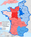
 Territorial Conquests of Philip II of France-nl.png 800 × 600; 426 KB
-
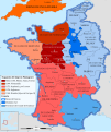
 Territorial Conquests of Philip II of France.png 2,160 × 1,625; 1.97 MB
-
 Historical atlas of modern Europe 1903 (135895447).jpg 6,790 × 9,039; 59.1 MB
_(14588061457).jpg)

_(14783970095).jpg)


.png)


.png)


_(14767184775).jpg)
.png)
.png)
.jpg)
,_est_extraite_d%27un_travail_in%C3%A9dit_et_commenc%C3%A9_par_M.M._Ed._Clerc_et_Bourgon_-_btv1b53088167f.jpg)


.png)


.svg)


_(14594444188).jpg)


.jpg)