Category:Maps in the National Library of Finland
Jump to navigation
Jump to search
Media in category "Maps in the National Library of Finland"
The following 42 files are in this category, out of 42 total.
-
 11th Map of Europe (Ulm Ptolemy).jpg 1,772 × 1,076; 480 KB
-
 Anthropomorphic map of Europe by Heinrich Bünting.jpg 4,254 × 2,946; 12.47 MB
-
 Asia polyglotta, linguarum genealogiam, cum literis, scribendique modis, exhibens.jpg 2,649 × 2,271; 8.28 MB
-
 Basic cartouche on a Paradisus map by Mercator.jpg 1,153 × 881; 1.08 MB
-
 Belägenheten af Helsingfors och Sveaborg 1808.jpeg 5,424 × 4,456; 2.53 MB
-

-
 Helsingfors med omgifningar 1845.jpeg 8,336 × 6,480; 5.48 MB
-
 Helsingin asemakaava 1909.jpeg 5,288 × 6,184; 4.53 MB
-
 Helsingin kartta 1932 2.jpeg 4,632 × 5,968; 3.11 MB
-
 Helsingin kartta 1932.jpeg 5,920 × 4,648; 3.3 MB
-
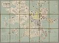
 Helsingin matkailijakartta 1940 2.jpg 7,232 × 7,560; 38.11 MB
-
 Helsingin matkailijakartta 1940.jpg 8,320 × 5,088; 29.71 MB
-
 Helsingin matkailijakartta 1949.jpg 8,320 × 5,088; 30.02 MB
-
 Helsingin raitiotiekartta 1 1932.jpeg 6,440 × 7,304; 4.76 MB
-
 Helsinki kartta 1696.jpeg 5,608 × 4,248; 1.99 MB
-
 Helsinki kartta ja luettelo kaduista ja nähtävyyksistä 1924.jpeg 5,224 × 8,784; 7.39 MB
-
 Helsinki ympäristöineen 1929 2.jpeg 1,720 × 2,944; 453 KB
-
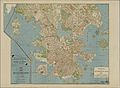
 Helsinki ympäristöineen 1929.jpeg 10,640 × 5,480; 8.15 MB
-
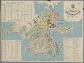
 Karta öfver Helsingfors 1860.jpeg 5,384 × 5,160; 3.58 MB
-
 Karta öfver Helsingfors 1866.jpeg 8,848 × 6,512; 6.85 MB
-

-
 Map of Asia, depicted as Pegasus.jpg 4,218 × 3,107; 13.21 MB
-
 Map of Helsinki-Helsingfors 1935 2.jpeg 1,288 × 2,208; 257 KB
-
 Map of Helsinki-Helsingfors 1935.jpeg 4,728 × 4,288; 3.06 MB
-
 Paradisus.jpg 2,502 × 1,956; 6.54 MB
-
 Pharus-asemakaava Helsinki.jpg 4,744 × 6,304; 21.6 MB
-
 Plan af Helsingfors 1863.jpeg 6,760 × 5,088; 4 MB
-
 Plan af Helsingfors 1876.jpeg 9,016 × 7,184; 7.54 MB
-
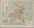 Plan af Helsingfors 1893.jpeg 5,472 × 4,528; 3.19 MB
-

-

-
 Plan af Helsingfors jemte omgifning 1880.jpeg 7,088 × 3,976; 3.37 MB
-
 Plan af Helsingfors år 1859.jpeg 4,328 × 3,720; 2.33 MB
-
 Plankarta öfver Helsingfors stad 1916 A1 1.jpeg 11,072 × 6,288; 9.03 MB
-
 Plankarta öfver Helsingfors stad 1916 A1 2.jpeg 11,072 × 6,288; 9.77 MB
-
 Plankarta öfver Helsingfors stad 1916 A1.jpeg 11,017 × 8,118; 12.03 MB
-
 Plankarta öfver Helsingfors stad 1916 A2 1.jpeg 11,072 × 6,288; 10.22 MB
-
 Plankarta öfver Helsingfors stad 1916 A2 2.jpeg 11,064 × 6,288; 9.78 MB
-
 Plankarta öfver Helsingfors stad 1916 A2.jpeg 10,995 × 8,111; 12.86 MB
-
 Tabula Peutingeriana - Miller.jpg 46,380 × 2,953; 37.87 MB
-
 Tabula Peutingeriana-deflate.tif 46,380 × 2,953; 288 MB
-
 Tabula Peutingeriana-nc.tif 46,380 × 2,953; 391.87 MB
.jpg)


