Category:Maps created in 2010
Jump to navigation
Jump to search
Media in category "Maps created in 2010"
The following 14 files are in this category, out of 14 total.
-
 Africa ChamberlinTrimetric.png 800 × 872; 125 KB
-
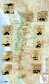 Cascade Range major volcanoes topographic map-fr.svg 403 × 693; 15.91 MB
-
 Cascade Range subdivisions map-fr.svg 403 × 693; 3.07 MB
-
 Cascade Range topographic blank map.png 403 × 693; 422 KB
-
 Cascade Range topographic map-fr.svg 403 × 693; 3.15 MB
-
 Columbia drainage basin blank map.png 808 × 790; 712 KB
-
 Crosne-VSG Modification territoriale (6-10-1967).svg 479 × 406; 2.12 MB
-
 Europe 180ad roman trade map.png 2,621 × 1,414; 1.24 MB
-
 Location map Washington DC Cleveland Park to Southwest Waterfront.png 717 × 734; 718 KB
-
 Location map Washington, D.C. central.png 627 × 599; 218 KB
-
 Location map Washington, D.C. east.png 767 × 731; 644 KB
-
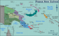 PNG Regions map.png 3,223 × 2,000; 1.39 MB
-
 ROCEEH Motm 2010 09 Distribution of Neandertal Fossils.pdf 1,752 × 1,239; 1.63 MB
-
 World map of calory consumption 1961 (v2).svg 940 × 415; 1.45 MB


.svg)


.svg)