
Category:Maps by Royal Prussian Land Survey
geodetic survey of Prussia 1830–1865 | |||||
| Upload media | |||||
| Instance of |
| ||||
|---|---|---|---|---|---|
| Author | |||||
| Start time |
| ||||
| End time |
| ||||
| |||||
Deutsch: Karten der Königlich Preussischen Landesaufname (1830–1865) ...
English: Maps created for Royal Prussian Land Survey (Königlich Preußische Landesaufnahme).
Subcategories
This category has the following 6 subcategories, out of 6 total.
K
M
Media in category "Maps by Royal Prussian Land Survey"
The following 200 files are in this category, out of 360 total.
(previous page) (next page)-
 174 Wolfsfurter Mühlen Uraufnahme.jpg 600 × 400; 79 KB
-
 175 Adamsmühle Uraufnahme.jpg 600 × 400; 73 KB
-
 176 Teutermühle Uraufnahme.jpg 600 × 400; 76 KB
-
 177 Pumper Mühle Uraufnahme.jpg 600 × 400; 74 KB
-
 178 Bardenberger Mühle Uraufnahme.jpg 600 × 400; 64 KB
-
 179 Grube Ath Würselen Uraufnahme.jpg 600 × 400; 73 KB
-
 180 Grube Furth Würselen Uraufnahme.jpg 600 × 400; 66 KB
-
 181 Klosterather Gruben Uraufnahme.jpg 600 × 400; 69 KB
-
 182 Broicher Mühle Uraufnahme.jpg 600 × 400; 53 KB
-
 183 Kranentalsmühle Uraufnahme.jpg 600 × 400; 71 KB
-
 184 Kellersberger Mühle Uraufnahme.jpg 600 × 400; 73 KB
-
 185 Linkens Mühle Uraufnahme.jpg 600 × 400; 67 KB
-
 186 Alsdorfer Ölmühle Uraufnahme.jpg 600 × 400; 68 KB
-
 1860er Jahre Übersicht zu Behringen Orten.png 2,568 × 1,200; 4 MB
-
 187 Römermühle Herzogenrath Uraufnahme.jpg 600 × 400; 63 KB
-
 188 Berger Mühle Uraufnahme.jpg 600 × 400; 65 KB
-
 1880 Dürrerhof.jpg 506 × 364; 190 KB
-
 1880 Mittelshof.png 693 × 584; 319 KB
-
 1880 MTB Hötzelsroda.jpg 680 × 465; 278 KB
-
 189 Erckensmühle Uraufnahme.jpg 600 × 400; 74 KB
-
 190 Bannmühle Herzogenrath Uraufnahme.jpg 600 × 400; 67 KB
-
 191 Nivelsteiner Mühle Uraufnahme.jpg 600 × 400; 56 KB
-
 192 Obermühle Horbach Uraufnahme.jpg 600 × 400; 62 KB
-
 193 Untermühle Horbach Uraufnahme.jpg 600 × 400; 51 KB
-
 194 Rimburger Mühlen Neuaufnahme.jpg 600 × 400; 69 KB
-
 194 Rimburger Mühlen Uraufnahme.jpg 600 × 400; 74 KB
-
 195 Übacher Mühle Neuaufnahme.jpg 600 × 400; 101 KB
-
 195 Übacher Mühle Uraufnahme.jpg 600 × 400; 78 KB
-
 196 Marienthaler Mühle Neuaufnahme.jpg 600 × 400; 96 KB
-
 196 Marienthaler Mühle Uraufnahme.jpg 600 × 400; 66 KB
-
 197 Zweibrügger Mühle Neuaufnahme.jpg 600 × 400; 87 KB
-
 197 Zweibrügger Mühle Uraufnahme.jpg 600 × 400; 68 KB
-
 198 Frelenberger Mühle Neuaufnahme.jpg 600 × 400; 91 KB
-
 198 Frelenberger Mühle Uraufnahme.jpg 600 × 400; 76 KB
-
 199 Mühle Hommerschen Neuaufnahme.jpg 600 × 400; 91 KB
-
 199 Mühle Hommerschen Uraufnahme.jpg 600 × 400; 65 KB
-
 200 Mühle Eichenthal Neuaufnahme.jpg 600 × 400; 94 KB
-
 200 Mühle Eichenthal Uraufnahme.jpg 600 × 400; 66 KB
-
 201Beeretz - Mühle Neuaufnahme.jpg 600 × 400; 97 KB
-
 201Beeretz-Mühle Uraufnahme.jpg 600 × 400; 69 KB
-
 202 Hünshovener Mühle Neuaufnahme.jpg 600 × 400; 90 KB
-
 202 Hünshovener Mühle Uraufnahme.jpg 600 × 400; 62 KB
-
 203 (a) Tripser Mühlen Neuaufnahme.jpg 600 × 400; 90 KB
-
 203 (b) Tripser Mühlen Uraufnahme.jpg 600 × 400; 79 KB
-
 204 Horriger Mühle Neuaufnahme.jpg 600 × 400; 96 KB
-
 204 Horriger Mühle Uraufnahme.jpg 600 × 400; 79 KB
-
 205 Süggerather Mühle Neuaufnahme.jpg 600 × 400; 100 KB
-
 205 Süggerather Mühle Uraufnahme.jpg 600 × 400; 84 KB
-
 206 Müllendorfer Mühle Neuaufnahme.jpg 600 × 400; 96 KB
-
 206 Müllendorfer Mühle Uraufnahme.jpg 600 × 400; 64 KB
-
 207 Randerather Ölmühle Neuaufnahme.jpg 600 × 400; 101 KB
-
 207 Randerather Ölmühle Uraufnahme.jpg 600 × 400; 60 KB
-
 208 Bommers Mühle Neuaufnahme.jpg 600 × 400; 97 KB
-
 208 Bommers Mühle Uraufnahme.jpg 600 × 400; 60 KB
-
 209 Porselener Mühle Neuaufnahme.jpg 600 × 400; 87 KB
-
 209 Porselener Mühle Uraufnahme.jpg 600 × 400; 59 KB
-
 210 Papiermühle Oberbruch Neuaufnahme.jpg 600 × 400; 100 KB
-
 210 Papiermühle Uraufnahme.jpg 600 × 400; 69 KB
-
 211 Unterbrucher Mühle Neuaufnahme.jpg 600 × 400; 79 KB
-
 211 Unterbrucher Mühle Uraufnahme.jpg 600 × 400; 60 KB
-
 214 Vollmühle Unterbruch Neuaufnahme.jpg 600 × 400; 93 KB
-
 214 Vollmühle Unterbruch Uraufnahme.jpg 600 × 400; 74 KB
-
 215 Lambertzmühle Neuaufnahme.jpg 600 × 400; 100 KB
-
 215 Lambertzmühle Uraufnahme.jpg 600 × 400; 61 KB
-
 216 Brünkers Mühle Neuaufnahme.jpg 600 × 400; 100 KB
-
 216 Brünkers Mühle Uraufnahme.jpg 600 × 400; 60 KB
-
 217 Horster Mühle Neuaufnahme.jpg 600 × 400; 103 KB
-
 217 Horster Mühle Uraufnahme.jpg 600 × 400; 60 KB
-
 218 Talmühle Dremmen Neuaufnahme.jpg 600 × 400; 93 KB
-
 218 Talmühle Uraufnahme.jpg 600 × 400; 67 KB
-
 219 Liecker Mühle Neuaufnahme.jpg 600 × 400; 98 KB
-
 219 Liecker Mühle Uraufnahme.jpg 600 × 400; 67 KB
-
 220 Schafhausener Ölmühle Uraufnahme.jpg 600 × 400; 64 KB
-
 221 Schafhausener Kornmühle Neuaufnahme.jpg 600 × 400; 107 KB
-
 222 Dahlmühle Neuaufnahme.jpg 600 × 400; 88 KB
-
 222 Dahlmühle Uraufnahme.jpg 600 × 400; 70 KB
-
 223 Stadtmühle Heinsberg Neuaufnahme.jpg 600 × 400; 114 KB
-
 223 Stadtmühle Heinsberg Uraufnahme.jpg 600 × 400; 70 KB
-
 224 Pulvermühle Neuaufnahme.jpg 600 × 400; 114 KB
-
 224 Pulvermühle Uraufnahme.jpg 600 × 400; 70 KB
-
 225 Aldenhover Mühle Neuaufnahme.jpg 600 × 400; 118 KB
-
 225 Aldenhover Mühle Uraufnahme.jpg 600 × 400; 75 KB
-
 226 Kemper Mühle Neuaufnahme.jpg 600 × 400; 94 KB
-
 226 Kemper Mühle Uraufnahme.jpg 600 × 400; 64 KB
-
 227 Karker Mühle Neuaufnahme.jpg 600 × 400; 87 KB
-
 227 Karker Mühle Uraufnahme.jpg 600 × 400; 65 KB
-
 228 Wolfhager Mühle Neuaufnahme.jpg 600 × 400; 81 KB
-
 228 Wolfhager Mühle Uraufnahme.jpg 600 × 400; 73 KB
-
 229 Kitscher Mühle Neuaufnahme.jpg 600 × 400; 65 KB
-
 229 Kitscher Mühle Uraufnahme.jpg 600 × 400; 67 KB
-
 368 Wilderather Mühle Neuaufnahme.jpg 600 × 400; 77 KB
-
 369 Schwalmer Mühle Neuaufnahme.jpg 600 × 400; 76 KB
-
 370 Pletschmühle Neuaufnahme.jpg 600 × 400; 78 KB
-
 371 Kappelsmühle Neuaufnahmen.jpg 600 × 400; 72 KB
-
 371 Kappelsmühle Urkataster.jpg 600 × 400; 73 KB
-
 372 Wickrathberger Mühle Neuaufnahme.jpg 600 × 400; 83 KB
-
 372 Wickrathberger Mühle Urkataster.jpg 600 × 400; 63 KB
-
 373 Schlossmühle Wickrath Neuaufnahme.jpg 600 × 400; 105 KB
-
 373 Schlossmühle Wickrath Urkataster.jpg 600 × 400; 65 KB
-
 374 Papiermühle Wickrath Neuaufnahme.jpg 600 × 400; 113 KB
-
 374 Papiermühle Wickrath Uraufnahme.jpg 600 × 400; 58 KB
-
 375 Wetscheweller Mühle Neuaufnahme.jpg 600 × 400; 103 KB
-
 375 Wetscheweller Mühle Urkataster.jpg 600 × 400; 75 KB
-
 376 Güdderather Mühle Neuaufnahme.jpg 600 × 400; 105 KB
-
 376 Güdderather Mühle Urkataster.jpg 600 × 400; 71 KB
-
 377 Burgmühle Neuaufnahme.jpg 600 × 400; 116 KB
-
 377 Burgmühle Odenkirchen Urkataster.jpg 600 × 400; 82 KB
-
 378 Bottmühle Neuaufnahme.jpg 600 × 400; 109 KB
-
 378 Bottmühle Urkataster.jpg 600 × 400; 71 KB
-
 379 Pixmühle Neuaufnahme.jpg 600 × 400; 108 KB
-
 379 Pixmühle Urkataster.jpg 600 × 400; 77 KB
-
 380 Bellermühle Neuaufnahme.jpg 600 × 400; 106 KB
-
 380 Bellermühle Urkataster.jpg 600 × 400; 71 KB
-
 381 Papiermühle Odenkirchen Neuaufnahme.jpg 600 × 400; 111 KB
-
 381 Papiermühle Urkataster.jpg 600 × 400; 78 KB
-
 382 Steinsmühle Neuaufnahme.jpg 600 × 400; 113 KB
-
 382 Steinsmühle Urkataster.jpg 600 × 400; 75 KB
-
 383 Eickesmühle Neuaufnahme.jpg 600 × 400; 102 KB
-
 383 Eickesmühle Urkataster.jpg 600 × 400; 80 KB
-
 384 Zoppenbroicher Mühle Neuaufnahme.jpg 600 × 400; 101 KB
-
 384 Zoppenbroicher MühleUrkataster.jpg 600 × 400; 83 KB
-
 385 Schlossmühle Rheydt Neuaufnahme.jpg 600 × 400; 84 KB
-
 385 Schlossmühle Rheydt Urkataster.jpg 600 × 400; 82 KB
-
 386 Klippertzmühle Neuaufnahme.jpg 352 × 305; 77 KB
-
 386 Klippertzmühle Urkataster.jpg 387 × 261; 75 KB
-
 387 Schlossmühle Myllendonk Neuaufnahme.jpg 709 × 559; 217 KB
-
 388 Nonnenmühle Neuaufnahme.jpg 600 × 400; 79 KB
-
 389 Oberste Mühle Urkataster.jpg 900 × 600; 206 KB
-
 390 Flieschermühle Urkataster.jpg 900 × 600; 184 KB
-
 391 Vitgesmühle Urkataster.jpg 900 × 600; 185 KB
-
 392 Krallsmühle Urkataster.jpg 900 × 600; 208 KB
-
 393 Rohrmühle Neuaufnahme.jpg 900 × 600; 204 KB
-
 393 Rohrmühle Urkataster.jpg 900 × 600; 189 KB
-
 394 Gierthmühle Neuaufnahme.jpg 600 × 400; 116 KB
-
 395 Compesmühle Neuaufnahme.jpg 900 × 600; 202 KB
-
 396 Engelsmühle Neuaufnahme.jpg 900 × 600; 167 KB
-
 397a Heldsmühle Neuaufnahme.jpg 673 × 463; 198 KB
-
 397b Birkmannsmühle Neuaufnahme.jpg 681 × 487; 194 KB
-
 398 Broichmühle Neuaufnahme.jpg 600 × 400; 96 KB
-
 Ahrweiler 1893 Karte.jpg 1,689 × 1,745; 1.45 MB
-
 Altenbochum Urmesstischblatt von 1840.jpg 2,115 × 1,834; 1.21 MB
-
 Apolda Karte 1921-2.gif 685 × 602; 462 KB
-
 Apweiler Urkataster.jpg 600 × 400; 58 KB
-
 Bauchem Urkataster.jpg 600 × 400; 69 KB
-
 Beeck Urkataster.jpg 600 × 400; 72 KB
-
 Bergheim 1893 Karte.jpg 1,654 × 1,684; 1.08 MB
-
 Birgden Neuaufnahme.jpg 600 × 400; 82 KB
-
 Birgden Urkataster.jpg 600 × 400; 121 KB
-
 BockerterHeide1844(PreußischeUraufnahme).jpg 1,264 × 711; 1.27 MB
-
 Bocket Neuaufnahme 1912.jpg 600 × 400; 92 KB
-
 Bocket Urkataster.jpg 600 × 400; 67 KB
-
 Bonn1906.jpg 3,252 × 3,353; 7.84 MB
-
-
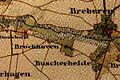
 Breberen Neuaufnahme.jpg 600 × 400; 98 KB
-
 Breberen Urkataster.jpg 600 × 400; 75 KB
-
 Broichhoven Neuaufnahme.jpg 600 × 400; 99 KB
-
 Broichhoven Urkataster.jpg 600 × 400; 77 KB
-
 Brüxgen Neuaufnahme.jpg 600 × 400; 99 KB
-
 Buscherheide Neuaufnahme.jpg 600 × 400; 100 KB
-
 Bökel-Vennheide1844(PreußischeUraufnahme).jpg 800 × 450; 562 KB
-
 Denkmal TP Marienhöhe Juli 2010-F 1.jpg 2,952 × 2,400; 1.74 MB
-
 Denkmal TP Marienhöhe Juli 2010-F 2.jpg 2,952 × 2,400; 1.3 MB
-
 Denkmal TP Marienhöhe Juli 2010-F.jpg 2,910 × 2,355; 5.66 MB
-
 Deubach (Hörsel).png 1,176 × 1,566; 2.66 MB
-

-
 Dieck Neuaufnahme.jpg 600 × 400; 84 KB
-
 Dieck Urkataster.jpg 600 × 400; 70 KB
-
 Duesseldorf 1907 (cropped).jpg 636 × 471; 183 KB
-
 Duesseldorf 1907 Lage Radrennbahn.jpg 636 × 471; 230 KB
-
 Duesseldorf 1907.jpg 450 × 309; 93 KB
-
 Eisenbahn railway metz 1893.JPG 2,446 × 1,657; 4.83 MB
-
 Eisenbahn railway metz 1908.JPG 2,446 × 1,648; 4.67 MB
-
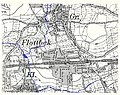 Flottbek Röbbek 1905.jpg 604 × 480; 186 KB
-
 Frankenforst.jpg 824 × 884; 498 KB
-
 Frauenmark 1879 Karte.jpg 1,654 × 1,791; 1.22 MB
-
 Frechen 1893 Karte.jpg 1,654 × 1,681; 1.16 MB
-
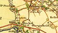
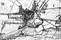 Gangelt Neuaufnahme.jpg 600 × 400; 103 KB
-
 Gedenktafel Marienhöher Weg (Temph) Trigonometrischer Punkt Rauenberg2.jpg 3,359 × 3,007; 9.63 MB
-
 Gillrath Urkataster.jpg 600 × 400; 75 KB
-
 Gips-Steinbruch am Kalkberg bei Kittelsthal.png 1,239 × 732; 2 MB
-
 Grotenrath Urkataster.jpg 600 × 400; 44 KB
-
 Großwehrhagen Neuaufnahme.jpg 600 × 400; 71 KB
-
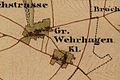 Großwehrhagen Urkataster.jpg 600 × 400; 65 KB
-
 Günthersdorf, Kreis Schweidnitz 1936 Messtischblatt 5063.PNG 980 × 543; 955 KB
-
 Harzelt Neuaufnahme.jpg 600 × 400; 86 KB
-
 Harzelt Urkataster.jpg 600 × 400; 106 KB
-
 Hastenrath Neuaufnahme.jpg 600 × 400; 68 KB
-
 Hastenrath Urkataster.jpg 600 × 400; 72 KB
-
 Hatterath Urkataster.jpg 600 × 400; 80 KB
-
 Havert Neuaufnahme.jpg 600 × 400; 79 KB
-
 Havert Urkataster.jpg 600 × 400; 79 KB
-
 Heilder Neuaufnahme.jpg 600 × 400; 83 KB
-
 Heilder Urkataster.jpg 600 × 400; 75 KB
-
 Hillensberg Neuaufnahme.jpg 600 × 400; 57 KB
-
 Hillensberg Urkataster.jpg 600 × 400; 75 KB
-
 Historika25 Schönholthausen 1841.jpg 641 × 548; 783 KB
-
 HK5311-Altenkirchen A1.jpg 4,517 × 2,988; 11.62 MB
-
 HK5311-Altenkirchen A2.jpg 4,488 × 3,325; 13.2 MB
-
 HK5311-Altenkirchen B1.jpg 4,492 × 3,388; 13.29 MB
-
 HK5311-Altenkirchen B2.jpg 4,557 × 3,382; 13.56 MB


_Tripser_M%C3%BChlen_Neuaufnahme.jpg)
_Tripser_M%C3%BChlen_Uraufnahme.jpg)


.jpg)


.jpg)


.png)


.jpg)


_Trigonometrischer_Punkt_Rauenberg2.jpg)


