Category:Maps by Reich Office for Land Survey
Appearance
English: Maps created for Reich Office for Land Survey (Reichsamt für Landesvermessung).
Subcategories
This category has the following 2 subcategories, out of 2 total.
Media in category "Maps by Reich Office for Land Survey"
The following 22 files are in this category, out of 22 total.
-
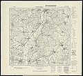
Hessen Meßtischblatt 5118 Marburg 1942.jpg 1,600 × 1,460; 1.01 MB
-
Hessen Meßtischblatt 5218 Niederwalgern 1937.jpg 1,600 × 1,469; 1.02 MB
-
Kartenausschnitt von Lüssen.PNG 971 × 603; 1,017 KB
-
Koberstadt 1893.JPG 2,580 × 3,364; 2.07 MB
-
Reichskarte 100 Bottrop.png 2,158 × 3,323; 17.21 MB
-
Reichskarte 100 Castrop-Rauxel.png 2,995 × 2,515; 18.41 MB
-
Reichskarte 100 Datteln.png 2,702 × 2,393; 15.38 MB
-
Reichskarte 100 Dorsten.png 3,500 × 3,942; 32.95 MB
-
Reichskarte 100 Gelsenkirchen.png 2,977 × 3,261; 23.5 MB
-
Reichskarte 100 Gladbeck.png 2,625 × 2,507; 15.47 MB
-
Reichskarte 100 Haltern.png 3,739 × 2,892; 25.72 MB
-
Reichskarte 100 Herne.png 2,549 × 2,257; 13.67 MB
-
Reichskarte 100 Herten.png 2,508 × 2,537; 14.99 MB
-
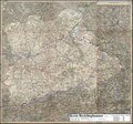
Reichskarte 100 Kreis Recklinghausen.pdf 1,754 × 1,637; 22.96 MB
-
Reichskarte 100 Kreis Recklinghausen.png 6,274 × 5,864; 86.91 MB
-
Reichskarte 100 Marl.png 2,877 × 2,710; 18.21 MB
-
Reichskarte 100 Oer-Erkenschwick.png 2,634 × 2,319; 10.67 MB
-
Reichskarte 100 Olfen.png 2,916 × 2,319; 16.22 MB
-
Reichskarte 100 Recklinghausen.png 3,085 × 2,813; 20.72 MB
-
Reichskarte 100 Vest Recklinghausen.pdf 1,754 × 1,262; 17.42 MB
-
Reichskarte 100 Vest Recklinghausen.png 6,277 × 4,525; 65.26 MB
-
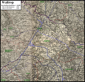
Reichskarte 100 Waltrop.png 2,582 × 2,471; 15.52 MB


