Category:Maps about the COVID-19 pandemic in Ohio
Jump to navigation
Jump to search
States of the United States: Alabama · Alaska · Arizona · Arkansas · California · Colorado · Connecticut · Delaware · Florida · Georgia · Hawaii · Idaho · Illinois · Indiana · Iowa · Kansas · Kentucky · Louisiana · Maine · Maryland · Massachusetts · Michigan · Minnesota · Mississippi · Missouri · Montana · Nebraska · Nevada · New Hampshire · New Jersey · New Mexico · New York · North Carolina · North Dakota · Ohio · Oklahoma · Oregon · Pennsylvania · South Carolina · South Dakota · Tennessee · Texas · Utah · Vermont · Virginia · Washington · West Virginia · Wisconsin · Wyoming
Media in category "Maps about the COVID-19 pandemic in Ohio"
The following 10 files are in this category, out of 10 total.
-
 COVID-19 Cases in Ohio by counties 2.svg 3,675 × 3,995; 154 KB
-
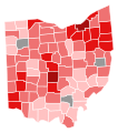 COVID-19 Cases in Ohio by counties.svg 230 × 260; 30 KB
-
 COVID-19 in Columbus.svg 512 × 331; 182 KB
-
 COVID-19 Prevalence in Ohio by county.svg 370 × 400; 52 KB
-
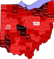
 COVID-19 rolling 14day Prevalence in Ohio by county.svg 3,675 × 3,995; 154 KB
-
 COVID-19 vaccination rate by county in Ohio.svg 3,675 × 3,995; 154 KB
-
 Ohio Coronavirus cases per hundred thousand by county.svg 3,675 × 3,995; 154 KB
-
 Ohio Coronavirus deaths per hundred thousand by county.svg 3,675 × 3,995; 154 KB
-
 Ohio coronavirus gif.gif 507 × 556; 577 KB
-
 Ohio Public Health Advisory System.svg 3,681 × 4,001; 82 KB


