Category:Maps about the COVID-19 pandemic in Illinois
Jump to navigation
Jump to search
States of the United States: Alabama · Alaska · Arizona · Arkansas · California · Colorado · Connecticut · Delaware · Florida · Georgia · Hawaii · Idaho · Illinois · Indiana · Iowa · Kansas · Kentucky · Louisiana · Maine · Maryland · Massachusetts · Michigan · Minnesota · Mississippi · Missouri · Montana · Nebraska · Nevada · New Hampshire · New Jersey · New Mexico · New York · North Carolina · North Dakota · Ohio · Oklahoma · Oregon · Pennsylvania · South Carolina · South Dakota · Tennessee · Texas · Utah · Vermont · Virginia · Washington · West Virginia · Wisconsin · Wyoming
Media in category "Maps about the COVID-19 pandemic in Illinois"
The following 4 files are in this category, out of 4 total.
-
 COVID-19 Cases in Illinois by counties (13.04.2020).png 478 × 764; 98 KB
-
 COVID-19 in Illinois.svg 512 × 913; 101 KB
-
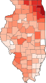
 COVID-19 Prevalence in Illinois by county.svg 226 × 400; 57 KB
-
 COVID-19 rolling 14day Prevalence in Illinois by county.svg 226 × 400; 57 KB
.png)


