Category:Map of the Caspian Sea by Guillaume Delisle (1720s)
Jump to navigation
Jump to search
Subcategories
This category has only the following subcategory.
Media in category "Map of the Caspian Sea by Guillaume Delisle (1720s)"
The following 17 files are in this category, out of 17 total.
-
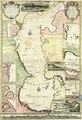
 Lisle, Guillaume de; Verden, Carl van. Composite- Mer Caspiene carte marine. 1721.jpg 8,259 × 11,327; 16.35 MB
-
 1723 map - Carte Marine de la Mer Caspienne.djvu 9,353 × 13,739; 10.23 MB
-
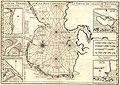
 Ca. 1723 French map of the Caspian Sea.jpg 16,133 × 23,099; 53.28 MB
-

-

-

-

-

-

-

-

-
-
 Guillaume Delisle, Carte marine de la Mer Caspiene 01 (FL37789061 3036590).jpg 16,449 × 12,562; 284.3 MB
-
 Guillaume Delisle, Carte marine de la Mer Caspiene 02 (FL37789063 3036590).jpg 16,474 × 12,433; 269.22 MB
-
 Map - Special Collections University of Amsterdam - OTM- HB-KZL 31-08-25.tif 7,584 × 6,382; 138.48 MB
-
 Map - Special Collections University of Amsterdam - OTM- HB-KZL 31-08-32.tif 7,948 × 6,519; 148.24 MB
-
 Map - Special Collections University of Amsterdam - OTM- HB-KZL 34.13.25.tif 7,277 × 10,247; 213.34 MB


_-_lev%C3%A9e_suivant_les_ordres_de_SM_Czariene,_par_Mr._Carl_Vanverden_en_1719,_1720_et_1721_;_r%C3%A9duite_au_m%C3%A9ridien_de_Paris_par_Guillaume_Delisle_-_btv1b53011738b_(1_of_2).jpg)
_-_lev%C3%A9e_suivant_les_ordres_de_SM_Czariene,_par_Mr._Carl_Vanverden_en_1719,_1720_et_1721_;_r%C3%A9duite_au_m%C3%A9ridien_de_Paris_par_Guillaume_Delisle_-_btv1b53011738b_(2_of_2).jpg)
_-_lev%C3%A9e_sur_les_ordres_de_SM_Czariene,_par_Mr._Carl_Vanverden_en_1719,_1720_et_1721_;_r%C3%A9duite_au_m%C3%A9ridien_de_Paris_par_Guillaume_Delisle_-_btv1b8593082k_(1_of_2).jpg)
_-_lev%C3%A9e_sur_les_ordres_de_SM_Czariene,_par_Mr._Carl_Vanverden_en_1719,_1720_et_1721_;_r%C3%A9duite_au_m%C3%A9ridien_de_Paris_par_Guillaume_Delisle_-_btv1b8593082k_(2_of_2).jpg)


.jpg)
.jpg)
.jpg)
.jpg)
.jpg)