Category:Map of Paris by Truschet and Hoyau - derivatives files
Jump to navigation
Jump to search
Media in category "Map of Paris by Truschet and Hoyau - derivatives files"
The following 80 files are in this category, out of 80 total.
-

-
 Pre-aux-Clercs sur le plan de Truschet & Hoyau.jpg 879 × 269; 95 KB
-
 1550 Paris St-Germain-Auxerrois.jpg 546 × 528; 357 KB
-
 Île de la Cité, Île aux Juifs & Îlot de la Gourdaine, Plan de Paris vers 1550.jpg 1,442 × 1,781; 2.06 MB
-
 Paris de Nicolas Flamel Plan de Bâle.jpg 604 × 599; 186 KB
-
 Saint Malgloire ( abbaye).jpg 346 × 450; 61 KB
-
 AFillesRepenties.jpg 654 × 768; 123 KB
-
 Bagnolet1 Truschey-Hoyau.jpg 973 × 1,169; 827 KB
-
 Bastillon vers 1550.png 511 × 408; 616 KB
-
 Bercy plan Truschet.jpg 1,343 × 529; 784 KB
-
 CarmesM.jpg 1,152 × 648; 327 KB
-
-
 Fulbert (2).jpg 361 × 523; 122 KB
-
 Grange Bateliere & Porcherons (Truschet).jpg 599 × 750; 182 KB
-
 Hopital Sainte-Catherine Paris 1550.jpg 1,020 × 674; 746 KB
-
 Hopital Trinité R St Denis Paris 1550.jpg 984 × 655; 795 KB
-
 Hotel des Tournelles 1550.jpg 1,529 × 1,062; 494 KB
-
 Hôpital Ste-Catherine vesr 1550.png 348 × 398; 363 KB
-
 Le bourg St-Marcel sur plan de Bâle de 1550.png 695 × 519; 1.03 MB
-
 Les 3 tours (Paris).jpg 1,680 × 1,050; 1.02 MB
-
 Lostel de Bourbon on 1550 map of Paris by Truschet & Hoyau.jpg 555 × 534; 183 KB
-
 Monastre de Filles (1550s).tif 606 × 452; 1.05 MB
-
 Palais de la Cité - 1550.jpg 1,395 × 975; 1.8 MB
-
 Palais de la Cité - Le Louvre - L'hôtel de Nesle - 1550.jpg 2,071 × 2,253; 5.95 MB
-
 Plan de Bâle 1552 - Extrait île de la Cité.jpg 682 × 1,030; 283 KB
-
 Plan de Bâle saint Victor.JPG 393 × 670; 99 KB
-
 Plan de Paris vers 1550 abbaye-St-Martin-des-champs.jpg 463 × 477; 348 KB
-
 Plan de Paris vers 1550 autour du Louvre.jpg 1,502 × 893; 1.34 MB
-
 Plan de Paris vers 1550 autour Saint-Sulpice.jpg 1,104 × 1,049; 1.38 MB
-
 Plan de Paris vers 1550 college de Navarre.jpg 308 × 348; 177 KB
-
 Plan de Paris vers 1550 color eglise Saint-Andre-des-arts.jpg 433 × 290; 189 KB
-
 Plan de Paris vers 1550 color tour de Billy disparue.jpg 600 × 544; 371 KB
-
 Plan de Paris vers 1550 eglise des Blancs-Manteaux.jpg 260 × 277; 147 KB
-
 Plan de Paris vers 1550 eglise Saint-Jacques-du-Haut-Pas.jpg 464 × 368; 138 KB
-
 Plan de Paris vers 1550 eglise St-Eustache.jpg 300 × 321; 179 KB
-
 Plan de Paris vers 1550 eglise St-Gervais.jpg 330 × 290; 171 KB
-
 Plan de Paris vers 1550 eglise St-Julien.jpg 293 × 262; 161 KB
-
 Plan de Paris vers 1550 eglise St-Marcel.jpg 679 × 475; 375 KB
-
 Plan de Paris vers 1550 eglise St-Merri.jpg 246 × 301; 135 KB
-
 Plan de Paris vers 1550 Gibet de Montfaucon.jpg 1,172 × 733; 1.14 MB
-
 Plan de Paris vers 1550 Halles.jpg 353 × 300; 192 KB
-
 Plan de Paris vers 1550 hotel-Dieu.jpg 258 × 378; 149 KB
-
 Plan de Paris vers 1550 Petit pont.jpg 247 × 168; 98 KB
-
 Plan de Paris vers 1550 place Maubert.jpg 707 × 447; 421 KB
-
 Plan de Paris vers 1550 Pont au change.jpg 326 × 157; 113 KB
-
 Plan de Paris vers 1550 Pont ND.jpg 433 × 222; 142 KB
-
 Plan de Paris vers 1550 pont St-Michel.jpg 316 × 164; 111 KB
-
 Plan de Paris vers 1550 porte Bordelle.jpg 467 × 427; 279 KB
-
 Plan de Paris vers 1550 porte de Buci.jpg 656 × 504; 372 KB
-
 Plan de Paris vers 1550 porte du Chaume.jpg 247 × 180; 103 KB
-
 Plan de Paris vers 1550 porte du Temple.jpg 663 × 544; 535 KB
-
 Plan de Paris vers 1550 porte Montmartre.jpg 709 × 480; 500 KB
-
 Plan de Paris vers 1550 porte St-Antoine.jpg 657 × 556; 485 KB
-
 Plan de Paris vers 1550 porte St-Denis.jpg 738 × 388; 400 KB
-
 Plan de Paris vers 1550 porte St-Germain.jpg 434 × 359; 230 KB
-
 Plan de Paris vers 1550 porte St-Honore.jpg 463 × 446; 302 KB
-
 Plan de Paris vers 1550 porte St-Jacques.jpg 382 × 250; 139 KB
-
 Plan de Paris vers 1550 porte St-Martin.jpg 677 × 356; 344 KB
-
 Plan de Paris vers 1550 porte St-Michel.jpg 277 × 325; 140 KB
-
 Plan de Paris vers 1550 porte St-Victor.jpg 276 × 356; 155 KB
-
 Plan de Paris vers 1550 Rue Montmartre.jpg 902 × 665; 890 KB
-
 Plan de Paris vers 1550 rue St-Paul.jpg 603 × 285; 246 KB
-
 Plan de Paris vers 1550 St-Jacques de la boucherie.jpg 292 × 265; 142 KB
-
 Plan de Paris vers 1550 St-Medart Bievre.jpg 375 × 419; 212 KB
-
 Plan de Paris vers 1550 Tour Barbeau.jpg 479 × 303; 202 KB
-
 Plan de Paris vers 1550 Tour et hôtel de Nesle face au Louvre.jpg 1,726 × 956; 1.73 MB
-
 Plan de Paris vers 1550 village Popincourt.jpg 609 × 537; 423 KB
-
 Ponts de l'ile de la Cité (1550).jpg 1,175 × 848; 381 KB
-
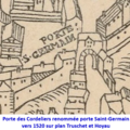 Porte des Cordeliers.png 433 × 432; 290 KB
-
 Rue de Braque 1552.jpg 349 × 515; 51 KB
-
 Rue des Archives (Truschet et Hoyau).jpg 1,339 × 1,124; 1.72 MB
-
 Rue des Barres dans son environnement.png 782 × 598; 1,010 KB
-
 Rue Portefoin (Truschet et Hoyau).jpg 1,211 × 1,069; 1.51 MB
-
 Rue Quoque-Heron.jpg 595 × 441; 250 KB
-
 Ruisseau de Ménilmontant sur le plan de Truschet et Hoyau.jpg 638 × 461; 95 KB
-
 St-Julien sur plan Truschet et Hoyau vers 1550.png 269 × 515; 390 KB
-
 THplanbièvre.jpg 1,152 × 922; 638 KB
-
 Île aux Juifs & Îlot de la Gourdaine, Plan de Paris vers 1550.jpg 773 × 591; 718 KB
-
 Île aux Vaches & île Notre-Dame, Plan de Paris vers 1550.jpg 885 × 853; 1.13 MB
-
 Île Louviers, Plan de Paris vers 1550.jpg 714 × 575; 625 KB


.jpg)


.jpg)
.jpg)


.jpg)


.jpg)


.jpg)

.jpg)


