Category:MBTA in 2015
Jump to navigation
Jump to search
Subcategories
This category has the following 2 subcategories, out of 2 total.
Media in category "MBTA in 2015"
The following 200 files are in this category, out of 645 total.
(previous page) (next page)-
 1996 boarding location at Riverside, December 2015.JPG 4,320 × 3,240; 4.17 MB
-
 2015 construction at Government Center MBTA Boston Massachusetts.jpg 3,648 × 2,048; 4.36 MB
-
 2015 construction at Government Center MBTA Boston USA .jpg 3,648 × 2,048; 4.83 MB
-
 2015 construction at Government Center MBTA Boston USA.jpg 2,048 × 3,648; 3.15 MB
-
 Abandoned tracks in Watertown Yard, July 2015.JPG 4,320 × 3,240; 3.13 MB
-
 Acela Express under Pawtucket-Central Falls station, August 2015.JPG 4,320 × 3,240; 3.81 MB
-
 Activated countdown signs at Kenmore station, August 2015.JPG 4,320 × 3,240; 2.65 MB
-
 Aerial view of Alewife garage and developments, November 2015.jpg 4,800 × 3,206; 7.24 MB
-
 Airport Station entrance from East Boston Greenway, August 2015.JPG 4,320 × 3,240; 2.28 MB
-
 Alewife station and Rindge Towers aerial, November 2015.jpg 6,000 × 4,000; 10.36 MB
-
 Anderson RTC from platform, January 2015.jpg 4,320 × 2,432; 3.45 MB
-
 Andover freight house, April 2015.jpg 3,472 × 2,332; 2.98 MB
-
 Arlington station Berkeley Street entrance, December 2015.JPG 4,320 × 3,240; 2.95 MB
-
 Arlington station Berkeley street entrances, December 2015.JPG 4,320 × 3,240; 2.31 MB
-
 Arlington station Berkeley Street exit, December 2015.jpg 3,229 × 2,424; 2.01 MB
-
 Arlington station Berkeley Street lobby, December 2015.jpg 4,320 × 2,432; 1.69 MB
-
 Arlington station former entrance from Boston Public Garden, December 2015.JPG 4,320 × 3,240; 3.4 MB
-
 Arlington station inbound platform, December 2015.JPG 4,320 × 3,240; 2.27 MB
-
 Auxiliary platforms at Boston College station, April 2015.jpg 3,373 × 2,412; 2.89 MB
-
 Back Bay skyline and Charles MGH station, September 2015.jpg 4,256 × 2,832; 3.28 MB
-
 Back Bay station rear facade from station garage, March 2015.JPG 4,320 × 3,240; 2.47 MB
-
 Back Bay station ventilation shaft and articulated bus, March 2015.jpg 2,233 × 3,256; 1.72 MB
-
 Ballardvale station platform, April 2015.jpg 3,882 × 2,432; 3.85 MB
-
 Beaconsfield shelter (1), December 2015.JPG 4,320 × 3,240; 4.01 MB
-
 Beaconsfield shelter (2), December 2015.JPG 4,320 × 3,240; 3.09 MB
-
 Beaconsfield station from Dean Road steps, December 2015.JPG 4,320 × 3,240; 5.15 MB
-
 Beaconsfield station from Dean Road steps, November 2015.JPG 4,320 × 3,240; 5.02 MB
-
 Bedford Depot from the north, May 2015.JPG 3,839 × 2,592; 2.47 MB
-
 Bedford Depot from the south, May 2015.JPG 4,320 × 3,240; 2.72 MB
-
 Bedford freight house and RDC 6211, May 2015.JPG 4,320 × 3,240; 2.77 MB
-
 Beverly Draw from School Street, April 2015.JPG 4,320 × 3,240; 4.56 MB
-
 Beverly Draw, April 2015.JPG 4,320 × 3,240; 2.61 MB
-
 Bicycle shelter at Sullivan Square station, July 2015.JPG 4,320 × 3,240; 2.7 MB
-
 Boston Landing construction east of Everett Street, November 2015.JPG 4,320 × 3,240; 3.02 MB
-
 Boston Landing station construction behind Stop and Shop, November 2015.jpg 3,813 × 2,354; 2.01 MB
-
 Boston Landing station construction, November 2015.JPG 4,320 × 3,240; 3.17 MB
-
 Boston Transit Building - Boston, MA - DSC04275.jpg 3,515 × 4,458; 7.98 MB
-
 Boston University East in the Snow February 2015.jpg 3,648 × 2,736; 2.2 MB
-
 Boston, Massachusetts (50912704486).jpg 2,625 × 3,809; 4.98 MB
-
 Bowdoin station headhouse, November 2015.JPG 4,320 × 3,240; 4.09 MB
-
 Bowdoin station island platform, November 2015.JPG 4,320 × 3,240; 2.86 MB
-
 Bowdoin station westbound platform, November 2015.JPG 4,320 × 3,240; 3.03 MB
-
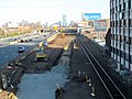
 Box District station construction from Broadway bridge, July 2015.JPG 4,320 × 3,240; 3.3 MB
-
 Box District station construction from Broadway, December 2015.JPG 4,320 × 3,240; 3.38 MB
-
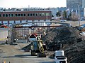
 Box District station construction, December 2015.JPG 4,320 × 3,240; 2.98 MB
-
 Box District station construction, July 2015.JPG 4,320 × 3,240; 2.77 MB
-
 Braintree station busway from garage roof, December 2015.JPG 4,320 × 3,240; 2.57 MB
-
 Braintree station commuter rail platform, December 2015.JPG 4,320 × 3,240; 2.57 MB
-
 Braintree station entrance from busway, December 2015.JPG 4,320 × 3,240; 1.93 MB
-
 Broadway station headhouses, March 2015.JPG 4,320 × 3,240; 3.21 MB
-
 Broken mini-high platform edge at North Billerica station, July 2015.JPG 4,320 × 3,240; 4.22 MB
-
 Bus boarding area at Lawrence station, April 2015.jpg 4,320 × 2,432; 2.77 MB
-
 Bus Bridge at JFK-UMass Station, August 2015.jpg 2,448 × 2,448; 1.41 MB
-
 Busway at Lynn station, April 2015.JPG 4,320 × 3,240; 2.81 MB
-
 Busways at Sullivan Square station, July 2015.JPG 3,801 × 2,855; 1.53 MB
-
 Cambridge Highlands aerial, November 2015.jpg 6,000 × 4,000; 10.91 MB
-
 Cambridgeside shuttle at Kendall MIT station, September 2015.JPG 3,483 × 2,615; 1.67 MB
-
 Canopy to platform entrance at Lynn station, April 2015.JPG 4,320 × 3,240; 3.09 MB
-
 CapeFLYER 2015 map.svg 1,080 × 1,080; 433 KB
-
 Catenary structures over South Station throat, March 2015.JPG 4,320 × 3,240; 3.89 MB
-
 Central Mass track space at Belmont Center station, January 2015.jpg 4,320 × 2,432; 4.21 MB
-
 Central Massachusetts Branch bridge over Route 128, August 2015.JPG 4,095 × 2,716; 2.08 MB
-
 Chelsea station with Silver Line construction, July 2015.JPG 4,320 × 3,240; 2.92 MB
-
 Chestnut Hill Avenue station facing inbound, April 2015.jpg 4,320 × 2,432; 4.15 MB
-
 Chestnut Hill station from overpass, October 2015.jpg 2,839 × 2,132; 2.15 MB
-
 Clarendon Hill busway, July 2015.JPG 4,133 × 3,105; 2.55 MB
-
 Clarendon Hill Towers and busway, July 2015.tif 2,076 × 953; 5.2 MB
-
 Clematis Brook station site, July 2015.JPG 4,320 × 3,240; 3.53 MB
-
 Clinton Path underpass, August 2015.JPG 4,320 × 3,240; 4.2 MB
-
 Closed entrance to Central station after snowstorm, January 2015.jpg 3,892 × 2,605; 4.62 MB
-
 Closed platform and future second platform site at Ruggles station, December 2015.JPG 4,085 × 3,069; 2.3 MB
-
 Closed platform section at Winchester Center station, August 2015.JPG 4,320 × 3,240; 3.25 MB
-
 Closed-off stairs at Fenway station, May 2015.jpg 4,320 × 2,432; 3.6 MB
-
 Commuter rail entrance at Porter station, August 2015.jpg 4,320 × 3,240; 2.61 MB
-
 Commuter rail platform at Quincy Center facing inbound, October 2015.JPG 3,280 × 2,237; 873 KB
-
 Commuter rail tracks at Sullivan Square station, June 2015.jpg 2,010 × 1,594; 853 KB
-
 Concrete buttresses at Riverside station, September 2015.JPG 4,193 × 3,158; 2.26 MB
-
 Conductor's Building from Mount Auburn Street, July 2015.JPG 4,320 × 3,240; 2.64 MB
-
 Contrasting profiles of Aquarium station, August 2015.JPG 4,320 × 3,240; 3.2 MB
-
 Dedham Branch abutment at River Street, November 2015.JPG 4,320 × 3,240; 4.23 MB
-
 Dedham Branch embankment off Avery Street, November 2015.JPG 4,320 × 3,240; 4.14 MB
-
 Dedham Branch grade crossing at Readville, November 2015.JPG 4,320 × 3,240; 3.73 MB
-
 Dedham Branch retaining wall off Avery Street, November 2015.JPG 4,320 × 3,240; 4.08 MB
-
 Dedham Branch ROW east of Avery Elementary School, November 2015.JPG 4,320 × 3,240; 4.24 MB
-
 Dedham Branch ROW east of River Street, November 2015.JPG 4,320 × 3,240; 4.74 MB
-
 Dedham Branch ROW east of Walnut Street, November 2015.JPG 4,320 × 3,240; 4.06 MB
-
 Dedham Branch ROW near Avery Street, November 2015.JPG 4,320 × 3,240; 4.7 MB
-
 Dedham Branch ROW near Linden Place, November 2015.JPG 4,320 × 3,240; 4.45 MB
-
 Dedham Branch ROW west of River Street, November 2015.JPG 4,320 × 3,240; 4.26 MB
-
 Dedham Corporate Center station facing inbound, November 2015.JPG 4,320 × 3,240; 2.87 MB
-
 Dedham Corporate Center station facing outbound, November 2015.JPG 4,320 × 3,240; 3.15 MB
-
 Dedham station site, November 2015.JPG 4,320 × 3,240; 3.03 MB
-
 Dedication plaque at Symphony station, August 2015.JPG 4,000 × 2,850; 2.32 MB
-
 Dilapidated Type 7 at Newton Highlands April 2015.jpg 3,648 × 2,736; 2.47 MB
-
 Disused tracks at Readville station (1), November 2015.jpg 4,320 × 3,240; 3.76 MB
-
 Disused tracks at Readville station (2), November 2015.JPG 4,320 × 3,240; 4.08 MB
-
 Disused tracks at Readville station (3), November 2015.JPG 4,320 × 3,240; 2.94 MB
-
 Dock at Logan Airport Ferry Terminal, August 2015.JPG 3,950 × 2,817; 1.64 MB
-
 Downtown Chelsea station construction, December 2015.JPG 4,320 × 3,240; 3.21 MB
-
 Drop-off lane at Salem station, April 2015.jpg 4,570 × 2,551; 3.2 MB
-
 Dudley Street Terminal shelter and interlocking tower, April 2015.jpg 3,753 × 2,275; 1.8 MB
-
 Dudley Street Terminal south shelter, April 2015.JPG 3,809 × 2,542; 1.37 MB
-
 East Boston Tunnel vent on Lewis Street, August 2015.JPG 4,320 × 3,240; 2.2 MB
-
 East Boston Tunnel ventilation shaft on Lewis Street, May 2015.jpg 4,320 × 2,432; 2.99 MB
-
 East Dedham station site, November 2015.JPG 4,320 × 3,240; 5.12 MB
-
 East end of Aquarium station, August 2015.JPG 4,320 × 3,240; 2.36 MB
-
 Eastbound headhouse at Park Street station, July 2019.JPG 5,184 × 3,888; 3.52 MB
-
 Eastbound platform at Bowdoin station, November 2015.JPG 4,320 × 3,240; 2.26 MB
-
 Eastern Avenue station construction site, July 2015.JPG 4,320 × 3,240; 2.66 MB
-
 Eastern Avenue station construction, December 2015.JPG 4,320 × 3,240; 3.17 MB
-
 Elevator at Porter station, August 2015.JPG 4,320 × 3,240; 2.86 MB
-
 Elevator on Red Line platform at Braintree station, December 2015.JPG 4,320 × 3,240; 2.47 MB
-
 Elevator shaft at Airport Station, August 2015.JPG 4,320 × 3,240; 2.27 MB
-
 Eliot station in the snow February 2015 1.jpg 3,648 × 2,736; 3.11 MB
-
 Eliot Yard tracks unearthed at Harvard Kennedy School.jpg 4,320 × 2,432; 3.83 MB
-
 Emergency exit at Oak Grove station, April 2015.jpg 4,320 × 2,432; 3.16 MB
-
 Emergency exits from Arlington inbound platform, December 2015.JPG 4,320 × 3,240; 2.8 MB
-
 Endicott entrance from Depot Avenue, November 2015.JPG 4,320 × 3,240; 4.92 MB
-
 Endicott station facing inbound, November 2015.JPG 4,320 × 3,240; 2.86 MB
-
 Exit-only staircase at Park Street station, March 2015.JPG 4,009 × 3,004; 2.52 MB
-
 Facing east at Belmont Center station, January 2015.jpg 4,320 × 2,432; 3.56 MB
-
 Facing south at Salem station, April 2015.JPG 4,320 × 3,240; 3.03 MB
-
 Facing west at Belmont Center station, January 2015.jpg 3,835 × 2,432; 2.93 MB
-
 Facing west at Newton Highlands station, December 2015.JPG 4,320 × 3,240; 3.32 MB
-
 Fairmount Line bridge over Hyde Park Avenue at Readville, November 2015.JPG 4,320 × 3,240; 2.56 MB
-
 Faregates at 28 State Street entrance, August 2015.JPG 4,320 × 3,240; 2.61 MB
-
 Faregates at 53 State Street entrance August 2015.JPG 4,320 × 3,240; 2.34 MB
-
 Faregates at 60 State Street entrance, August 2015.jpg 4,320 × 3,240; 2.66 MB
-
 Fitchburg bus bays from garage, November 2015.JPG 4,320 × 3,240; 2.88 MB
-
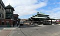
 Fitchburg Intermodal Transportation Center panorama, November 2015.jpg 5,721 × 1,738; 2.08 MB
-
 Fitchburg Line bridge work over Princeton Road, November 2015.JPG 4,320 × 2,852; 2.12 MB
-
 Fitchburg Line grade crossing of Beaver Street, July 2015.JPG 4,320 × 3,240; 2.7 MB
-
 Fitchburg station garage from Water Street, November 2015.jpg 4,320 × 3,240; 3.19 MB
-
 Footbridge at Readville station, November 2015.JPG 4,320 × 3,240; 2.86 MB
-
 Footbridge to Salem station, April 2015.JPG 4,320 × 3,240; 2.77 MB
-
 Former Beaver Brook station platform and Massasoit Street from US 20 bridge, July 2015.JPG 4,320 × 3,240; 3.27 MB
-
 Former Beaver Brook station platform from US 20 bridge, July 2015.JPG 2,163 × 1,620; 901 KB
-
 Former Beaver Brook station platform, July 2015.JPG 4,320 × 3,240; 3.9 MB
-
 Former Central Mass Branch switch near Clematis Brook station site, July 2015.JPG 4,320 × 2,893; 3.21 MB
-
 Former East Boston ferry terminal, August 2015.JPG 4,320 × 2,886; 2.05 MB
-
 Former interlocking tower at Dudley Street Terminal, April 2015.JPG 3,100 × 2,328; 1.22 MB
-
 Former location of Casey Overpass at Forest Hills station, November 2015.jpg 4,365 × 2,259; 2.24 MB
-
 Former passageway on inbound platform at Hynes Convention Center, December 2015.JPG 4,320 × 3,240; 2.53 MB
-
 Former pedestrian tunnel entrance in Hynes station lobby, February 2015.jpg 4,320 × 2,432; 2.96 MB
-
 Former School Street substation, July 2015.JPG 4,320 × 3,240; 2.68 MB
-
 Former site of Arlington (MA) station, July 2015.JPG 4,320 × 3,240; 3.61 MB
-
 Former site of Cherry Brook station, August 2015.JPG 4,320 × 3,240; 3.3 MB
-
 Former site of East Sudbury station, August 2015.JPG 4,320 × 3,240; 3.71 MB
-
 Former site of Riverview station (1), July 2015.JPG 4,320 × 3,240; 3.91 MB
-
 Former site of Riverview station (2), July 2015.JPG 4,320 × 3,240; 3.36 MB
-
 Former site of Tower Hill station, August 2015.JPG 4,320 × 3,240; 3.64 MB
-
 Former Temple Place stairs to Park Street station, March 2015.JPG 3,849 × 2,801; 2.5 MB
-
 Former Worcester platform and CSX yard, September 2015.JPG 4,320 × 3,240; 3.12 MB
-
 Framingham station looking east at pedestrian bridge, January 2015.JPG 4,320 × 3,240; 2.44 MB
-
 Framingham station looking east from bridge, January 2015.JPG 4,320 × 3,240; 2.33 MB
-
 Framingham station looking west from bridge, January 2015.JPG 4,320 × 3,240; 2.79 MB
-
 Framingham Station Massachusetts 02-07-2015.jpg 5,152 × 3,864; 4.28 MB
-
 Framingham station outbound mini-high platform, January 2015.JPG 4,320 × 3,240; 3.49 MB
-
 Franklin Line train at Readville station, November 2015.JPG 4,320 × 3,240; 2.6 MB
-
 Future Silver Line platform at Airport station, August 2015.JPG 4,320 × 3,240; 3.08 MB
-
 Garage and platform at Salem station, April 2015.JPG 4,320 × 3,240; 3.57 MB
-
 Garage entrance at Lynn station, April 2015.JPG 4,288 × 3,200; 2.45 MB
-
 Garage interior at Lynn station, April 2015.JPG 4,320 × 3,240; 3.08 MB
-
 Government Center headhouse construction, August 2015.JPG 4,320 × 3,240; 2.51 MB
-
 Government Center headhouse construction, July 2015.JPG 4,320 × 3,240; 2.59 MB
-
 Government Center headhouse construction, November 2015.JPG 4,320 × 3,240; 2.38 MB
-
 Government Center headhouse, July 2015.JPG 3,316 × 2,487; 1.59 MB
-
 Government Center interior construction, December 2015.JPG 4,320 × 3,240; 2.2 MB
-
 Government Center secondary entrance construction, August 2015.JPG 4,320 × 3,240; 2.43 MB
-
 Government Center station emergency exit construction, October 2015.JPG 4,320 × 3,240; 3.44 MB
-
 Government Center station entrance construction, June 2015.JPG 4,320 × 3,240; 2.85 MB
-
 Government Center station headhouse construction (1), October 2015.JPG 4,320 × 3,240; 2.55 MB
-
 Government Center station headhouse construction (2), October 2015.JPG 4,320 × 3,240; 2.99 MB
-
 Government Center station headhouse construction (3), October 2015.JPG 4,320 × 3,240; 2.9 MB
-
Governor Baker's MBTA Winter Resiliency Plan.webm 2 min 31 s, 1,280 × 720; 15.75 MB
-
 Grand Junction Railroad under McGovern Institute, August 2015.JPG 4,320 × 3,240; 2.15 MB
-
 Green Line sub-passage at Park Street station, March 2015.JPG 4,320 × 3,240; 2.64 MB
-
 Green Street station from Amory Street, July 2015.JPG 4,320 × 3,240; 2.42 MB
-
 Haverhill Line train passing Assembly station, July 2015.JPG 4,320 × 3,240; 2.39 MB
-
 Haymarket busway from Boston Public Market roof, October 2015.JPG 4,320 × 3,240; 2.98 MB
-
 Headhouses at Park Street station, July 2019.JPG 5,184 × 3,888; 3.52 MB
-
 Hyde Street entrance to Newton Highlands station, December 2015.JPG 4,320 × 3,240; 3.75 MB
-
 Hynes Convention Center station outbound stairwell and platform, October 2015.JPG 4,320 × 3,240; 2.8 MB
-
 Inbound headhouse at Symphony station, August 2015.JPG 4,150 × 3,109; 2.78 MB
-
 Inbound shelter at North Beverly station, June 2015.jpg 4,320 × 2,432; 3.13 MB
-
 Inbound train arriving at Orient Heights, July 2015.JPG 4,320 × 3,240; 3.86 MB
-
 Inbound train at BU West, October 2015.jpg 4,608 × 3,072; 5.06 MB
-
 Inbound train at Chestnut Hill station, December 2015.JPG 4,320 × 3,240; 3.45 MB
-
 Inbound train at North Billerica station, July 2015.JPG 4,320 × 3,240; 2.63 MB
-
 Inbound train at North Wilmington station, June 2015.JPG 4,320 × 3,240; 4.1 MB
-
 Inbound train at Prudential station, July 2015.jpg 1,200 × 800; 455 KB
-
 Inbound train at Riverside station, September 2015.JPG 4,320 × 3,240; 2.95 MB
-
 Inbound train at Woodland station, September 2015.JPG 4,320 × 3,240; 2.57 MB
-
 Inbound train leaving Lynn station, April 2015.JPG 4,320 × 3,240; 3.36 MB
-
 Incomplete platform segment at Lawrence station, April 2015.jpg 4,320 × 2,432; 4.28 MB
-
 JFK UMASS MBTA station 09082015.jpg 3,264 × 2,448; 2.12 MB
-
 Kendal Green station facing inbound, August 2015.JPG 4,091 × 2,728; 2.29 MB
-
 Kendall Green station and level crossing, August 2015.JPG 3,664 × 2,440; 2.17 MB
-
 Kendall Green station facing outbound, August 2015.JPG 4,320 × 3,240; 2.86 MB
-
 Kendall secondary outbound headhouse, August 2015.JPG 4,320 × 3,240; 2.44 MB


.jpg)


,_November_2015.jpg)
,_November_2015.JPG)
,_November_2015.JPG)


_station,_July_2015.JPG)


,_July_2015.JPG)
,_July_2015.JPG)


,_October_2015.JPG)
,_October_2015.JPG)
,_October_2015.JPG)


,_December_2015.JPG)
,_December_2015.JPG)