Category:MBTA in 2011
Jump to navigation
Jump to search
Subcategories
This category has only the following subcategory.
Media in category "MBTA in 2011"
The following 200 files are in this category, out of 375 total.
(previous page) (next page)-
 1967 MBTA subway map at Orient Heights.jpg 1,660 × 1,536; 546 KB
-
 2011-09-02 Harvard Ave and Comm Ave, Allston, Boston, Massachusetts (53225477338).jpg 2,048 × 1,150; 296 KB
-
 Old State House subway entrance.JPG 2,048 × 1,536; 1.08 MB
-
 Abandoned warehouse, Plymouth station.jpg 3,264 × 1,952; 1.58 MB
-
 Alewife parking garage over Steel Place, October 2011.jpg 4,000 × 3,000; 3.92 MB
-
 Allston Street Outbound 2.JPG 2,048 × 1,536; 1.13 MB
-
 Allston Street outbound.JPG 2,048 × 1,536; 976 KB
-
 Allston Street sign.JPG 2,048 × 1,536; 628 KB
-
 Allston Street.JPG 2,048 × 1,536; 1.09 MB
-
 Amtrak Acela 2027 at South Station, September 2011.jpg 3,546 × 2,760; 4.94 MB
-
 Anderson Regional Transportation Center.jpg 1,000 × 605; 241 KB
-
 Andrew crossover lobby.JPG 4,320 × 3,240; 2.85 MB
-
 Andrew inbound train.JPG 4,320 × 3,240; 2.55 MB
-
 Ashland, Secretary Davey, October 28, 2011 (6311950151).jpg 2,592 × 1,936; 1.88 MB
-
 Ashmont from PCC car.JPG 4,320 × 3,240; 3.41 MB
-
 Ashmont renovated.JPG 4,320 × 3,240; 3.02 MB
-
 Atrium of Alewife parking garage, December 2011.jpg 2,708 × 4,062; 9.78 MB
-
 Auburndale station from Mass Pike, April 2011.jpg 1,000 × 549; 157 KB
-
 Ayer station.agr.jpg 2,048 × 1,536; 1.13 MB
-
 Babcock Street MBTA station, Boston MA.jpg 2,816 × 2,112; 1.66 MB
-
 Back Bay Columbus Avenue panorama.jpg 4,211 × 999; 823 KB
-
 Back Bay from Berkeley Street.JPG 1,776 × 1,279; 314 KB
-
 Back Bay NEC platforms.JPG 3,616 × 2,005; 856 KB
-
 Back Bay platform.JPG 2,048 × 1,536; 450 KB
-
 Back Bay station Clarendon Street facade, August 2011.jpg 2,576 × 1,936; 959 KB
-
 Back Bay Station platform.jpg 1,024 × 682; 236 KB
-
 Back Bay track 5.JPG 1,669 × 1,289; 456 KB
-
 Back Bay track 7.JPG 1,682 × 1,209; 481 KB
-
 Back of the Hill MBTA station, Boston MA.jpg 2,816 × 2,112; 2.2 MB
-
 BBY platform HDR.jpg 4,080 × 3,060; 3.9 MB
-
 BERy monument and Harvard Kennedy School of Government.JPG 1,657 × 1,301; 555 KB
-
 BERy monument at Eliot Yard.jpg 3,482 × 1,095; 1.42 MB
-
 Beverly Farms station building.JPG 2,048 × 1,536; 544 KB
-
 Beverly Farms station sign.JPG 1,634 × 1,447; 509 KB
-
 Bicycle racks at Davis station, October 2011.jpg 4,000 × 3,000; 3.31 MB
-
 Big Red exterior.JPG 4,320 × 3,240; 2.38 MB
-
 Big Red interior.JPG 4,320 × 3,240; 3.06 MB
-
 Bike cage construction at Oak Grove station, November 2011.jpg 4,000 × 3,000; 2.83 MB
-
 Blandford Street with tram.JPG 1,569 × 1,014; 371 KB
-
 Blue Line Train Passing Through State Street Station.jpg 3,819 × 2,662; 4.82 MB
-
 Boarding at Harvard Avenue.JPG 1,792 × 1,420; 571 KB
-
 Boarding commuter rail at Ruggles.jpg 1,200 × 1,600; 610 KB
-
 Boston College MBTA station, Brighton MA.jpg 2,816 × 2,112; 1.59 MB
-
 Boston University West MBTA station, Boston MA.jpg 2,816 × 2,112; 1.94 MB
-
 Bowdoin headhouse.JPG 2,048 × 1,536; 927 KB
-
 Bowdoin inbound.jpg 2,048 × 1,536; 763 KB
-
 Bowdoin sign.JPG 2,048 × 1,536; 690 KB
-
 Brattle Loop track at Government Center station, November 2011.jpg 2,048 × 1,536; 756 KB
-
 Brattle Loop track from platform, November 2011.jpg 1,782 × 1,536; 613 KB
-
 Brigham Circle and Fenwood Road.JPG 2,048 × 1,536; 656 KB
-
 Brigham Circle sign.JPG 2,048 × 1,536; 646 KB
-
 Broadway tiles.JPG 4,312 × 3,232; 2.88 MB
-
 Bronze tiles at Alewife station, 2011.jpg 2,816 × 2,112; 1.68 MB
-
 Bus stop snow removal on Blue Hill Avenue, January 31, 2011.jpg 2,048 × 1,536; 686 KB
-
 Butler station 1.JPG 3,238 × 2,820; 1.6 MB
-
 Butler station 2.JPG 4,320 × 3,240; 3.27 MB
-
 Butler station 3.JPG 4,320 × 3,240; 3.18 MB
-
 Butler station 4.JPG 4,320 × 3,240; 2.83 MB
-
 Cambridge Center, Cambridge MA.jpg 2,816 × 2,112; 1.7 MB
-
 Canal Street Incline remains.jpg 3,249 × 2,103; 2.25 MB
-
 Capen Street station facing inbound, December 2011.jpg 2,268 × 1,705; 822 KB
-
 Cedar Grove station from outbound streetcar, December 2011.jpg 4,320 × 3,240; 2.75 MB
-
 Central Avenue station facing inbound, December 2011.jpg 1,947 × 1,600; 675 KB
-
 Central station stairs and 765 Mass Ave, August 2011.jpg 5,179 × 3,449; 9.75 MB
-
 Community College station and namesake, March 2011.jpg 2,048 × 1,536; 860 KB
-
 Coolidge Corner inbound platform.jpg 2,048 × 1,536; 757 KB
-
 Coolidge Corner inbound shelter.jpg 1,535 × 1,411; 524 KB
-
 Coolidge Corner outbound platform.jpg 2,048 × 1,536; 786 KB
-
 Copley outbound.JPG 2,048 × 1,536; 747 KB
-
 Copley station sign.JPG 1,799 × 1,299; 583 KB
-
 Depot Road crossing in Boxborough, November 2011.jpg 4,000 × 3,000; 2.52 MB
-
 Deteriorated platforms at Orient Heights station, October 2011.jpg 2,048 × 1,536; 559 KB
-
 Dewey Square and Financial District buildings, June 2011.jpg 4,000 × 2,250; 4.77 MB
-
 Double tracking work in Boxborough, November 2011.jpg 4,000 × 3,000; 2.9 MB
-
 Downtown Boston from Hyatt Boston Harbor 01.JPG 3,072 × 2,304; 684 KB
-
 Downtown Boston from Hyatt Boston Harbor 02.JPG 3,072 × 2,304; 599 KB
-
 Dudley and Warren Street, Roxbury MA.jpg 4,928 × 3,264; 7.71 MB
-
 Dudley Square MBTA station.jpg 4,370 × 2,760; 6.6 MB
-
 East Berkeley Street Outbound, Boston MA.jpg 2,816 × 2,112; 1.97 MB
-
 East Boston Tunnel plaque returned to State station, October 2011.jpg 2,148 × 1,432; 1.78 MB
-
 Elevated supports on Charlestown bridge.JPG 2,048 × 1,536; 625 KB
-
 Eliot station facing inbound at night, November 2011.jpg 2,048 × 1,536; 835 KB
-
 Entrance to underpass at Massachusetts Avenue station, December 2011.jpg 4,320 × 3,240; 3.21 MB
-
 Essex Street bus lane, December 2011.jpg 4,320 × 3,240; 3.98 MB
-
 Facing inbound at Science Park station, November 2011.jpg 4,320 × 3,240; 2.64 MB
-
 Fairmount Line at Uphams Corner.JPG 4,320 × 3,240; 4.48 MB
-
 Fairmount Line from Bird Street.JPG 4,320 × 3,240; 4.8 MB
-
 Fenwood Road MBTA station, Boston MA.jpg 2,816 × 2,112; 1.73 MB
-
 Fields Corner signage.JPG 4,320 × 3,240; 1.46 MB
-
 Fields Corner station outside.JPG 3,140 × 2,932; 1.24 MB
-
 Fields Corner station platforms.JPG 4,320 × 3,240; 2.69 MB
-
 Floor detail of Glove Cycle, March 2011.jpg 1,600 × 1,200; 666 KB
-
 Fordham Road inbound.JPG 1,690 × 1,289; 568 KB
-
 Fordham Road outbound.JPG 1,670 × 1,423; 651 KB
-
 Former Littleton depot.JPG 4,000 × 3,000; 2.32 MB
-
 Former location of Boylston Street Incline, October 2011.jpg 2,048 × 1,536; 825 KB
-
 Former outbound platform at Summit Avenue, November 2011.jpg 2,048 × 1,536; 856 KB
-
 Foxboro station and parking lot.jpg 682 × 432; 237 KB
-
 Gallagher LRTA Transportation Terminal station, northwest side; Lowell, MA; 2011-12-08.JPG 4,608 × 3,456; 6.17 MB
-
 Gallagher LRTA Transportation Terminal station; Lowell, MA; 2011-09-09.JPG 4,608 × 3,456; 5.21 MB
-
 Gallagher LRTA Transportation Terminal; Lowell, MA; 2011-09-09.JPG 4,608 × 3,456; 4.97 MB
-
 Geneva construction 1.JPG 4,320 × 3,240; 4.31 MB
-
 Geneva construction 2.JPG 3,442 × 1,665; 985 KB
-
 Geneva construction 3.JPG 4,320 × 3,240; 3.88 MB
-
 Geneva construction 4.JPG 4,320 × 3,240; 3.56 MB
-
 Gift of the Wind, August 2011.jpg 4,221 × 3,104; 3.23 MB
-
Gift of the Wind, August 2011.ogv 2 min 5 s, 720 × 1,280; 52.4 MB
-
 Grand Junction RR bridge.JPG 2,048 × 1,205; 841 KB
-
 Grates at Harvard Holyoke headhouse location, October 2011.JPG 1,536 × 2,048; 1.04 MB
-
 Green Line A Branch turnoff.jpg 2,048 × 1,536; 1.1 MB
-
 Green Line at Forest Hills.JPG 2,048 × 1,536; 925 KB
-
 Green Line E Branch near MFA, June 2011.jpg 5,616 × 3,744; 18.22 MB
-
 Griggs Street inbound.JPG 2,048 × 1,536; 782 KB
-
 Griggs Street outbound.JPG 2,048 × 1,536; 878 KB
-
 Griggs Street station facing outbound, November 2011.jpg 2,048 × 1,536; 900 KB
-
 Hamilton Wenham platform.JPG 4,004 × 2,673; 1.91 MB
-
 Harvard Avenue outbound.JPG 1,761 × 1,377; 549 KB
-
 Harvard Avenue sign.JPG 2,048 × 1,536; 668 KB
-
 Harvard Bus Tunnel tile mosaic, October 2011.jpg 2,048 × 1,536; 864 KB
-
 Hatch on Eliot Shops tunnel, October 2011.JPG 2,048 × 1,536; 900 KB
-
 Haverhill station underpass.jpg 3,648 × 2,736; 6.58 MB
-
 Haverhill train station.jpg 3,648 × 2,736; 5.39 MB
-
 Hawes Street MBTA station, Brookline MA.jpg 2,816 × 2,112; 1.48 MB
-
 Haymarket Green westbound.jpg 2,592 × 1,728; 2.12 MB
-
 Herald Street Outbound, Boston MA.jpg 2,816 × 2,112; 1.28 MB
-
 Horticultural Hall, Boston MA.jpg 2,816 × 2,112; 2.06 MB
-
 Hyde Street entrance to Newton Highlands station at night, July 2011.jpg 3,039 × 2,014; 4.58 MB
-
 Inbound platform at Science Park station, November 2011.jpg 4,320 × 3,240; 2.68 MB
-
 Inbound side of Broadway station platform, December 2011.jpg 4,320 × 3,240; 2.76 MB
-
 Inbound stairs at Central station, September 2011.jpg 2,048 × 1,536; 885 KB
-
 Inbound train approaching Massachusetts Avenue station, December 2011.jpg 4,320 × 3,240; 2.61 MB
-
 Inbound train at Mission Park stop, October 2011.jpg 1,651 × 1,139; 285 KB
-
 Inbound train in motion at Davis station, December 2011.jpg 4,320 × 3,240; 3.26 MB
-
 Inbound train leaving Warren Street.jpg 2,048 × 1,536; 840 KB
-
 JFK UMass commuter rail sign.JPG 3,786 × 2,963; 2.73 MB
-
 JFK UMass Red Line platforms.JPG 3,973 × 3,240; 2.42 MB
-
 JFK UMass Red Line sign.JPG 4,320 × 3,240; 2.61 MB
-
 Joy Street Portal location.JPG 1,657 × 1,298; 614 KB
-
 K cars at South Station.JPG 2,048 × 1,536; 708 KB
-
 Kawasaki bilevels at South Station.jpg 3,264 × 1,840; 1.29 MB
-
 Kendall Square station, November 2011.jpg 4,000 × 2,248; 3.83 MB
-
 Kenmore Bus Shelter.JPG 2,048 × 1,536; 469 KB
-
 Kenmore Bus Station.JPG 1,762 × 1,247; 650 KB
-
 Kent Street MBTA station, Brookline MA.jpg 2,816 × 2,112; 1.95 MB
-
 Kepler (part of Kendall Band), April 2011.jpg 2,375 × 1,782; 495 KB
-
 Kingston, MBTA Wind Turbine Groundbreaking, October 25, 2011 (6280468638).jpg 2,048 × 1,536; 359 KB
-
 Lechmere Viaduct from Science Park station, March 2011.jpg 2,048 × 1,536; 947 KB
-
 Lincoln MBTA station plan.svg 731 × 1,052; 46 KB
-
 Littleton depot 2011.JPG 4,000 × 3,000; 3.29 MB
-
 Littleton depot gatekeeper's shanty.JPG 3,142 × 2,618; 2.19 MB
-
 Littleton double tracking.JPG 4,000 × 3,000; 4.37 MB
-
 Littleton looking west.JPG 4,000 × 3,000; 2.78 MB
-
 Locomotives outside MBTA CRMF, November 2011.jpg 2,592 × 1,944; 1.12 MB
-
 Longwood MBTA station, Brookline MA.jpg 2,816 × 2,112; 2.47 MB
-
 Longwood Medical Area station 2.JPG 2,048 × 1,536; 850 KB
-
 Longwood Medical Area station from MassArt dorm, June 2011.jpg 2,640 × 1,980; 907 KB
-
 Longwood Medical Area station.JPG 2,048 × 1,536; 973 KB
-
 Looking east from McGovern Transportation Center; Lawrence, MA; 2011-04-10.jpg 4,608 × 3,456; 5.1 MB
-
 Lowell Line bridge at MBTA CRMF, June 2011.jpg 4,320 × 3,240; 3.69 MB
-
 Mansfield MBTA.jpg 1,600 × 1,071; 406 KB
-
 MARC 61 and trucks at MBTA CRMF, November 2011.jpg 2,592 × 1,944; 1.29 MB
-
 MARC unit in Newburyport yard.JPG 2,915 × 1,880; 1.03 MB
-
 Massachusetts Avenue station entrance at night, September 2012.jpg 4,288 × 2,848; 3.04 MB
-
 Massachusetts Avenue station HDR, December 2011.jpg 4,320 × 3,200; 3.84 MB
-
 Massachusetts Avenue surface station, September 2011.jpg 1,572 × 1,383; 629 KB
-
 Mattapan new and old.JPG 3,730 × 2,650; 1.54 MB
-
 Maverick station headhouse (landscape), April 2011.jpg 3,072 × 2,304; 2.65 MB
-
 Maverick station headhouse (portrait), April 2011.jpg 2,448 × 3,264; 2.32 MB
-
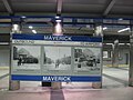 Maverick station sign with historical images, October 2011.jpg 2,048 × 1,536; 851 KB
-
 Max Klein at T station for Wikipedia in Higher Education Summit, 2011-07-07.jpg 1,600 × 1,067; 1.38 MB
-
 MBTA 010 at South Station, February 2011.jpg 640 × 480; 68 KB
-
 MBTA 1004 in Charlestown.jpg 2,048 × 1,536; 499 KB
-
 MBTA 1011 at MBTA CRMF, November 2011.jpg 2,592 × 1,944; 1.75 MB
-
 MBTA 1028 in the shop.JPG 4,320 × 3,240; 3.31 MB
-
 MBTA 1118 near South Station, September 2011.jpg 4,224 × 2,172; 4.46 MB
-
 MBTA 1634 on Longfellow Bridge, September 2011.jpg 3,880 × 2,441; 4 MB
-
 MBTA 205 at MBTA CRMF, November 2011.jpg 2,592 × 1,944; 1.69 MB
-
 MBTA 2nd New Locomotive In Service, February 14, 2011 (5446319814).jpg 2,816 × 2,112; 1.87 MB
-
 MBTA 3610 at Museum of Fine Arts station, December 2011.jpg 612 × 612; 156 KB
-
 MBTA 3640 at Riverside, October 2011.jpg 3,264 × 2,448; 3.64 MB
-
 MBTA 59 at North Station, September 2011.jpg 4,000 × 3,000; 2.87 MB
-
 MBTA 616 shop.jpg 2,592 × 1,944; 1.59 MB
-
 MBTA Acting GM Davis, Park Street Station, September 8, 2011 (6129814073).jpg 4,288 × 2,848; 7.9 MB
-
 MBTA Ashmont Station, Secretary Davey, October 21, 2011 (6267440316).jpg 2,048 × 1,536; 491 KB
-
 MBTA Boston subway map.png 3,062 × 2,415; 650 KB
-
 MBTA commuter car headend.agr.jpg 2,048 × 1,536; 1.13 MB
-
 MBTA Commuter Rail Maintenance Facility.jpg 3,240 × 4,320; 2.02 MB
-
 MBTA Green Line shuttle bus at North Station, September 2011.jpg 2,048 × 1,536; 604 KB
-

-
 MBTA locomotives at South Station.JPG 2,048 × 1,536; 704 KB
-
 MBTA locomotives running light near Back Bay, August 2011.jpg 1,294 × 1,941; 596 KB
-
 MBTA Lowell line boarding platform at Gallagher station; Lowell, MA; 2011-09-09.JPG 4,608 × 3,456; 5.1 MB
-
 MBTA Maintenance Facility from Inner Belt.jpg 4,315 × 1,717; 1.53 MB
-
 MBTA Neoplan AN440LF 0474.jpg 3,648 × 2,736; 2.71 MB
-
 MBTA Neoplan AN440LF 4122 Trolleybus.jpg 1,314 × 722; 449 KB
-
 MBTA New Flyer D40LF 0664 at Haymarket, March 2011.jpg 1,024 × 768; 465 KB
-
 MBTA RDCs 1.JPG 1,333 × 1,023; 350 KB
-
 MBTA Red Line 1400 series.JPG 2,592 × 1,936; 1.01 MB
-
 MBTA Red Line Floating Slab Project construction, December, 2011.jpg 640 × 480; 137 KB
-
 MBTA Red Line Reconstruction, December 4, 2011 (6459562745).jpg 640 × 480; 156 KB

.jpg)


.jpg)


,_April_2011.jpg)
.jpg)


,_April_2011.jpg)
,_April_2011.jpg)


.jpg)


.jpg)
.jpg)


.jpg)


.jpg)