Category:Locator maps of territories of the Holy Roman Empire (1789)
Jump to navigation
Jump to search

The Holy Roman Empire circa 1789
Portions of member states not within the Holy Roman Empire
Media in category "Locator maps of territories of the Holy Roman Empire (1789)"
The following 11 files are in this category, out of 11 total.
-
 Austrian Netherlands 1789.svg 450 × 456; 858 KB
-
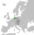
 Duchy of Holstein 1789.svg 450 × 456; 928 KB
-
 Duchy of Mecklenburg-Schwerin 1789.svg 450 × 456; 928 KB
-
 Duchy of Württemberg 1789.svg 450 × 456; 928 KB
-
 Ecclesiastical lands of the Holy Roman Empire 1789.svg 450 × 456; 928 KB
-
 Electorate of Bavaria 1789.svg 450 × 456; 928 KB
-
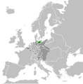
 Electorate of Brunswick-Lüneburg 1789.svg 450 × 456; 928 KB
-
 Electorate of Saxony 1789.svg 450 × 456; 928 KB
-
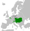 Habsburg Monarchy 1789.svg 450 × 456; 857 KB
-
 Kingdom of Prussia 1789.svg 450 × 456; 876 KB
-
 Landgraviate of Hesse-Kassel 1789.svg 450 × 456; 928 KB


