Category:Locator maps of territories of the Holy Roman Empire
Jump to navigation
Jump to search
Subcategories
This category has the following 8 subcategories, out of 8 total.
.
Media in category "Locator maps of territories of the Holy Roman Empire"
The following 29 files are in this category, out of 29 total.
-
 Bavarian Circle-2005-10-15-de.png 727 × 714; 67 KB
-
 Bavarian Circle-2005-10-15-en.png 727 × 714; 67 KB
-
 Bavarian Circle-hu.png 610 × 599; 218 KB
-
 Bayern-Straubing nach der Teilung 1392.png 1,200 × 723; 311 KB
-
 Duchy of Bohemia and the Holy Roman Empire in 11th century.svg 485 × 340; 1.23 MB
-
 Free Imperial Cities 1792.png 1,545 × 1,330; 439 KB
-
 Habsburg Monarchy 1714.svg 450 × 456; 915 KB
-
 HRE Dioceses Prince-Bishoprics, c. 1780.jpg 1,013 × 1,294; 337 KB
-
 Karte Niederbayern-Landshut und Oberbayern.png 1,200 × 1,140; 361 KB
-
 Locator Austrian Circle.svg 1,165 × 1,140; 193 KB
-
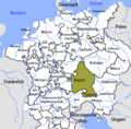
 Locator Bavarian Circle.svg 1,165 × 1,140; 193 KB
-
 Locator Bishopric of Meissen - NL.png 1,917 × 1,289; 1,008 KB
-
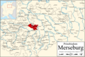 Locator Bishopric of Merseburg - NL.png 1,917 × 1,289; 1,013 KB
-
 Locator Bishopric of Naumburg - NL.png 1,917 × 1,289; 1,012 KB
-
 Locator Burgundian Circle.svg 1,165 × 1,140; 156 KB
-
 Locator Duchy of Saxony (1554-1566)-NL.svg 1,725 × 1,160; 444 KB
-
 Locator Electoral Rhenish Circle.svg 1,165 × 1,140; 193 KB
-
 Locator Franconian Circle.svg 1,165 × 1,140; 193 KB
-
 Locator Lower Saxon Circle.svg 1,165 × 1,140; 193 KB
-
 Locator Swabian Circle.svg 1,165 × 1,140; 193 KB
-
 Locator Upper Saxon Circle.svg 1,165 × 1,140; 193 KB
-
 Locator Upper-Rhenisch Circle.svg 1,165 × 1,140; 193 KB
-
 Locator Westphalian Circle.svg 1,165 × 1,140; 193 KB
-
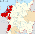
 Low Countries Locator Cleves.svg 1,550 × 2,000; 381 KB
-
 Low Countries Locator Duchy of Julich.svg 1,550 × 2,000; 381 KB
-
 Swabian Circle hu.PNG 610 × 599; 212 KB
-
 Swabian Circle-2005-10-15-en.png 727 × 714; 67 KB
-
 The County of Guastalla.png 2,560 × 2,560; 114 KB
-
 帝国自由都市.png 1,545 × 1,330; 496 KB


-NL.svg)


