Category:Locator maps of islands in Australia
Appearance
Subcategories
This category has the following 8 subcategories, out of 8 total.
A
C
H
L
N
Media in category "Locator maps of islands in Australia"
The following 29 files are in this category, out of 29 total.
-
Aus - Bribie Island.PNG 660 × 557; 37 KB
-
Aus - Daydream Island.PNG 660 × 456; 14 KB
-
Aus - Hamilton Island.PNG 660 × 456; 13 KB
-
Aus - Hayman Island.PNG 660 × 456; 13 KB
-
Aus - Long Island.PNG 660 × 456; 13 KB
-
Aus - Moreton bay area.PNG 660 × 557; 37 KB
-
Aus - Moreton Island.PNG 660 × 557; 38 KB
-
Aus - North Stradbroke Island.PNG 660 × 557; 37 KB
-
Aus - Russel Island.PNG 660 × 557; 37 KB
-
Aus - South Stradbroke Island.PNG 660 × 557; 37 KB
-
Aus - Whitesunday Island.PNG 660 × 456; 14 KB
-
Aus - Whitsunday Islands.PNG 660 × 455; 13 KB
-
Australia Groote Eylandt.png 625 × 656; 9 KB
-
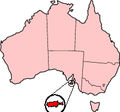
Australia Kangaroo Island.png 200 × 186; 11 KB
-
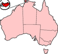
Australia Melville Island.png 200 × 186; 11 KB
-
CSIslands.png 308 × 223; 4 KB
-
Curtis Island location map.png 678 × 881; 23 KB
-
Fraser Island location map.png 678 × 881; 22 KB
-
Fraser Island.PNG 660 × 506; 14 KB
-
FurneauxGroup.png 369 × 504; 20 KB
-
GardenIsland.gif 550 × 746; 15 KB
-
LGATasmania Flinders.png 369 × 504; 22 KB
-
Location Wolf Rock (Queensland).png 542 × 467; 9 KB
-
Lord Howe Island.PNG 542 × 467; 9 KB
-
Maatsuyker Islands.PNG 553 × 519; 12 KB
-
Major islands off Perth, Western Australia.svg 2,218 × 2,495; 54 KB
-
Stradbroke Island location.png 678 × 881; 27 KB
-
Tasmania locator-MJC.png 563 × 476; 12 KB
-
Whitsunday Islands locator-MJC.png 563 × 476; 23 KB


