Category:Locator maps of countries of Europe (gray and green globe scheme)
Jump to navigation
Jump to search
Temperate regions: North America · South America · Africa · Europe · Asia · Oceania – Polar regions: – Other regions:

Subcategories
This category has the following 2 subcategories, out of 2 total.
Media in category "Locator maps of countries of Europe (gray and green globe scheme)"
The following 9 files are in this category, out of 9 total.
-
 1Ukraine (orthographic projection).png 2,048 × 2,048; 1.03 MB
-
 Balearic Islands, Spain (orthographic projection).png 543 × 548; 104 KB
-
 Norhern Cyprus (orthographic projection).png 2,000 × 2,000; 658 KB
-
 Northern Cyprus (ortographic projection).png 2,000 × 2,000; 659 KB
-
 Orthographic projection map of Serbia (2006–2008).png 1,106 × 1,106; 487 KB
-
 Republic of Artsakh (orthographic projection) v1.png 617 × 613; 120 KB
-
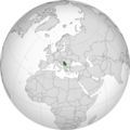
 Romania (orthographic projection).png 550 × 550; 140 KB
-
 Spain (orthographic projection).png 550 × 550; 130 KB
-
 Ukraine (orthographic projection).png 2,048 × 2,048; 1.03 MB
.png)
.png)
.png)
.png)
.png)
_v1.png)
.png)
.png)
.png)