Category:Locator maps of Europe (gray and green globe scheme)
Jump to navigation
Jump to search
Subcategories
This category has the following 2 subcategories, out of 2 total.
Media in category "Locator maps of Europe (gray and green globe scheme)"
The following 4 files are in this category, out of 4 total.
-
 Catalonia (orthographic projection).png 1,280 × 1,280; 501 KB
-
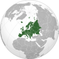 Europe orthographic Caucasus Urals boundary (with borders).png 537 × 536; 157 KB
-
 French constitutional referendum, 1958 results.png 2,000 × 2,000; 317 KB
-
 Locator maps of Europe (including Cyprus and Transcaucasia).png 2,052 × 2,048; 869 KB
.png)
.png)

.png)