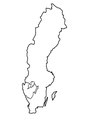
Category:Locator maps of counties of Sweden
Jump to navigation
Jump to search
Svenska: Lägeskartor över Sveriges län.
Subcategories
This category has only the following subcategory.
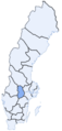
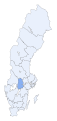
Media in category "Locator maps of counties of Sweden"
The following 52 files are in this category, out of 52 total.
-
 Counties of Sweden, SCB, letters.png 294 × 674; 7 KB
-
 Sweden counties.png 240 × 512; 8 KB
-
 Sweden regions.png 240 × 512; 7 KB
-
 Svcmap blekinge.png 192 × 400; 8 KB
-
 SverigesLän2007Blekinge.svg 287 × 606; 74 KB
-
 Svcmap dalarna.png 192 × 400; 8 KB
-
 SverigesLän2007Dalarna.svg 287 × 606; 74 KB
-
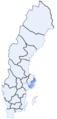
 Svcmap gotland.png 192 × 400; 8 KB
-
 SverigesLän2007Gotland.svg 287 × 606; 74 KB
-
 Svcmap gavleborg.png 192 × 400; 8 KB
-
 SverigesLän2007Gävleborg.svg 287 × 606; 74 KB
-
 SverigesLän1997Göteborgs och Bohus.svg 290 × 660; 54 KB
-
 Svcmap halland.png 192 × 400; 8 KB
-
 SverigesLän2007Halland.svg 287 × 606; 74 KB
-
 Svcmap jamtland.png 192 × 400; 8 KB
-
 SverigesLän2007Jämtland.svg 287 × 606; 74 KB
-
 Svcmap jonkoping.png 192 × 400; 8 KB
-
 SverigesLän2007Jönköping.svg 287 × 606; 74 KB
-
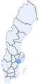
 Svcmap kalmar.png 192 × 400; 8 KB
-
 SverigesLän2007Kalmar.svg 287 × 606; 74 KB
-
 SverigesLän1996Kristianstad.svg 290 × 660; 55 KB
-
 Svcmap kronoberg.png 192 × 400; 8 KB
-
 SverigesLän2007Kronoberg.svg 287 × 606; 73 KB
-
 SverigesLän1996Malmöhus.svg 290 × 660; 55 KB
-
 Svcmap norrbotten.png 192 × 400; 9 KB
-
 SverigesLän2007Norrbotten.svg 287 × 606; 74 KB
-
 SverigesLän1997Skaraborg.svg 290 × 660; 54 KB
-
 Svcmap skane.png 192 × 400; 4 KB
-
 SverigesLän2007Skåne.svg 287 × 606; 74 KB
-
 Svcmap stockholm.png 192 × 400; 8 KB
-
 SverigesLän2007Stockholm.svg 287 × 606; 73 KB
-
 Svcmap sodermanland.png 192 × 400; 8 KB
-
 SverigesLän2007Södermanland.svg 287 × 606; 73 KB
-
 Svcmap uppsala.png 192 × 400; 8 KB
-
 SverigesLän2007Uppsala.svg 287 × 606; 74 KB
-
 Svcmap varmland.png 192 × 400; 8 KB
-
 SverigesLän2007Värmland.svg 287 × 606; 74 KB
-
 Svcmap vasterbotten.png 192 × 400; 8 KB
-
 SverigesLän2007Västerbotten.svg 287 × 606; 74 KB
-
 Svcmap vasternorrland.png 192 × 400; 8 KB
-
 SverigesLän2007Västernorrland.svg 287 × 606; 73 KB
-
 Svcmap vastmanland.png 192 × 400; 8 KB
-
 SverigesLän2007Västmanland.svg 287 × 606; 73 KB
-
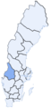
 Svcmap vastra gotaland.png 192 × 400; 8 KB
-
 SverigesLän2007Västra Götaland.svg 287 × 606; 73 KB
-
 Västra Götaland County borders 01.pdf 1,239 × 1,754; 14 KB
-
 Västra Götaland County borders 02.png 3,562 × 7,014; 288 KB
-
 SverigesLän1997Älvsborg.svg 290 × 660; 54 KB
-
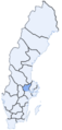
 Svcmap Orebro.png 192 × 400; 8 KB
-
 SverigesLän2007Örebro.svg 287 × 606; 73 KB
-
 Svcmap Ostergotland.png 192 × 400; 8 KB
-
 SverigesLän2007Östergötland.svg 287 × 606; 73 KB


