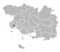
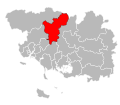
Category:Locator maps of cantons of Morbihan
Jump to navigation
Jump to search
Departments of Metropolitan France: Ain [01] · Aisne [02] · Allier [03] · Alpes-de-Haute-Provence [04] · Hautes-Alpes [05] · Alpes-Maritimes [06] · Ardèche [07] · Ardennes [08] · Ariège [09] · Aube [10] · Aude [11] · Aveyron [12] · Bouches-du-Rhône [13] · Calvados [14] · Cantal [15] · Charente [16] · Charente-Maritime [17] · Cher [18] · Corrèze [19] · Corse-du-Sud [2A]† · Haute-Corse [2B]† · Côte-d’Or [21] · Côtes-d'Armor [22] · Creuse [23] · Dordogne [24] · Doubs [25] · Drôme [26] · Eure [27] · Eure-et-Loir [28] · Finistère [29] · Gard [30] · Haute-Garonne [31] · Gers [32] · Gironde [33] · Hérault [34] · Ille-et-Vilaine [35] · Indre [36] · Indre-et-Loire [37] · Isère [38] · Jura [39] · Landes [40] · Loir-et-Cher [41] · Loire [42] · Haute-Loire [43] · Loire-Atlantique [44] · Loiret [45] · Lot [46] · Lot-et-Garonne [47] · Lozère [48] · Maine-et-Loire [49] · Manche [50] · Marne [51] · Haute-Marne [52] · Mayenne [53] · Meurthe-et-Moselle [54] · Meuse [55] · Morbihan [56] · Moselle [57] · Nièvre [58] · Nord [59] · Oise [60] · Orne [61] · Pas-de-Calais [62] · Puy-de-Dôme [63] · Pyrénées-Atlantiques [64] · Hautes-Pyrénées [65] · Pyrénées-Orientales [66] · Bas-Rhin [67] · Haut-Rhin [68] · Haute-Saône [70] · Saône-et-Loire [71] · Sarthe [72] · Savoie [73] · Haute-Savoie [74] · Paris [75] · Seine-Maritime [76] · Seine-et-Marne [77] · Yvelines [78] · Deux-Sèvres [79] · Somme [80] · Tarn [81] · Tarn-et-Garonne [82] · Var [83] · Vaucluse [84] · Vendée [85] · Vienne [86] · Haute-Vienne [87] · Vosges [88] · Yonne [89] · Territoire de Belfort [90] · Essonne [91] · Hauts-de-Seine [92] · Seine-Saint-Denis [93] · Val-de-Marne [94] · Val-d'Oise [95]
Overseas departments and regions: Guadeloupe [971] · Martinique [972] · French Guiana [973] · Réunion [974] · Mayotte [976]
Overseas departments and regions: Guadeloupe [971] · Martinique [972] · French Guiana [973] · Réunion [974] · Mayotte [976]
Subcategories
This category has the following 3 subcategories, out of 3 total.
Pages in category "Locator maps of cantons of Morbihan"
This category contains only the following page.
Media in category "Locator maps of cantons of Morbihan"
The following 43 files are in this category, out of 43 total.
-
Locator map of Kanton Auray 2019.png 2,500 × 1,890; 816 KB
-
Locator map of Kanton Gourin 2019.png 2,500 × 1,890; 825 KB
-
Locator map of Kanton Grand-Champ 2019.png 2,500 × 1,890; 822 KB
-
Locator map of Kanton Guer 2019.png 2,500 × 1,890; 822 KB
-
Locator map of Kanton Guidel 2019.png 2,500 × 1,890; 819 KB
-
Locator map of Kanton Hennebont 2019.png 2,500 × 1,890; 816 KB
-
Locator map of Kanton Lanester 2019.png 2,500 × 1,890; 815 KB
-
Locator map of Kanton Lorient-1 2019.png 2,500 × 1,890; 814 KB
-
Locator map of Kanton Lorient-2 2019.png 2,500 × 1,890; 814 KB
-
Morbihan - Canton Auray 2015.svg 486 × 423; 32 KB
-
Morbihan - Canton Gourin 2015.svg 486 × 423; 32 KB
-
Morbihan - Canton Grand-Champ 2015.svg 486 × 423; 32 KB
-
Morbihan - Canton Guer 2015.svg 486 × 423; 32 KB
-
Morbihan - Canton Guidel - 2015.png 1,140 × 992; 210 KB
-
Morbihan - Canton Guidel 2015.svg 486 × 423; 32 KB
-
Morbihan - Canton Hennebont 2015.svg 486 × 423; 32 KB
-
Morbihan - Canton Lanester 2015.svg 486 × 423; 32 KB
-
Morbihan - Canton Lorient-1 2015.svg 486 × 423; 32 KB
-
Morbihan - Canton Lorient-2 2015.svg 486 × 423; 32 KB
-
Morbihan - Canton Moréac 2015.svg 486 × 423; 32 KB
-
Morbihan - Canton Muzillac 2015.svg 486 × 423; 32 KB
-
Morbihan - Canton Ploemeur 2015.svg 486 × 423; 32 KB
-
Morbihan - Canton Ploërmel 2015.svg 486 × 423; 32 KB
-
Morbihan - Canton Pluvigner 2015.svg 486 × 423; 32 KB
-
Morbihan - Canton Pontivy 2015.svg 486 × 423; 32 KB
-
Morbihan - Canton Questembert 2015.svg 486 × 423; 32 KB
-
Morbihan - Canton Quiberon 2015.svg 486 × 423; 32 KB
-
Morbihan - Canton Séné 2015.svg 486 × 423; 32 KB
-
Morbihan - Canton Vannes-1 2015.svg 486 × 423; 32 KB
-
Morbihan - Canton Vannes-2 2015.svg 486 × 423; 32 KB
-
Morbihan - Canton Vannes-3 2015.svg 486 × 423; 32 KB
-
Locator map of Kanton Moréac 2019.png 2,500 × 1,890; 819 KB
-
Locator map of Kanton Muzillac 2019.png 2,500 × 1,890; 817 KB
-
Locator map of Kanton Ploemeur 2019.png 2,500 × 1,890; 815 KB
-
Locator map of Kanton Ploërmel 2019.png 2,500 × 1,890; 822 KB
-
Locator map of Kanton Pluvigner 2019.png 2,500 × 1,890; 819 KB
-
Locator map of Kanton Pontivy 2022.png 2,500 × 1,890; 820 KB
-
Locator map of Kanton Questembert 2019.png 2,500 × 1,890; 821 KB
-
Locator map of Kanton Quiberon 2019.png 2,500 × 1,890; 818 KB
-
Locator map of Kanton Séné 2019.png 2,500 × 1,890; 817 KB
-
Locator map of Kanton Vannes-1 2019.png 2,500 × 1,890; 815 KB
-
Locator map of Kanton Vannes-2 2019.png 2,500 × 1,890; 817 KB
-
Locator map of Kanton Vannes-3 2019.png 2,500 × 1,890; 816 KB


