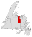
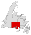
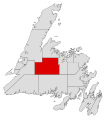
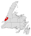
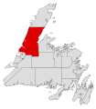
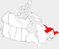
Category:Locator maps of Newfoundland and Labrador
Jump to navigation
Jump to search
Provinces and territories of Canada: Alberta · British Columbia · Manitoba · New Brunswick · Newfoundland and Labrador · Nova Scotia · Ontario · Prince Edward Island · Quebec · Saskatchewan · Northwest Territories · Nunavut · Yukon
Media in category "Locator maps of Newfoundland and Labrador"
The following 31 files are in this category, out of 31 total.
-
Baie Verte-Green Bay electoral district map.svg 545 × 620; 680 KB
-
Bonavista electoral district map.svg 545 × 620; 680 KB
-
Burgeo-La Poile electoral district map.svg 545 × 620; 680 KB
-
Burin-Grand Bank electoral district map.svg 545 × 620; 680 KB
-
Carbonear-Trinity-Bay de Verde electoral district map.svg 545 × 620; 680 KB
-
Corner Brook electoral district map.svg 545 × 620; 680 KB
-
Dominionofnewfoundlandlocation.PNG 1,280 × 1,280; 522 KB
-
Exploits electoral district map.svg 545 × 620; 680 KB
-
Ferryland electoral district map.svg 545 × 620; 680 KB
-
Fogo Island-Cape Freels electoral district map.svg 545 × 620; 680 KB
-
Fortune Bay-Cape La Hune electoral district map.svg 545 × 620; 680 KB
-
Gander electoral district map.svg 545 × 620; 680 KB
-
Grand Falls-Windsor-Buchans electoral district map.svg 545 × 620; 680 KB
-
Harbour Grace-Port de Grave electoral district map.svg 545 × 620; 680 KB
-
Harbour Main electoral district map.svg 545 × 620; 680 KB
-
Humber-Bay of Islands electoral district map.svg 545 × 620; 680 KB
-
Humber-Gros Morne electoral district map.svg 545 × 620; 680 KB
-
Lewisporte-Twillingate electoral district map.svg 545 × 620; 680 KB
-
Localisation TNL.svg 1,083 × 919; 96 KB
-
Newfoundland and Labrador highlighted in red in Canada.png 1,207 × 1,024; 309 KB
-
Newfoundland and Labrador in Canada 2.svg 1,114 × 942; 279 KB
-
Newfoundland and Labrador-map.png 280 × 230; 14 KB
-
NL-Canada-province.png 852 × 698; 165 KB
-
Nunatsiavut.png 280 × 230; 53 KB
-
Placentia West-Bellevue electoral district map.svg 545 × 620; 680 KB
-
Placentia-St. Mary's electoral district map.svg 545 × 620; 680 KB
-
Provmap-nl.png 250 × 210; 8 KB
-
St. Barbe-L'Anse aux Meadows electoral district map.svg 545 × 620; 680 KB
-
St. George's-Humber electoral district map.svg 545 × 620; 680 KB
-
Stephenville-Port au Port electoral district map.svg 545 × 620; 680 KB
-
Terra Nova electoral district map.svg 545 × 620; 680 KB


