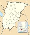
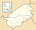
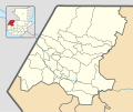
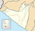
Category:Location maps of departments of Guatemala
Jump to navigation
Jump to search
| This category should only contain blank "Location maps" created for geo-location purposes which follow a same uniform standard, and have been created with a Geographic information system (GIS) software program using a compatible equirectangular or conical projection and for which the geographic coordinate system is known. For more information or questions see the wikiproject: German Wikipedia:Kartenwerkstatt/Positionskarten and this discussion page. |
Media in category "Location maps of departments of Guatemala"
The following 22 files are in this category, out of 22 total.
-
Alta Verapaz department location map.svg 453 × 351; 1.05 MB
-
Baja Verapaz department location map.svg 301 × 166; 886 KB
-
Chimaltenango department location map.svg 174 × 202; 892 KB
-
Chiquimula department location map.svg 206 × 231; 865 KB
-
El Progreso department location map.svg 211 × 179; 861 KB
-
Escuintla department location map.svg 306 × 216; 912 KB
-
Guatemala department location map.svg 186 × 228; 895 KB
-
Huehuetenango department location map.svg 375 × 313; 1.03 MB
-
Izabal department location map.svg 431 × 297; 1,008 KB
-
Jalapa department location map.svg 227 × 178; 849 KB
-
Jutiapa department location map.svg 257 × 265; 913 KB
-
Petén department location map.svg 703 × 638; 1.14 MB
-
Quetzaltenango department location map.svg 242 × 239; 910 KB
-
Quiché department location map.svg 341 × 408; 1.01 MB
-
Retalhuleu department location map.svg 223 × 199; 924 KB
-
Sacatepéquez department location map.svg 111 × 122; 812 KB
-
San Marcos department location map.svg 216 × 295; 924 KB
-
Santa Rosa department location map.svg 216 × 245; 892 KB
-
Sololá department location map.svg 159 × 148; 850 KB
-
Suchitepéquez department location map.svg 187 × 242; 944 KB
-
Totonicapán department location map.svg 130 × 167; 848 KB
-
Zacapa department location map.svg 236 × 217; 866 KB


