Category:Location maps of Guatemala
Jump to navigation
Jump to search
Countries of North America: Antigua and Barbuda · The Bahamas · Barbados · Belize · Canada · Costa Rica · Cuba · Dominica · Dominican Republic · El Salvador · Grenada · Guatemala · Haiti · Honduras · Jamaica · Mexico · Nicaragua · Panama · Saint Kitts and Nevis · Saint Lucia · Saint Vincent and the Grenadines · Trinidad and Tobago‡ · United States of America‡
Other territories: Greenland · Guadeloupe · Martinique · Montserrat · Puerto Rico · Saint Barthélemy · Saint-Martin · Saint Pierre and Miquelon · United States Virgin Islands
‡: partly located in North America
Other territories: Greenland · Guadeloupe · Martinique · Montserrat · Puerto Rico · Saint Barthélemy · Saint-Martin · Saint Pierre and Miquelon · United States Virgin Islands
‡: partly located in North America
 |
This category should only contain blank "Location maps" created for geo-location purposes which follow a same uniform standard, and have been created with a Geographic information system (GIS) software program using a compatible equirectangular or conical projection and for which the geographic coordinate system is known. For more information or questions see the wikiproject: German Wikipedia:Kartenwerkstatt/Positionskarten and this discussion page. |
Subcategories
This category has only the following subcategory.
Media in category "Location maps of Guatemala"
The following 5 files are in this category, out of 5 total.
-
 Guatemala location map (+Belize).svg 512 × 571; 230 KB
-
 Guatemala location map.svg 982 × 1,080; 120 KB
-
 Guatemala-geographic map-blank.svg 2,000 × 2,232; 14.42 MB
-
 Península de Yucatán.svg 923 × 753; 183 KB
-
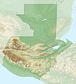 Relief map of Guatemala.jpg 1,160 × 1,276; 497 KB
.svg)


