Category:Location maps of Thuringia
Jump to navigation
Jump to search
Federal states of Germany:
 |
This category should only contain blank "Location maps" created for geo-location purposes which follow a same uniform standard, and have been created with a Geographic information system (GIS) software program using a compatible equirectangular or conical projection and for which the geographic coordinate system is known. For more information or questions see the wikiproject: German Wikipedia:Kartenwerkstatt/Positionskarten and this discussion page. |
Media in category "Location maps of Thuringia"
The following 5 files are in this category, out of 5 total.
-
 Germany Thuringia rel location map.svg 966 × 758; 719 KB
-
 Thuringia relief location map.jpg 1,492 × 1,171; 798 KB
-
 Thuringia location map G.svg 966 × 758; 781 KB
-
 Thuringia location map.svg 966 × 758; 161 KB
-
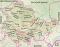 Thüringen Kreise Namen.png 2,076 × 1,630; 6.29 MB


