Category:Linguistic maps of Ireland
Jump to navigation
Jump to search
Subcategories
This category has only the following subcategory.
E
Media in category "Linguistic maps of Ireland"
The following 30 files are in this category, out of 30 total.
-
 Cainteoirí Gaeilge - Irish Speakers.JPG 483 × 604; 51 KB
-
 Cainteoirí Gaeilge - Irish Speakers.png 402 × 501; 55 KB
-
 Cainteoirí Gaeilge - Irish Speakers.svg 710 × 910; 152 KB
-
 Density BIR.jpg 2,100 × 2,100; 151 KB
-
 Density CATTU.jpg 2,100 × 2,100; 150 KB
-
 Density LUG.jpg 2,100 × 2,100; 161 KB
-
 Density MAQI.jpg 2,100 × 2,100; 151 KB
-
 Density MUCOI.jpg 2,100 × 2,100; 155 KB
-
 Dialects of English in UK and Ireland.svg 744 × 1,052; 324 KB
-
 Foreign languages in northern ireland.png 18,870 × 14,693; 11 MB
-
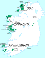
 Gaeilig in Uladh.jpg 330 × 364; 25 KB
-
 Gaeltacht.jpg 273 × 347; 26 KB
-
 Gaeltacht.svg 906 × 1,163; 72 KB
-
 Gaeltachtai le hainmneacha2 br.svg 906 × 1,163; 86 KB
-
 Gaeltachtai le hainmneacha2.svg 906 × 1,163; 224 KB
-
 Idioma irlandés.PNG 336 × 332; 5 KB
-
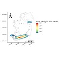
 Ireland, Kurdish population (2016 census).svg 710 × 891; 590 KB
-
 Irish speakers in 2011.png 11,541 × 14,788; 4.6 MB
-
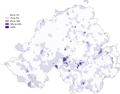
 Irish speakers in the 2011 census in Northern Ireland.png 21,689 × 16,887; 13.91 MB
-
 Irishin1871.jpg 793 × 967; 614 KB
-
 Languages of Great Britain and Ireland.png 4,765 × 6,618; 3.35 MB
-
 Map of those with some ability in Irish in the 2011 census in Northern Ireland.png 18,870 × 14,693; 11.65 MB
-

-
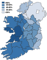
 Percentage stating they can speak Irish in the 2011 census.png 12,407 × 17,491; 15.54 MB
-

-
 Percentage stating they speak Irish daily outside the education system in the 2011 census.png 10,560 × 14,885; 10.61 MB
-
 PSM V52 D169 Origin of place names of the british isles.png 1,960 × 3,073; 395 KB
-
 Ulster-Scots speakers in the 2011 census in Northern Ireland.png 20,838 × 16,226; 13.07 MB
-
 Ír nyelv (1917).png 459 × 624; 418 KB
-
 Гелтахт.svg 906 × 1,163; 185 KB


.svg)


.png)


.png)
