Category:Linguistic maps of England
Jump to navigation
Jump to search
Subcategories
This category has the following 2 subcategories, out of 2 total.
Media in category "Linguistic maps of England"
The following 14 files are in this category, out of 14 total.
-
 (1898) p207 - Map of Northumberland dialects.jpg 1,508 × 2,324; 811 KB
-
 -ham and -ingham place names (1).png 1,632 × 2,016; 291 KB
-
 -ham and -ingham place names.png 1,632 × 2,016; 298 KB
-
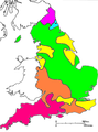
 English Dialects.jpg 2,722 × 3,662; 849 KB
-
 Final er in Farmer English dialects.PNG 440 × 594; 33 KB
-
 Foot-strut split.svg 1,129 × 1,385; 115 KB
-
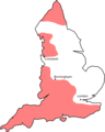
 H-dropping.svg 1,129 × 1,385; 113 KB
-
 Idioma córnico.jpg 401 × 607; 27 KB
-
 Initial fricative voicing.svg 1,129 × 1,385; 108 KB
-
 Local pronunciations of bath in England.jpg 558 × 625; 320 KB
-
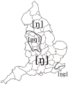 Ng-coalescence.svg 1,129 × 1,385; 110 KB
-
 RhoticEngland.png 1,144 × 1,425; 87 KB
-
 RhoticEngland2.png 1,144 × 1,425; 66 KB
-
 Traditional dialect isoglosses in northern England.PNG 585 × 721; 92 KB
_p207_-_Map_of_Northumberland_dialects.jpg)
.png)


