Category:Libberton (civil parish)
Jump to navigation
Jump to search
Scottish parish in South Lanarkshire, Scotland, UK | |||||
| Upload media | |||||
| Instance of | |||||
|---|---|---|---|---|---|
| Part of |
| ||||
| Location |
| ||||
| Population |
| ||||
| Area |
| ||||
 | |||||
Subcategories
This category has the following 3 subcategories, out of 3 total.
Media in category "Libberton (civil parish)"
The following 200 files are in this category, out of 240 total.
(previous page) (next page)-

-
 A bend in the Clyde, Libberton - geograph.org.uk - 6335277.jpg 1,600 × 1,060; 246 KB
-
 A meander of the South Medwin - geograph.org.uk - 6133403.jpg 3,264 × 2,448; 4.7 MB
-
 A trig point at Libberton - geograph.org.uk - 1305792.jpg 640 × 472; 131 KB
-
 A721, Oggscastle Bridge - geograph.org.uk - 6511093.jpg 1,024 × 769; 584 KB
-

-

-
 Autumn beeches by Biggar Road - geograph.org.uk - 5608919.jpg 1,024 × 586; 136 KB
-

-
 B7016 heading out of Libberton - geograph.org.uk - 3684217.jpg 640 × 480; 48 KB
-
 B7016 leaving Libberton - geograph.org.uk - 6335265.jpg 1,600 × 1,060; 210 KB
-
 B7016 near Knock Wood - geograph.org.uk - 5608921.jpg 1,024 × 670; 154 KB
-
 B7016 road to Carnwath - geograph.org.uk - 5607043.jpg 1,024 × 682; 131 KB
-
 B7016, Whitecastle - geograph.org.uk - 2277376.jpg 640 × 359; 200 KB
-
 Barley field by the Cleave Burn - geograph.org.uk - 4526906.jpg 4,608 × 3,456; 5.59 MB
-
 Barley field in springtime - geograph.org.uk - 4502793.jpg 1,024 × 685; 188 KB
-
 Beeches, Quothquan Law - geograph.org.uk - 1854518.jpg 480 × 640; 120 KB
-
 Between Biggar and Thankerton - geograph.org.uk - 4904121.jpg 640 × 396; 108 KB
-
 Biggar Country Paths Network - geograph.org.uk - 4904092.jpg 439 × 640; 120 KB
-
 Birch trees near Millridge Farm - geograph.org.uk - 6130854.jpg 3,264 × 2,448; 5.98 MB
-
 Blackwell Tryst - geograph.org.uk - 2277391.jpg 640 × 480; 242 KB
-
 Bridge over the South Medwin - geograph.org.uk - 6133408.jpg 3,264 × 2,448; 4.44 MB
-
 Buildings at Roadhead Farm - geograph.org.uk - 1315749.jpg 640 × 366; 156 KB
-
 Burn near Cocklaw - geograph.org.uk - 1853840.jpg 640 × 480; 100 KB
-
 Cattle crossing the road, Quothquan - geograph.org.uk - 4713454.jpg 1,024 × 640; 151 KB
-
 Cocklaw Hill from the air - geograph.org.uk - 3117540.jpg 640 × 480; 139 KB
-
 Conifer-lined B7016 - geograph.org.uk - 3663599.jpg 640 × 480; 64 KB
-
 Cormiston Countryside - geograph.org.uk - 3751462.jpg 2,592 × 1,936; 1.61 MB
-
 Cormiston farm tracks - geograph.org.uk - 4948197.jpg 4,896 × 3,672; 6.69 MB
-

-
 Cormiston Roads - geograph.org.uk - 4904105.jpg 640 × 439; 92 KB
-
 Cottages at Libberton - geograph.org.uk - 6335262.jpg 1,600 × 1,060; 446 KB
-

-
 Cultivated field below Quothquan Law - geograph.org.uk - 5876256.jpg 1,024 × 768; 197 KB
-
 Dark clouds over Quothquan Law - geograph.org.uk - 5876241.jpg 1,024 × 768; 221 KB
-
 Disused railway track - geograph.org.uk - 161873.jpg 640 × 480; 74 KB
-
 Dovecote at Shieldhill, Quothquan - geograph.org.uk - 6005398.jpg 1,600 × 1,060; 366 KB
-
 Eastertown, Quothquan - geograph.org.uk - 4847012.jpg 1,024 × 682; 165 KB
-
 Eastertown, Quothquan - geograph.org.uk - 6005384.jpg 1,600 × 1,060; 374 KB
-
 Edge of Knock Wood - geograph.org.uk - 2277358.jpg 640 × 480; 280 KB
-

-
 Entering Libberton from the North - geograph.org.uk - 3663559.jpg 640 × 480; 69 KB
-
 Entrance to Cormiston Estate - geograph.org.uk - 3677233.jpg 640 × 442; 95 KB
-
 Entrance to forestry near Whitecastle - geograph.org.uk - 6129829.jpg 3,264 × 2,448; 5.25 MB
-
 Entrance to Shieldhill Castle Hotel, Quothquan - geograph.org.uk - 6005405.jpg 1,600 × 1,060; 522 KB
-
 Fallen gate - geograph.org.uk - 2067483.jpg 640 × 480; 142 KB
-
 Farm buildings at Muirlea Farm - geograph.org.uk - 6130250.jpg 3,264 × 2,448; 3.99 MB
-
 Farm name sign, Libberton - geograph.org.uk - 6335280.jpg 1,600 × 1,060; 141 KB
-
 Farm track down to the River Clyde - geograph.org.uk - 5876260.jpg 1,024 × 768; 144 KB
-
 Farmland above the Clyde - geograph.org.uk - 1864892.jpg 640 × 480; 73 KB
-
 Farmland and Quothquan Law - geograph.org.uk - 6335269.jpg 1,600 × 1,060; 285 KB
-
 Farmland at Cormiston - geograph.org.uk - 4058117.jpg 1,024 × 685; 214 KB
-
 Farmland by the B7016, Libberton - geograph.org.uk - 6335285.jpg 1,600 × 1,060; 447 KB
-
 Farmland by the Medwin Water - geograph.org.uk - 3697470.jpg 640 × 453; 62 KB
-
 Farmland near Cormiston Mains - geograph.org.uk - 1864916.jpg 640 × 480; 105 KB
-
 Farmlands below Quothquan Law - geograph.org.uk - 3680069.jpg 640 × 480; 51 KB
-
 Field at West Whitecastle - geograph.org.uk - 6129817.jpg 3,264 × 2,448; 5.07 MB
-

-
 Field, Blackwell Tryst - geograph.org.uk - 2277383.jpg 640 × 480; 263 KB
-
 Field, Quothquan - geograph.org.uk - 1854567.jpg 640 × 480; 102 KB
-
 Field, Whitecastle - geograph.org.uk - 2277371.jpg 640 × 359; 191 KB
-
 Fields and forestry near Libberton - geograph.org.uk - 6130864.jpg 3,264 × 2,448; 5.01 MB
-
 Fields at Libberton - geograph.org.uk - 6130824.jpg 3,264 × 2,448; 4.07 MB
-
 Forestry margin on the Biggar Road - geograph.org.uk - 6129757.jpg 3,264 × 2,448; 4.56 MB
-
 Friesian cattle on Quothquan Law - geograph.org.uk - 4526883.jpg 4,608 × 3,456; 4.52 MB
-
 Friesian cow on Quothquan Law - geograph.org.uk - 4526880.jpg 4,608 × 3,456; 5.35 MB
-
 Friesian heifers, Quothquan Law - geograph.org.uk - 1854561.jpg 640 × 359; 104 KB
-
 Friesians, Quothquan Law - geograph.org.uk - 1854539.jpg 640 × 480; 100 KB
-
 Gate to Barley field near Blackwell Tryst - geograph.org.uk - 6129837.jpg 3,264 × 2,448; 4.81 MB
-
 Gladstone - geograph.org.uk - 2728698.jpg 640 × 360; 224 KB
-
 Gladstone House - geograph.org.uk - 6135672.jpg 2,582 × 1,936; 2.08 MB
-
 Grass crop at Libberton - geograph.org.uk - 6130848.jpg 3,264 × 2,448; 5.01 MB
-
 Grass field by the Wooleyburn Strip - geograph.org.uk - 6133392.jpg 3,264 × 2,448; 3.86 MB
-
 Grass field near Whitecastle - geograph.org.uk - 6129914.jpg 3,264 × 2,448; 4.26 MB
-
 Grassland, Cormiston - geograph.org.uk - 2067847.jpg 640 × 480; 80 KB
-
 Grasslands and woods near Ogscastle - geograph.org.uk - 3764403.jpg 640 × 480; 55 KB
-

-

-
 Heather moorland on Biggar Common - geograph.org.uk - 5566738.jpg 4,608 × 3,456; 5.06 MB
-
 Heather moorland on Huntfield Hill - geograph.org.uk - 5566739.jpg 4,608 × 3,456; 5.95 MB
-
 Hill top pasture, Bellscraigs - geograph.org.uk - 6315388.jpg 1,024 × 683; 238 KB
-
 Hill top, Bellscraigs - geograph.org.uk - 6315386.jpg 1,024 × 683; 288 KB
-
 Hillhead - geograph.org.uk - 2067461.jpg 640 × 480; 51 KB
-
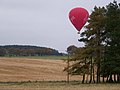 Hot Air Balloon Stuck In Tree^ - geograph.org.uk - 1536874.jpg 640 × 480; 63 KB
-
 Houses at Libberton - geograph.org.uk - 3697491.jpg 640 × 434; 52 KB
-
 Huntfield Hill - geograph.org.uk - 2732528.jpg 640 × 384; 202 KB
-
 Knock Wood - geograph.org.uk - 2277352.jpg 640 × 480; 309 KB
-
 Larch shelter belt - geograph.org.uk - 6129850.jpg 3,264 × 2,448; 4.32 MB
-
 Law Wood - geograph.org.uk - 4526895.jpg 4,608 × 3,456; 4.37 MB
-
 Lay-by beside Medwin Water, near Libberton - geograph.org.uk - 4713476.jpg 1,024 × 640; 131 KB
-
 Libberton and Quothquan Church - geograph.org.uk - 4191611.jpg 4,000 × 3,000; 2.82 MB
-
 Libberton And Quothquan Parish Church - geograph.org.uk - 4125431.jpg 2,560 × 1,920; 2.29 MB
-
 Libberton Churchyard - geograph.org.uk - 3697515.jpg 640 × 480; 116 KB
-
 Libberton Farmland - geograph.org.uk - 3697503.jpg 640 × 433; 73 KB
-
 Libberton House - geograph.org.uk - 5608923.jpg 1,024 × 682; 291 KB
-
 Libberton ^ Quothquan Parish Church - geograph.org.uk - 3663589.jpg 640 × 480; 71 KB
-
 Loanhead - geograph.org.uk - 2066279.jpg 640 × 480; 101 KB
-
 Loanhead Farm - geograph.org.uk - 1304471.jpg 640 × 419; 141 KB
-
 Logging road, Knock Wood - geograph.org.uk - 2277363.jpg 640 × 480; 261 KB
-
 Looking towards Shieldhill Hotel - geograph.org.uk - 3680207.jpg 640 × 480; 95 KB
-
 Medwin Water - geograph.org.uk - 3697445.jpg 640 × 461; 87 KB
-
 Medwin Water - geograph.org.uk - 3697452.jpg 640 × 464; 84 KB
-
 Medwin Water at Roseburgh Bridge - geograph.org.uk - 5608929.jpg 1,024 × 575; 123 KB
-
 Medwin Water from the air - geograph.org.uk - 3117936.jpg 480 × 640; 100 KB
-
 Midhill Farm sign - geograph.org.uk - 6130231.jpg 3,264 × 2,448; 3.02 MB
-
 Millridge Farm - geograph.org.uk - 6129798.jpg 3,264 × 2,448; 3.82 MB
-
 Minor road by Larch Knowe Wood - geograph.org.uk - 6335296.jpg 1,600 × 1,060; 385 KB
-
 Minor road to Yett and Townhead - geograph.org.uk - 5608924.jpg 1,024 × 682; 213 KB
-
 Molehills in a newly sown grass field - geograph.org.uk - 6130240.jpg 3,264 × 2,448; 4.51 MB
-
 New house, Libberton Moor - geograph.org.uk - 1181252.jpg 640 × 471; 70 KB
-
 New houses in Muirhouse Strip - geograph.org.uk - 5608926.jpg 1,024 × 690; 234 KB
-
 Newtown of Covington - geograph.org.uk - 2067459.jpg 640 × 480; 70 KB
-
 On the way to Libberton - geograph.org.uk - 3684176.jpg 640 × 480; 46 KB
-
 Ordnance Survey Flush Bracket G556 - geograph.org.uk - 4261668.jpg 4,000 × 3,000; 4.67 MB
-
 Ordnance Survey Flush Bracket G557 - geograph.org.uk - 4261697.jpg 4,000 × 3,000; 4.33 MB
-
 OS Bench mark G556 - geograph.org.uk - 1484115.jpg 640 × 480; 66 KB
-
 Paddock near Millridge Farm - geograph.org.uk - 6129768.jpg 3,264 × 2,448; 4.62 MB
-
 Paddock near Millridge Farm - geograph.org.uk - 6129771.jpg 3,264 × 2,448; 5.38 MB
-
 Parish Church of Libberton ^ Quothquan, Libberton - geograph.org.uk - 5769996.jpg 4,320 × 3,240; 2.75 MB
-
 Parish Church of Libberton ^ Quothquan, Libberton - geograph.org.uk - 5769999.jpg 4,320 × 3,240; 3.06 MB
-
 Parish Church of Libberton ^ Quothquan, Libberton - geograph.org.uk - 5770003.jpg 4,320 × 3,240; 2.99 MB
-
 Parkhouse - geograph.org.uk - 1854504.jpg 640 × 480; 78 KB
-
 Parkhouse - geograph.org.uk - 2066319.jpg 640 × 480; 82 KB
-
 Parkhouse Farm - geograph.org.uk - 1305834.jpg 640 × 427; 127 KB
-
 Pasture and plantation near Bellscraigs - geograph.org.uk - 6133386.jpg 3,264 × 2,448; 3.91 MB
-
 Pasture and trees near Whitecastle Farm - geograph.org.uk - 6129821.jpg 3,264 × 2,448; 5.11 MB
-
 Pasture at Baitlaw Farm - geograph.org.uk - 6129856.jpg 3,264 × 2,448; 3.92 MB
-
 Pasture near Whitecastle - geograph.org.uk - 6129890.jpg 3,264 × 2,448; 4.69 MB
-
 Pasture, Bellscraig - geograph.org.uk - 6315389.jpg 1,024 × 683; 249 KB
-
 Pasture, Bellscraigs - geograph.org.uk - 6315391.jpg 1,024 × 683; 223 KB
-
 Pasture, Cormiston - geograph.org.uk - 2905684.jpg 640 × 360; 228 KB
-
 Phone Box at Libberton - geograph.org.uk - 3697482.jpg 640 × 453; 72 KB
-
 Plantation on Whinney Brae - geograph.org.uk - 4948176.jpg 4,896 × 3,672; 6.64 MB
-
 Pleasant countryside view in summer - geograph.org.uk - 3095449.jpg 1,024 × 768; 145 KB
-
 Ploughed field close to Cormiston Mains - geograph.org.uk - 3939872.jpg 1,024 × 685; 203 KB
-
 Quothquan church ruins and churchyard - geograph.org.uk - 1496897.jpg 640 × 480; 110 KB
-
 Quothquan Law - geograph.org.uk - 1207524.jpg 640 × 480; 74 KB
-
 Quothquan Law - geograph.org.uk - 1305824.jpg 640 × 427; 154 KB
-
 Quothquan Law - geograph.org.uk - 1864899.jpg 640 × 359; 75 KB
-
 Quothquan Law - geograph.org.uk - 2066263.jpg 640 × 480; 93 KB
-
 Quothquan Law - geograph.org.uk - 3293738.jpg 1,600 × 1,200; 817 KB
-
 Quothquan Law - geograph.org.uk - 3956610.jpg 640 × 317; 73 KB
-
 Quothquan Law - geograph.org.uk - 815327.jpg 640 × 480; 23 KB
-
 Quothquan Law Farm - geograph.org.uk - 1305809.jpg 640 × 427; 121 KB
-
 Quothquan Law Farm - geograph.org.uk - 2067452.jpg 640 × 480; 105 KB
-
 Quothquan Law from the northeast - geograph.org.uk - 6005418.jpg 1,600 × 1,060; 280 KB
-
 Quothquan Law Hill Fort with its Triangulation Pillar - geograph.org.uk - 4191597.jpg 4,000 × 3,000; 2.65 MB
-
 Quothquan Law seen from chapel ruins - geograph.org.uk - 1496928.jpg 640 × 480; 70 KB
-
 Quothquan Law trig point - geograph.org.uk - 4526891.jpg 4,608 × 3,456; 4.37 MB
-
 Quothquan Lodge - geograph.org.uk - 1181255.jpg 640 × 454; 65 KB
-
 Quothquan Lodge - geograph.org.uk - 2067447.jpg 640 × 321; 54 KB
-
 Quothquan Road - geograph.org.uk - 807746.jpg 640 × 480; 64 KB
-
 Quothquan Village Hall - geograph.org.uk - 6005376.jpg 1,600 × 1,060; 383 KB
-
 Quothquan village sign - geograph.org.uk - 6005415.jpg 1,600 × 1,060; 573 KB
-
 Restoration of the old village hall - geograph.org.uk - 1484091.jpg 640 × 432; 131 KB
-
 River Clyde - geograph.org.uk - 2067450.jpg 640 × 480; 80 KB
-
 Road and Barns at Eastertown Farm - geograph.org.uk - 4191601.jpg 4,000 × 3,000; 2.38 MB
-
 Road between Eastertown and Quothquan Mill - geograph.org.uk - 4847018.jpg 1,024 × 682; 193 KB
-
 Road casualty near Muirlea Farm - geograph.org.uk - 6130260.jpg 3,264 × 2,448; 5.05 MB
-
 Road from Biggar Common - geograph.org.uk - 1864908.jpg 640 × 480; 97 KB
-
 Road to Biggar Common - geograph.org.uk - 1854552.jpg 640 × 480; 123 KB
-
 Road to Cormiston - geograph.org.uk - 4526908.jpg 4,608 × 3,456; 4.59 MB
-
 Road to Millridge near Libberton - geograph.org.uk - 6335291.jpg 1,600 × 1,060; 194 KB
-
 Roadhead - geograph.org.uk - 2066328.jpg 640 × 480; 84 KB
-
 Roads in Quothquan - geograph.org.uk - 3775194.jpg 2,592 × 1,936; 1.7 MB
-
 Roman Road (A721) - geograph.org.uk - 6511134.jpg 1,024 × 769; 621 KB
-
 Rose Cottage - geograph.org.uk - 3627315.jpg 800 × 533; 121 KB
-

-
 Rough ground beneath Quothquhan Law - geograph.org.uk - 2067480.jpg 640 × 480; 114 KB
-
 Sheep at Libberton Moor - geograph.org.uk - 4847024.jpg 1,024 × 682; 187 KB
-
 Sheep grazing by the Wooleyburn Strip - geograph.org.uk - 6133393.jpg 3,264 × 2,448; 4.22 MB
-
 Sheep near Gladstone - geograph.org.uk - 2731023.jpg 640 × 360; 229 KB
-
 Sheep, Shieldhill Road - geograph.org.uk - 1853849.jpg 640 × 480; 80 KB
-

-
 Shieldhill Road, along the River Clyde - geograph.org.uk - 3777527.jpg 2,592 × 1,936; 1.54 MB
-

-
 Slopes of Quothquan Law - geograph.org.uk - 2067467.jpg 640 × 480; 91 KB
-
 South Lanarkshire farmland - geograph.org.uk - 6133381.jpg 3,264 × 2,448; 4.49 MB
-
 Spring Barley at Libberton - geograph.org.uk - 6130834.jpg 3,264 × 2,448; 4.12 MB
-
 Spring Barley near Blackwell Tryst - geograph.org.uk - 6129845.jpg 3,264 × 2,448; 5.29 MB
-
 Spring grass, Roadhead Farm - geograph.org.uk - 1853854.jpg 640 × 480; 74 KB
-
 Spring grass, Roadhead Farm - geograph.org.uk - 1853857.jpg 640 × 480; 76 KB
-
 Stile To Law Hill - geograph.org.uk - 3293734.jpg 1,600 × 1,200; 929 KB
-
 Stile, Quothquan Law - geograph.org.uk - 1864883.jpg 640 × 480; 112 KB
-
 Storage tank at Millridge Farm - geograph.org.uk - 6129788.jpg 3,264 × 2,448; 3.5 MB
-
 Strip wood, Shieldhill Road - geograph.org.uk - 1853846.jpg 640 × 480; 158 KB
-
 Stripwood, Blackwell Tryst - geograph.org.uk - 6315393.jpg 1,024 × 683; 369 KB
-
 Stubble field at East Whitecastle - geograph.org.uk - 5608916.jpg 1,024 × 682; 238 KB
-
 Stubble field near Libberton - geograph.org.uk - 4713464.jpg 1,024 × 424; 84 KB
-
 Stubble, Gladstone - geograph.org.uk - 2731021.jpg 640 × 360; 246 KB
-
 Summit, Biggar Common - geograph.org.uk - 2067837.jpg 640 × 480; 128 KB
-
 Sunny afternoon close to Wester Whitecastle Farm - geograph.org.uk - 4029863.jpg 1,024 × 685; 190 KB
-
 Surrounded by Friesians - geograph.org.uk - 1854529.jpg 640 × 359; 94 KB
-
 Thankerton - geograph.org.uk - 1864904.jpg 640 × 480; 95 KB
-
 Thankerton from Quothquan Law - geograph.org.uk - 4526901.jpg 4,608 × 3,456; 4.47 MB
-
 The Black Mount - geograph.org.uk - 5844759.jpg 2,899 × 2,441; 2.91 MB
-
 The Clyde at Thankerton - geograph.org.uk - 6005368.jpg 1,600 × 1,060; 356 KB
-
 The Clyde At Thankerton Bridge - geograph.org.uk - 4289770.jpg 4,592 × 3,448; 4.28 MB
-
 The Medwin Water - geograph.org.uk - 3684234.jpg 640 × 480; 61 KB
-
 The old Smiddy at Quothquan - geograph.org.uk - 1484121.jpg 640 × 480; 28 KB
.jpg)


_-_geograph.org.uk_-_6511134.jpg)


&filefrom=The+Parish+Kirk+of+Libberton+and+Quothquan+-+geograph.org.uk+-+3684193.jpg#mw-category-media)