Category:Lasswade (civil parish)
Jump to navigation
Jump to search
Scottish parish in Midlothian, Scotland, UK | |||||
| Upload media | |||||
| Instance of | |||||
|---|---|---|---|---|---|
| Part of |
| ||||
| Named after | |||||
| Location |
| ||||
| Population |
| ||||
| Area |
| ||||
 | |||||
Subcategories
This category has the following 9 subcategories, out of 9 total.
Media in category "Lasswade (civil parish)"
The following 200 files are in this category, out of 914 total.
(previous page) (next page)-
 'The Carving is Complete' Rosslyn Chapel - geograph.org.uk - 2896549.jpg 800 × 533; 141 KB
-
 A Corner of the Kirkyard - geograph.org.uk - 5984482.jpg 640 × 640; 855 KB
-
 A Georgian House - geograph.org.uk - 5593345.jpg 640 × 427; 394 KB
-
 A gully on Kirk Bank - geograph.org.uk - 6774574.jpg 1,024 × 683; 427 KB
-
 A view of the Pentland Hills, Roslin - geograph.org.uk - 6773574.jpg 1,024 × 683; 172 KB
-
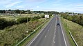
 A6094 - geograph.org.uk - 6516858.jpg 1,024 × 768; 253 KB
-
 A6094 - geograph.org.uk - 6829684.jpg 1,024 × 768; 251 KB
-
 A6094, Upper Firth - geograph.org.uk - 6516994.jpg 1,024 × 768; 198 KB
-
 A7 at Hardengreen - geograph.org.uk - 4338414.jpg 1,024 × 682; 179 KB
-
 A7, Eskbank bypass - geograph.org.uk - 2617085.jpg 640 × 360; 231 KB
-
 A7, Eskbank bypass - geograph.org.uk - 6154613.jpg 800 × 600; 115 KB
-
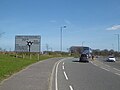
 A701 approaching roundabout - geograph.org.uk - 5454394.jpg 640 × 480; 53 KB
-
 A701 at Bilston - geograph.org.uk - 6529188.jpg 800 × 533; 332 KB
-
 A701 Gowkley Moss deviation - geograph.org.uk - 4914039.jpg 1,024 × 768; 258 KB
-
 A701 near to Bilston - geograph.org.uk - 6529197.jpg 800 × 533; 312 KB
-

-
 A701 southbound near Niven's Knowe - geograph.org.uk - 3541016.jpg 640 × 480; 48 KB
-
 A701 southbound, leaving Bilston - geograph.org.uk - 3541619.jpg 640 × 480; 62 KB
-
 A701 towards Edinburgh - geograph.org.uk - 5454396.jpg 640 × 480; 41 KB
-
 A701, Gowkley Moss - geograph.org.uk - 6526443.jpg 800 × 533; 269 KB
-
 A703 (Seafield Moor Road) at Damhead - geograph.org.uk - 6527224.jpg 800 × 600; 391 KB
-
 A768 leaving Loanhead - geograph.org.uk - 6509254.jpg 1,024 × 768; 276 KB
-
 Access road near Roslin - geograph.org.uk - 6053447.jpg 1,600 × 1,066; 681 KB
-
 Access road to Firth Mains - geograph.org.uk - 2076827.jpg 640 × 480; 79 KB
-
 Access to cyclepath at Rosslyn Castle Station - geograph.org.uk - 6078498.jpg 1,600 × 1,146; 693 KB
-
 Access to Roslin Glen - geograph.org.uk - 3961126.jpg 1,600 × 1,067; 943 KB
-
 Allermuir and Caerketton, from above Roslin - geograph.org.uk - 2162241.jpg 1,024 × 768; 147 KB
-
 Allermuir Hill - geograph.org.uk - 3377882.jpg 2,592 × 1,944; 1.2 MB
-
 Allermuir Hill - geograph.org.uk - 4271085.jpg 4,608 × 3,456; 5.56 MB
-
 Allermuir Hill - geograph.org.uk - 6753636.jpg 4,148 × 2,765; 3.45 MB
-
 Allermuir Hill - geograph.org.uk - 6753648.jpg 4,148 × 2,765; 3.8 MB
-
 Allermuir Hill - geograph.org.uk - 6753652.jpg 5,184 × 3,456; 6.43 MB
-

-
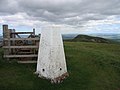
 Allermuir Hill, the summit - geograph.org.uk - 2179264.jpg 640 × 359; 53 KB
-
 An invitation to sit and blether - geograph.org.uk - 6052948.jpg 1,600 × 1,030; 545 KB
-
 Ancient Mound - geograph.org.uk - 2069498.jpg 3,072 × 2,304; 1.45 MB
-
 Apiary area at the Secret Herb Garden - geograph.org.uk - 5597400.jpg 3,264 × 2,448; 4.11 MB
-
 Aqueduct crossing Penicuik - Dalkeith cyclepath (2) - geograph.org.uk - 6088746.jpg 1,600 × 1,060; 459 KB
-
 Aqueduct crossing Penicuik - Dalkeith cyclepath - geograph.org.uk - 6088740.jpg 1,600 × 1,060; 755 KB
-
 Aqueduct crossing the North Esk, Roslin Glen - geograph.org.uk - 6088020.jpg 1,600 × 1,060; 713 KB
-
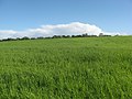 Arable crop at Gourlaw - geograph.org.uk - 2069483.jpg 3,072 × 2,304; 1.24 MB
-
 Artificial ski slope at Hillend, Edinburgh - geograph.org.uk - 6412541.jpg 1,797 × 1,198; 567 KB
-

-
 Auchendinny Wood - geograph.org.uk - 4854175.jpg 1,024 × 683; 472 KB
-
 Auchnacree - geograph.org.uk - 6527232.jpg 800 × 600; 431 KB
-
 Autumn by Rosslyn Chapel - geograph.org.uk - 3738618.jpg 640 × 424; 70 KB
-
 Autumn Scene - geograph.org.uk - 5983776.jpg 640 × 427; 408 KB
-
 Awaiting development, Rosewell - geograph.org.uk - 3692612.jpg 640 × 480; 263 KB
-
 B6372, Elginhaugh - geograph.org.uk - 6774581.jpg 1,024 × 683; 318 KB
-
 B7026 between Howgate and Auchendinny - geograph.org.uk - 6526005.jpg 1,024 × 769; 643 KB
-
 B7026 Northbound - geograph.org.uk - 6526010.jpg 1,024 × 683; 570 KB
-
 B7026 towards Auchendinny - geograph.org.uk - 6526020.jpg 1,024 × 683; 541 KB
-
 B7026, Loanstone - geograph.org.uk - 6526016.jpg 1,024 × 683; 586 KB
-
 Back view of chapel - geograph.org.uk - 4596355.jpg 4,608 × 3,456; 3.39 MB
-
 Badger by the road - geograph.org.uk - 3652325.jpg 3,264 × 2,448; 5.17 MB
-
 Battle of Roslin memorial - geograph.org.uk - 4192418.jpg 4,258 × 3,154; 5.24 MB
-
 Battle of Roslin Memorial - geograph.org.uk - 7046857.jpg 4,148 × 2,765; 6.02 MB
-
 Battle of Roslin monument - geograph.org.uk - 2815893.jpg 640 × 360; 281 KB
-
 Beech wood near Gowkley Moss - geograph.org.uk - 4766343.jpg 1,024 × 682; 291 KB
-
 Beside Mavisbank Gardens - geograph.org.uk - 5593515.jpg 640 × 427; 313 KB
-
 Bikes, Allermuir Hill - geograph.org.uk - 4638689.jpg 600 × 800; 211 KB
-
 Bilston Burn - geograph.org.uk - 6000596.jpg 1,600 × 1,066; 652 KB
-
 Bilston Burn - geograph.org.uk - 6961302.jpg 1,024 × 768; 146 KB
-
 Bilston Burn Park - geograph.org.uk - 6000479.jpg 1,600 × 1,066; 558 KB
-
 Bilston Burn Park - geograph.org.uk - 7133362.jpg 2,874 × 2,127; 1.37 MB
-
 Bilston Glen and Burn - geograph.org.uk - 2281317.jpg 2,048 × 1,536; 2.54 MB
-
 Bilston Glen Colliery's mineral line - geograph.org.uk - 6772802.jpg 1,024 × 683; 294 KB
-
 Bilston Glen from near Dryden Mains - geograph.org.uk - 2173403.jpg 1,024 × 768; 243 KB
-
 Bilston Glen from the viaduct - geograph.org.uk - 2173459.jpg 1,024 × 768; 127 KB
-
 Bilston Viaduct - geograph.org.uk - 7046876.jpg 4,148 × 2,765; 3.83 MB
-
 Bilston Wood - geograph.org.uk - 6772806.jpg 1,024 × 683; 410 KB
-
 Birches in Bilston Glen - geograph.org.uk - 2173411.jpg 576 × 768; 151 KB
-

-
 Boghall Burn, Spring - geograph.org.uk - 3997421.jpg 4,288 × 2,848; 5.68 MB
-
 Boghall Farm - geograph.org.uk - 5688296.jpg 640 × 427; 334 KB
-
 Boghall farm, Scottish Agricultural College - geograph.org.uk - 4083101.jpg 1,024 × 678; 228 KB
-
 Boghall Glen - geograph.org.uk - 5688242.jpg 640 × 427; 394 KB
-
 Boghall Masts - geograph.org.uk - 5688277.jpg 427 × 640; 299 KB
-
 Bonnyrigg Health Centre - geograph.org.uk - 2809518.jpg 640 × 360; 203 KB
-
 Brand-new Houses - geograph.org.uk - 5593398.jpg 640 × 427; 324 KB
-
 Brick outhouse at Rosslynlee - geograph.org.uk - 5757106.jpg 3,264 × 2,448; 5.34 MB
-
 Bridge at Polton Mill - geograph.org.uk - 5593493.jpg 640 × 427; 419 KB
-
 Bridge at Rosslyn Castle - geograph.org.uk - 2897250.jpg 800 × 533; 203 KB
-
 Bridge at Rosslyn Castle - geograph.org.uk - 5425835.jpg 481 × 640; 819 KB
-
 Bridge down - geograph.org.uk - 3290283.jpg 800 × 600; 249 KB
-
 Bridge for Firth House - geograph.org.uk - 6077807.jpg 1,600 × 1,138; 663 KB
-
 Bridge over cycleway, Rosewell - geograph.org.uk - 3532667.jpg 1,024 × 768; 324 KB
-

-
 Bridge over the Bilston Burn - geograph.org.uk - 3442534.jpg 3,264 × 2,448; 4.19 MB
-
 Bridge over the North Esk - geograph.org.uk - 3671532.jpg 640 × 480; 90 KB
-
 Bridge over the old railway, Edgefield - geograph.org.uk - 2722671.jpg 800 × 530; 216 KB
-
 Bridge over the railway path near Roslin Glen - geograph.org.uk - 6077817.jpg 1,600 × 1,066; 626 KB
-
 Bridge over the Tyne Esk Trail - geograph.org.uk - 2173233.jpg 1,024 × 768; 235 KB
-
 Bridge, Eskbank bypass - geograph.org.uk - 2630800.jpg 640 × 360; 231 KB
-
 Bridge, Eskbank Road - geograph.org.uk - 2983480.jpg 640 × 360; 217 KB
-
 Bridge, Lasswade - geograph.org.uk - 2809525.jpg 640 × 360; 228 KB
-
 Bridge, Lasswade - geograph.org.uk - 2983487.jpg 640 × 360; 252 KB
-
 Broadmeadows Strip - geograph.org.uk - 2631158.jpg 640 × 480; 266 KB
-
 Building site entrance, Seafield Road Bilston - geograph.org.uk - 3827539.jpg 1,024 × 678; 135 KB
-
 Building site near Bonnyrigg - geograph.org.uk - 6509429.jpg 1,024 × 768; 303 KB
-
 Building site near Bonnyrigg - geograph.org.uk - 6516521.jpg 1,024 × 768; 183 KB
-
 Building site preparation, Loanhead - geograph.org.uk - 6052482.jpg 1,600 × 1,066; 349 KB
-
 Building site, Roslin - geograph.org.uk - 6773563.jpg 1,024 × 683; 190 KB
-
 Building site, Roslin - geograph.org.uk - 6773564.jpg 1,024 × 683; 196 KB
-
 Burn and grassland near Aucrielaw - geograph.org.uk - 5597890.jpg 1,600 × 1,060; 511 KB
-
 Burnt out buildings, Rosslynlee Hospital - geograph.org.uk - 4854114.jpg 1,024 × 683; 366 KB
-
 Bus on the A703 towards Penicuik - geograph.org.uk - 6527220.jpg 800 × 533; 295 KB
-
 Bus stop and shelter on the A701 - geograph.org.uk - 5454400.jpg 640 × 480; 84 KB
-

-
 Bus stop on the A702, Lothianburn - geograph.org.uk - 5454446.jpg 640 × 480; 73 KB
-
 Bush Campus - geograph.org.uk - 7158160.jpg 1,024 × 768; 187 KB
-
 Businesses at Boghall - geograph.org.uk - 5688294.jpg 640 × 480; 104 KB
-
 Butterfly on fruit, Butterfly World, Lasswade - geograph.org.uk - 3512361.jpg 1,024 × 682; 222 KB
-
 Caerketton Hill - geograph.org.uk - 2178399.jpg 640 × 359; 50 KB
-
 Caerketton Hill - geograph.org.uk - 2180537.jpg 640 × 359; 67 KB
-
 Caerketton Hill from Boghead - geograph.org.uk - 5688235.jpg 640 × 427; 290 KB
-
 Cairn on Caerketton Hill - geograph.org.uk - 2180119.jpg 640 × 480; 79 KB
-
 Cameron Gardens, Bilston - geograph.org.uk - 3827446.jpg 1,024 × 678; 180 KB
-
 Cameron Gardens, Bilston - geograph.org.uk - 3827466.jpg 1,024 × 678; 208 KB
-
 Capelaw Hill - geograph.org.uk - 7138283.jpg 1,024 × 576; 370 KB
-
 Car park and path near Roslin - geograph.org.uk - 4766570.jpg 1,024 × 682; 256 KB
-
 Car park at Ikea - geograph.org.uk - 1941702.jpg 640 × 480; 65 KB
-
 Car park at IKEA, Loanhead - geograph.org.uk - 6262675.jpg 1,600 × 900; 203 KB
-
 Car park, Boghall - geograph.org.uk - 4081741.jpg 1,024 × 678; 330 KB
-
 Car park, Edinburgh College - geograph.org.uk - 5478122.jpg 640 × 480; 54 KB
-
 Car park, IKEA - geograph.org.uk - 5310617.jpg 1,024 × 649; 101 KB
-

-

-
 Carnethie Street - geograph.org.uk - 5593638.jpg 640 × 427; 309 KB
-
 Carnethie Street, Rosewell - geograph.org.uk - 2631175.jpg 640 × 480; 272 KB
-
 Carnethie Street, Rosewell - geograph.org.uk - 2863541.jpg 800 × 533; 90 KB
-
 Carnethie Street, Rosewell - geograph.org.uk - 3961181.jpg 5,184 × 3,456; 6.48 MB
-
 Carnethie Street, Rosewell - geograph.org.uk - 3961189.jpg 3,456 × 5,184; 7.77 MB
-
 Carnethie Street, Rosewell - geograph.org.uk - 3961195.jpg 5,184 × 3,456; 6.9 MB
-
 Carnethie Street, Rosewell - geograph.org.uk - 3961832.jpg 5,184 × 3,456; 6.7 MB
-
 Carnethie Street, Rosewell - geograph.org.uk - 3961977.jpg 1,600 × 1,067; 476 KB
-
 Carnethie Street, Rosewell - geograph.org.uk - 4396876.jpg 800 × 600; 131 KB
-
 Carnethie Street, Rosewell - geograph.org.uk - 4778909.jpg 1,024 × 683; 303 KB
-
 Carnethie Street, Rosewell - geograph.org.uk - 4778932.jpg 1,024 × 683; 313 KB
-
 Carnethie Street, Rosewell - geograph.org.uk - 6829680.jpg 1,024 × 768; 231 KB
-
 Carved stone, Roslin Glen - geograph.org.uk - 2731722.jpg 800 × 530; 257 KB
-
 Carved Wooden Seat - geograph.org.uk - 5593304.jpg 640 × 427; 437 KB
-
 Cattle and sheep, Boghall Glen - geograph.org.uk - 4081772.jpg 1,024 × 678; 210 KB
-
 Cemetery entrance and car park, Rosewell - geograph.org.uk - 3961996.jpg 1,600 × 1,067; 617 KB
-
 Cemetery off Newbattle Road - geograph.org.uk - 5478149.jpg 640 × 480; 66 KB
-
 Cemetery on a slope - geograph.org.uk - 3675527.jpg 2,048 × 1,536; 1.55 MB
-
 Chapel Loan, Roslin - geograph.org.uk - 3962799.jpg 1,600 × 1,067; 522 KB
-
 Chauffeur Drive - geograph.org.uk - 6975289.jpg 1,024 × 683; 574 KB
-
 Children's play area at the Secret Herb Garden - geograph.org.uk - 5597423.jpg 3,264 × 2,448; 5.64 MB
-
 Chimney base, Roslin Glen gunpowder mills - geograph.org.uk - 6088029.jpg 1,600 × 1,060; 873 KB
-
 Christmas tree, Roslin - geograph.org.uk - 6079083.jpg 800 × 600; 110 KB
-
 Cibo Italian Restaurant, Gowkley Moss - geograph.org.uk - 4281341.jpg 1,024 × 682; 198 KB
-
 Closed section of B7003, Roslin Glen - geograph.org.uk - 1880478.jpg 800 × 600; 161 KB
-
 Clouds over the Pentland Hills - geograph.org.uk - 6831819.jpg 768 × 1,024; 163 KB
-
 Coffee and cars - geograph.org.uk - 7065733.jpg 4,032 × 3,024; 2.26 MB
-
 Coghorn - geograph.org.uk - 4790047.jpg 1,024 × 769; 357 KB
-
 Col behind the hillfort, Hillhead - geograph.org.uk - 7158504.jpg 1,024 × 768; 262 KB
-
 Collegehill House, Roslin - geograph.org.uk - 6297718.jpg 640 × 480; 78 KB
-
 Collegehill House, Roslin - geograph.org.uk - 7133284.jpg 4,000 × 3,000; 2.87 MB
-
 Communication-TV masts near Howgate - geograph.org.uk - 2320834.jpg 2,048 × 1,536; 1.34 MB
-
 Community Garden - geograph.org.uk - 4202716.jpg 800 × 600; 451 KB
-
 Community Garden - geograph.org.uk - 4202720.jpg 800 × 600; 394 KB
-
 Concrete huts, Rosslynlee Hospital - geograph.org.uk - 6386989.jpg 1,600 × 1,066; 365 KB
-
 Construction, Bilston - geograph.org.uk - 7158156.jpg 1,024 × 768; 248 KB
-
 Corby Craig Avenue - geograph.org.uk - 6510188.jpg 1,024 × 822; 283 KB
-
 Corby Craig Avenue - geograph.org.uk - 6510337.jpg 1,024 × 842; 269 KB
-
 Corby Craig Crescent - geograph.org.uk - 6507936.jpg 1,024 × 768; 339 KB
-
 Corby Craig housing estate, Bilston - geograph.org.uk - 7133377.jpg 4,032 × 3,024; 2.67 MB
-
 Corby Craig Terrace - geograph.org.uk - 6511027.jpg 1,024 × 768; 233 KB
-
 Cottage by A701, Bilston - geograph.org.uk - 3960052.jpg 5,184 × 3,456; 6.78 MB
-
 Cottages by B7006, Bilston - geograph.org.uk - 3962809.jpg 5,184 × 3,456; 7.57 MB
-
 Cottages in Loanhead - geograph.org.uk - 5593432.jpg 640 × 427; 266 KB
-
 Council Offices - geograph.org.uk - 5593334.jpg 640 × 427; 424 KB
-
 Crag, Roslin Glen - geograph.org.uk - 2983813.jpg 640 × 360; 262 KB
-
 Cross Roads Cottage, Gourlaw Junction - geograph.org.uk - 3962031.jpg 1,600 × 1,067; 561 KB
-

-
 Crossroads Cottage - geograph.org.uk - 4530539.jpg 4,087 × 2,249; 2.21 MB
-
 Crossroads south of Rosewell - geograph.org.uk - 6368779.jpg 1,600 × 1,066; 365 KB
-
 Crumbling Away - geograph.org.uk - 5688221.jpg 640 × 427; 295 KB
-
 Crusader Drive - geograph.org.uk - 5694701.jpg 640 × 389; 283 KB
-
 Cutting, Penicuik Railway - geograph.org.uk - 2816982.jpg 640 × 360; 262 KB
-
 Cyclepath in Loanhead - geograph.org.uk - 6052931.jpg 1,600 × 1,066; 566 KB
-
 Cyclepath, Loanhead - geograph.org.uk - 6508408.jpg 1,024 × 768; 515 KB
-
 Cycleway approaching Loanhead - geograph.org.uk - 2723285.jpg 800 × 530; 209 KB
-
 Cycleway leaving Bonnyrigg - geograph.org.uk - 4337108.jpg 1,024 × 682; 205 KB
-
 Damhead Holdings - geograph.org.uk - 2180075.jpg 640 × 480; 112 KB
-
 Damhead Holdings - geograph.org.uk - 2180092.jpg 640 × 480; 103 KB
-
 Damhead Holdings - geograph.org.uk - 4400972.jpg 3,725 × 2,044; 2.84 MB
-
 Damhead Holdings - geograph.org.uk - 4470528.jpg 2,512 × 1,469; 2.8 MB
-
 Damhead Holdings - geograph.org.uk - 5688231.jpg 640 × 427; 303 KB
-
 Dark Contrails - geograph.org.uk - 5279514.jpg 427 × 640; 187 KB
-
 Demolition, Loanhead - geograph.org.uk - 6510289.jpg 1,024 × 768; 309 KB
-
 Desire line - geograph.org.uk - 6155372.jpg 800 × 600; 232 KB
-
 Detail of the Coghorn sculpture - geograph.org.uk - 3331260.jpg 800 × 601; 119 KB
-
 Disused land, Oatslie - geograph.org.uk - 6773577.jpg 1,024 × 683; 275 KB
-
 Disused section of the A6094 - geograph.org.uk - 6829670.jpg 1,024 × 768; 213 KB
-
 Dobbies Garden World - geograph.org.uk - 3930862.jpg 3,264 × 2,448; 3.77 MB
-
 Dog waste disposal point, Roslin - geograph.org.uk - 4766848.jpg 1,024 × 682; 254 KB
-
 Drive through - geograph.org.uk - 6155377.jpg 800 × 600; 160 KB
-
 Driveway of Melville Castle - geograph.org.uk - 2049582.jpg 640 × 480; 91 KB


_at_Damhead_-_geograph.org.uk_-_6527224.jpg)


_-_geograph.org.uk_-_6088746.jpg)


,_Butterfly_World,_Lasswade_-_geograph.org.uk_-_4527440.jpg)


&filefrom=Drummond+Aisle%2C+Lasswade+Old+Kirkyard+-+geograph.org.uk+-+4507190.jpg#mw-category-media)