Category:Lanark (civil parish)
Jump to navigation
Jump to search
Scottish parish in South Lanarkshire, Scotland, UK | |||||
| Upload media | |||||
| Instance of | |||||
|---|---|---|---|---|---|
| Part of |
| ||||
| Named after | |||||
| Location |
| ||||
| Population |
| ||||
| Area |
| ||||
 | |||||
Subcategories
This category has the following 4 subcategories, out of 4 total.
Media in category "Lanark (civil parish)"
The following 200 files are in this category, out of 578 total.
(previous page) (next page)-
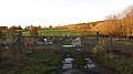 A fenced enclosure - geograph.org.uk - 2685090.jpg 640 × 360; 194 KB
-
 A little extra water, New Lanark - geograph.org.uk - 3866878.jpg 1,024 × 678; 306 KB
-
 A view of Glasgow - geograph.org.uk - 3004458.jpg 640 × 426; 214 KB
-
 A70 - geograph.org.uk - 2477613.jpg 640 × 359; 204 KB
-
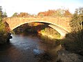
 A70 crosses River Clyde over Hyndford Bridge - geograph.org.uk - 2493721.jpg 3,648 × 2,552; 1.47 MB
-

-
 A73 - A72 Road Junction - geograph.org.uk - 2248130.jpg 640 × 480; 67 KB
-
 A743, St Leonard's Street, Lanark - geograph.org.uk - 6467221.jpg 1,024 × 769; 441 KB
-
 Approaching Lanark - geograph.org.uk - 2189407.jpg 640 × 396; 61 KB
-
 Approaching New Lanark - geograph.org.uk - 3865570.jpg 1,024 × 678; 282 KB
-
 Arable land at Castlehill, Cartland - geograph.org.uk - 6241505.jpg 4,552 × 3,035; 3.2 MB
-
 Ash tree and boundary wall - geograph.org.uk - 5046386.jpg 4,896 × 3,672; 6.53 MB
-
 Auchenglen Ruin - geograph.org.uk - 3645123.jpg 640 × 480; 82 KB
-
 Autumn colour by the Clyde gorge - geograph.org.uk - 4724434.jpg 600 × 800; 213 KB
-
 Aviation in Lanark – a Centenary - geograph.org.uk - 2328564.jpg 2,048 × 1,536; 1.53 MB
-
 Ayr Road - geograph.org.uk - 2479098.jpg 640 × 480; 313 KB
-
 Badger mural near Bonnington power station - geograph.org.uk - 5767806.jpg 1,600 × 1,105; 449 KB
-
 Bannatyne Street - geograph.org.uk - 3426073.jpg 640 × 413; 110 KB
-
 Beech lined road - geograph.org.uk - 2708386.jpg 640 × 360; 263 KB
-
 Beech trees, Bonnington - geograph.org.uk - 5584502.jpg 4,608 × 3,456; 5.17 MB
-
 Beech-lined road, Bonnington - geograph.org.uk - 5584495.jpg 4,386 × 3,289; 4.21 MB
-
 Bellcote, New Buildings - geograph.org.uk - 6408101.jpg 1,600 × 1,067; 509 KB
-
 Bellefield Road - geograph.org.uk - 6376187.jpg 1,024 × 563; 236 KB
-
 Below Bonnington Linn - geograph.org.uk - 4465342.jpg 3,504 × 2,336; 3.98 MB
-
 Below Bonnington Linn Sluice Gates, Falls of Clyde - geograph.org.uk - 2079322.jpg 3,648 × 2,736; 3.44 MB
-
 Bird Cherry - geograph.org.uk - 1862199.jpg 1,024 × 768; 134 KB
-
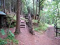 Bird hide above Cora Linn - geograph.org.uk - 876735.jpg 640 × 480; 100 KB
-
 Bluebells in Burgh Wood - geograph.org.uk - 4946923.jpg 4,896 × 3,672; 7.13 MB
-
 Boardwalk beside the Clyde - geograph.org.uk - 6408544.jpg 1,067 × 1,600; 480 KB
-
 Boardwalk by the Clyde - geograph.org.uk - 3864740.jpg 1,024 × 678; 222 KB
-
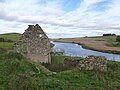
 Boathaugh - geograph.org.uk - 2206143.jpg 3,264 × 1,855; 1.63 MB
-
 Boathaugh and the River Clyde - geograph.org.uk - 5584637.jpg 4,608 × 3,456; 5.97 MB
-
 Bonnington Linn - geograph.org.uk - 3286026.jpg 640 × 480; 127 KB
-
 Bonnington Linn - geograph.org.uk - 3840427.jpg 2,560 × 1,920; 3.15 MB
-
 Bonnington Linn - geograph.org.uk - 6401717.jpg 1,024 × 731; 279 KB
-
 Bonnington Linn Sluice Gates Above Falls of Clyde - geograph.org.uk - 2079295.jpg 3,648 × 2,736; 3.5 MB
-
 Bonnington Linn Weir - geograph.org.uk - 3630982.jpg 640 × 480; 120 KB
-
 Bonnington Mains Farm - geograph.org.uk - 5584522.jpg 3,734 × 2,987; 2.17 MB
-
 Bonnington Pavilion - geograph.org.uk - 6408995.jpg 1,600 × 1,067; 645 KB
-
 Bonnington Power Station - geograph.org.uk - 5767957.jpg 1,600 × 1,066; 474 KB
-
 Bonnington Power Station - geograph.org.uk - 6401707.jpg 568 × 1,024; 178 KB
-
 Bonnington Power Station - geograph.org.uk - 6408588.jpg 1,600 × 1,067; 427 KB
-
 Bonnington Power Station, Falls of Clyde - geograph.org.uk - 3864949.jpg 1,024 × 678; 182 KB
-
 Bonninton Mains Farm - geograph.org.uk - 3640217.jpg 640 × 480; 81 KB
-
 Bottom of the Stey Brae - geograph.org.uk - 5046415.jpg 4,896 × 3,672; 7.24 MB
-
 Braidwood Road east of Crossford - geograph.org.uk - 5108245.jpg 640 × 481; 112 KB
-
 Bridge above Bonnington Linn, River Clyde - geograph.org.uk - 3865083.jpg 1,024 × 678; 260 KB
-
 Bridge on the Clyde Walkway near Crossford - geograph.org.uk - 5907637.jpg 1,024 × 753; 303 KB
-
 Buildings in West Port, Lanark - geograph.org.uk - 5590495.jpg 1,024 × 768; 162 KB
-
 Burned Wood - geograph.org.uk - 2843233.jpg 640 × 426; 257 KB
-
 Bus on Lanark High Street - geograph.org.uk - 6466869.jpg 1,024 × 768; 545 KB
-
 Bus Stops on St Leonard's Street - geograph.org.uk - 6467219.jpg 1,024 × 683; 450 KB
-
 Carlinside Farm - geograph.org.uk - 3640162.jpg 640 × 480; 88 KB
-
 Cartland - geograph.org.uk - 2708389.jpg 640 × 360; 209 KB
-
 Cartland - geograph.org.uk - 3644994.jpg 640 × 480; 57 KB
-
 Cartland - geograph.org.uk - 4981859.jpg 4,000 × 2,088; 1.93 MB
-
 Cartland Bridge - geograph.org.uk - 3036276.jpg 640 × 480; 84 KB
-
 Cartland Bridge - geograph.org.uk - 6375987.jpg 576 × 1,024; 219 KB
-
 Cartland from the air - geograph.org.uk - 5670023.jpg 640 × 480; 136 KB
-
 Cartland from the air - geograph.org.uk - 5670024.jpg 640 × 480; 135 KB
-
 Cartland Muir - geograph.org.uk - 2709788.jpg 640 × 480; 234 KB
-
 Cattle, Castlehill - geograph.org.uk - 2708388.jpg 640 × 360; 206 KB
-
 Caution^ Unsafe Structure - geograph.org.uk - 6409143.jpg 1,045 × 1,600; 297 KB
-
 Cemetery chapel at St. Kentigern's - geograph.org.uk - 2102355.jpg 640 × 480; 83 KB
-
 Christ Church, Lanark - geograph.org.uk - 5594564.jpg 1,024 × 805; 165 KB
-
 Christ Church, Lanark - geograph.org.uk - 5594830.jpg 1,024 × 768; 164 KB
-
 Clear-felled area, Cartland Muir Plantation - geograph.org.uk - 5723661.jpg 4,608 × 3,456; 4.97 MB
-
 Clear-felled area, Cartland Muir Plantation - geograph.org.uk - 5723662.jpg 4,608 × 3,456; 5.36 MB
-
 Cleghorn Level Crossing - geograph.org.uk - 2247217.jpg 4,000 × 3,000; 4.58 MB
-
 Cleghorn Level Crossing - geograph.org.uk - 4601208.jpg 640 × 481; 87 KB
-
 Clyde Shelter Belt - geograph.org.uk - 1109397.jpg 640 × 398; 109 KB
-
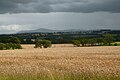
 Clyde Valley Flood Plain - geograph.org.uk - 3320790.jpg 640 × 417; 63 KB
-
 Clyde Valley Woodlands NNR - geograph.org.uk - 1862169.jpg 1,024 × 768; 208 KB
-
 Clyde Walkway - geograph.org.uk - 892947.jpg 640 × 480; 113 KB
-
 Clyde Walkway near Crossford - geograph.org.uk - 4239611.jpg 4,608 × 3,456; 5.45 MB
-

-
 Clyde Walkway north of New Lanark - geograph.org.uk - 4998034.jpg 481 × 640; 132 KB
-
 Clyde Walkway opposite Hazelbank - geograph.org.uk - 965282.jpg 640 × 481; 98 KB
-
 Clyde Walkway towards Lanark - geograph.org.uk - 3866988.jpg 1,024 × 678; 363 KB
-
 Clyde Walkway, Castlebank wood - geograph.org.uk - 3867033.jpg 1,024 × 678; 358 KB
-
 Clydesholm Bridge - geograph.org.uk - 5309772.jpg 1,600 × 1,200; 461 KB
-
 Clydewalkway at Stonebyres - geograph.org.uk - 892739.jpg 640 × 480; 107 KB
-
 Collielaw Cottage - geograph.org.uk - 2708385.jpg 640 × 480; 238 KB
-
 Collielaw Cottage - geograph.org.uk - 3645263.jpg 640 × 480; 89 KB
-
 Come to see the peregrines - geograph.org.uk - 1862271.jpg 1,024 × 768; 249 KB
-
 Commemorative plaque. - geograph.org.uk - 1470374.jpg 640 × 480; 120 KB
-
 Cora Linn - geograph.org.uk - 6081212.jpg 640 × 427; 137 KB
-
 Cora Linn - geograph.org.uk - 6401712.jpg 731 × 1,024; 286 KB
-
 Corra Linn - geograph.org.uk - 1862177.jpg 1,024 × 768; 203 KB
-
 Corra Linn - geograph.org.uk - 2005269.jpg 1,024 × 768; 327 KB
-
 Corra Linn - geograph.org.uk - 2411616.jpg 640 × 480; 193 KB
-
 Corra Linn from the viewing area - geograph.org.uk - 3320151.jpg 2,592 × 1,944; 1.29 MB
-

-

-
 Corra Linn, Falls of Clyde - geograph.org.uk - 4490416.jpg 800 × 600; 581 KB
-
 Corra Linn, Falls of Clyde - geograph.org.uk - 5767828.jpg 1,600 × 1,140; 658 KB
-
 Corra Linn, River Clyde - geograph.org.uk - 3864974.jpg 678 × 1,024; 244 KB
-
 Corra Linn, The Falls of Clyde - geograph.org.uk - 6410918.jpg 769 × 1,024; 557 KB
-
 Cottages in Broomgate. Lanark - geograph.org.uk - 5594877.jpg 1,024 × 768; 121 KB
-
 Cottages in Greenside Lane, Lanark - geograph.org.uk - 5590484.jpg 1,024 × 768; 160 KB
-
 Counting House - geograph.org.uk - 3051376.jpg 480 × 640; 80 KB
-
 Crag, Corra Linn - geograph.org.uk - 929889.jpg 640 × 480; 97 KB
-
 Craigen Hill - geograph.org.uk - 4479945.jpg 640 × 428; 80 KB
-
 Craigenhill Road - geograph.org.uk - 3645095.jpg 640 × 480; 64 KB
-
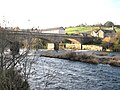 Crossford Bridge - geograph.org.uk - 5313398.jpg 1,600 × 1,200; 462 KB
-
 David Dale's House - geograph.org.uk - 2328822.jpg 2,048 × 1,536; 1.84 MB
-
 David Dale's House, New Lanark - geograph.org.uk - 2102819.jpg 480 × 640; 94 KB
-
 Debris filter at inlet for power station - geograph.org.uk - 6081223.jpg 640 × 427; 155 KB
-
 Derelict footbridge by the Clyde Walkway - geograph.org.uk - 5907642.jpg 1,024 × 768; 365 KB
-
 Double Row Restoration Project - geograph.org.uk - 6438874.jpg 1,600 × 1,067; 417 KB
-
 Drainage ditch, Lanark Moor - geograph.org.uk - 3227453.jpg 640 × 360; 274 KB
-
 Dundaff Linn - geograph.org.uk - 4739402.jpg 1,634 × 946; 423 KB
-
 Dundaff Linn - geograph.org.uk - 4739407.jpg 1,182 × 1,741; 556 KB
-
 Dundaff Linn - geograph.org.uk - 6407272.jpg 1,600 × 1,003; 371 KB
-
 Dundaff Linn, Falls of Clyde - geograph.org.uk - 6410882.jpg 1,024 × 768; 518 KB
-
 Dundaff Linn, New Lanark - geograph.org.uk - 6410820.jpg 1,024 × 768; 528 KB
-
 E.U. Kirk Lanark - geograph.org.uk - 5594889.jpg 1,024 × 768; 112 KB
-
 Early one Sunday morning - geograph.org.uk - 1862227.jpg 1,024 × 768; 155 KB
-
 Educational seat by the River Clyde - geograph.org.uk - 1862173.jpg 1,024 × 768; 214 KB
-
 Entrance to Cartlandbridge Hotel - geograph.org.uk - 5108221.jpg 640 × 475; 100 KB
-
 Entrance, Lanark Muir Country Park - geograph.org.uk - 2923197.jpg 640 × 360; 199 KB
-
 Evening light, Springbank - geograph.org.uk - 4201620.jpg 640 × 480; 216 KB
-
 Explanatory plaque at the site of Castle Qua - geograph.org.uk - 6376158.jpg 1,024 × 576; 253 KB
-
 Falkirk, Wellgate - geograph.org.uk - 6466872.jpg 1,024 × 769; 568 KB
-
 Falls of Clyde - geograph.org.uk - 1862262.jpg 1,024 × 768; 196 KB
-
 Falls of Clyde - geograph.org.uk - 3627476.jpg 480 × 640; 90 KB
-
 Falls of Clyde - geograph.org.uk - 3738728.jpg 640 × 424; 111 KB
-
 Falls of Clyde - geograph.org.uk - 3738753.jpg 640 × 424; 129 KB
-
 Falls of Clyde - geograph.org.uk - 4465338.jpg 1,067 × 1,600; 446 KB
-
 Falls of Clyde Bonnington Power Station - geograph.org.uk - 6410910.jpg 1,024 × 768; 735 KB
-
 Falls of Clyde Bonnington Power Station - geograph.org.uk - 6410919.jpg 1,024 × 683; 482 KB
-
 Falls of Clyde Nature Reserve - geograph.org.uk - 6410920.jpg 1,024 × 768; 769 KB
-
 Falls of Clyde, Corra Linn - geograph.org.uk - 6410916.jpg 1,024 × 768; 612 KB
-
 Falls of Clyde, Dundaff Linn - geograph.org.uk - 6410730.jpg 1,024 × 768; 648 KB
-
 Falls of Clyde, New Lanark - geograph.org.uk - 4885715.jpg 5,022 × 3,355; 6.16 MB
-
 Farm buildings at Leemuir - geograph.org.uk - 5723666.jpg 4,607 × 2,900; 2.63 MB
-
 Farmland around The Beeches, Lanark - geograph.org.uk - 1249354.jpg 640 × 480; 102 KB
-
 Farmland near Ravenstruther - geograph.org.uk - 2328171.jpg 2,048 × 1,536; 1.98 MB
-
 Field near Cleghorn - geograph.org.uk - 843812.jpg 640 × 480; 54 KB
-
 Field, Caldwellside - geograph.org.uk - 2843255.jpg 640 × 360; 233 KB
-
 Field, Huntlybank - geograph.org.uk - 2925175.jpg 640 × 482; 278 KB
-
 Fields at Huntlyhill - geograph.org.uk - 2328167.jpg 2,048 × 1,536; 1.99 MB
-
 Fields next to the Nemphlar Moor Road - geograph.org.uk - 3162789.jpg 3,072 × 2,304; 1.75 MB
-
 Fish seat by the River Clyde - geograph.org.uk - 1862280.jpg 1,024 × 768; 197 KB
-
 Flooded quarry workings, Craigen Hill - geograph.org.uk - 5723657.jpg 4,608 × 3,456; 5.98 MB
-
 Flooded road - geograph.org.uk - 2708387.jpg 640 × 360; 186 KB
-
 Folly Wood Ruin - geograph.org.uk - 4043405.jpg 2,592 × 1,936; 2.7 MB
-
 Footbridge on the Clyde Walkway - geograph.org.uk - 3640206.jpg 480 × 640; 124 KB
-
 Footbridge on the path by the Mouse Water - geograph.org.uk - 6376176.jpg 1,024 × 574; 258 KB
-
 Footpath down to New Lanark - geograph.org.uk - 3183739.jpg 640 × 427; 186 KB
-
 Footpath near Nemphlar - geograph.org.uk - 4946896.jpg 3,672 × 4,896; 6.24 MB
-
 Former Church in Hope Street Lanark - geograph.org.uk - 4191575.jpg 3,000 × 4,000; 2 MB
-
 Former County Police Station, Lanark - geograph.org.uk - 5594548.jpg 1,024 × 768; 153 KB
-
 Former golf course, Lanark Moor - geograph.org.uk - 2923193.jpg 640 × 360; 179 KB
-
 Former Lanark Livestock Market - geograph.org.uk - 2244536.jpg 640 × 480; 52 KB
-
 Former Lanark Racecourse - geograph.org.uk - 2244609.jpg 640 × 480; 67 KB
-
 Former Lanark racecourse from the air - geograph.org.uk - 5680772.jpg 640 × 480; 171 KB
-
 Former Lanark racecourse from the air - geograph.org.uk - 5680773.jpg 640 × 480; 156 KB
-
 Former Livestock Market - geograph.org.uk - 3055727.jpg 640 × 480; 85 KB
-
 Former New Lanark Church - geograph.org.uk - 6408086.jpg 1,600 × 1,067; 464 KB
-
 Former New Lanark Church and war memorial - geograph.org.uk - 6407387.jpg 1,600 × 1,067; 430 KB
-
 Former racecourse, Lanark - geograph.org.uk - 3864024.jpg 1,024 × 678; 124 KB
-
 Former Winston Barracks - geograph.org.uk - 4116299.jpg 640 × 480; 51 KB
-
 Fulwood Burn - geograph.org.uk - 3645238.jpg 640 × 480; 100 KB
-
 Garden nursery near Birkenhead - geograph.org.uk - 843262.jpg 640 × 480; 57 KB
-
 Gorse by the Lee Burn - geograph.org.uk - 802310.jpg 640 × 480; 85 KB
-
 Grassland, Cartland Mains - geograph.org.uk - 2679964.jpg 640 × 360; 184 KB
-
 Grassland, Cobblehaugh - geograph.org.uk - 2477014.jpg 640 × 480; 299 KB
-
 Grassland, Drum - geograph.org.uk - 2709792.jpg 640 × 480; 249 KB
-
 Gravestone, New Lanark Burial Ground - geograph.org.uk - 6081217.jpg 640 × 427; 189 KB
-
 Greentowers Farm - geograph.org.uk - 4566347.jpg 2,558 × 1,918; 1.97 MB
-
 Greentowers Road - geograph.org.uk - 2679968.jpg 640 × 360; 259 KB
-
 Greentowers Road - geograph.org.uk - 2708390.jpg 640 × 360; 219 KB
-
 Greentowers Road - geograph.org.uk - 2708391.jpg 640 × 360; 257 KB
-
 Greyfriars Parish Church, Lanark - geograph.org.uk - 5594903.jpg 768 × 1,024; 92 KB
-
 Heron on Weir - geograph.org.uk - 3738709.jpg 640 × 449; 78 KB
-
 High St, Lanark, decked out for Lanimer Day - geograph.org.uk - 4018729.jpg 4,320 × 3,240; 3.03 MB
-

-
 House near Hyndford Bridge - geograph.org.uk - 5109529.jpg 2,592 × 1,936; 1.53 MB
-
 House near the power station - geograph.org.uk - 929877.jpg 640 × 480; 106 KB
-
 Houses at River View - geograph.org.uk - 2972730.jpg 640 × 451; 75 KB
-
 Houses in Bloomgate, Lanark - geograph.org.uk - 5594885.jpg 1,024 × 768; 130 KB
-
 Houses on Rosedale Street - geograph.org.uk - 6081227.jpg 640 × 427; 163 KB
-
 Hyndford Bridge - geograph.org.uk - 1869916.jpg 640 × 480; 136 KB
-
 Hyndford Bridge - geograph.org.uk - 1876231.jpg 640 × 390; 161 KB
-
 Hyndford Bridge - geograph.org.uk - 2328161.jpg 2,048 × 1,536; 2.17 MB
-
 Hyndford Bridge - geograph.org.uk - 2479081.jpg 640 × 480; 301 KB
-
 Hyndford Bridge - geograph.org.uk - 3382495.jpg 4,320 × 3,240; 2.74 MB
-
 Hyndford Bridge - geograph.org.uk - 3382577.jpg 4,320 × 3,240; 2.72 MB
-
 Hyndford Bridge - geograph.org.uk - 4634337.jpg 2,560 × 1,439; 1.62 MB
-
 Hyndford Bridge - geograph.org.uk - 4904833.jpg 1,024 × 684; 131 KB
-
 Hyndford Bridge - geograph.org.uk - 5304957.jpg 1,600 × 1,200; 397 KB
-
 Hyndford Bridge - geograph.org.uk - 5787911.jpg 640 × 427; 399 KB
-
 Hyndford Bridge - geograph.org.uk - 5787912.jpg 640 × 427; 349 KB
-
 Hyndford Bridge - geograph.org.uk - 911807.jpg 640 × 480; 104 KB
-
 Hyndford Bridge from the air - geograph.org.uk - 5670017.jpg 640 × 480; 138 KB
-
 Hyndford Bridge View - geograph.org.uk - 3320784.jpg 640 × 477; 144 KB
-
 Hyndford Quarry - geograph.org.uk - 3640228.jpg 640 × 480; 64 KB
-
 Hyndford Quarry from the air - geograph.org.uk - 5670018.jpg 640 × 480; 149 KB
-
 Information Board, Corra Linn - geograph.org.uk - 3320154.jpg 2,592 × 1,944; 2.02 MB


&filefrom=Inn+on+the+Loch+-+geograph.org.uk+-+2244582.jpg#mw-category-media)