Category:Kodaikanal–Munnar Road
Jump to navigation
Jump to search
road in Tamil Nadu, India | |||||
| Upload media | |||||
| Instance of | |||||
|---|---|---|---|---|---|
| Location |
| ||||
| Inception |
| ||||
| End time |
| ||||
| Length |
| ||||
| |||||
Subcategories
This category has the following 5 subcategories, out of 5 total.
Media in category "Kodaikanal–Munnar Road"
The following 13 files are in this category, out of 13 total.
-
 "Causeway" on the Munnar Road, past first trout stream.jpg 640 × 480; 48 KB
-
 AMS-Dindigul, Kodai-Munnar Escape road 1955.jpg 1,478 × 190; 412 KB
-
 AMS-K-M Road Intersections.jpg 2,400 × 1,530; 2.68 MB
-
 Bodinayakanur.jpg 1,280 × 530; 79 KB
-
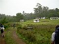
 En Route to Venderavu from Kodaikanal.jpg 6,448 × 4,624; 51.79 MB
-
 Foundation Stone of Munnar Road.JPG 2,592 × 1,944; 1.77 MB
-
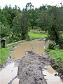
 K M road in the rain.jpg 1,024 × 768; 245 KB
-
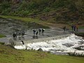 K-M Level crossing in flood.jpg 1,024 × 768; 179 KB
-
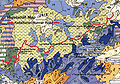 K-M Road Vegetation Map.jpg 936 × 657; 879 KB
-
 KM-Second Trout Stream bridge.jpg 360 × 480; 42 KB
-
 Milestone top station 5 miles.jpg 1,024 × 768; 274 KB
-
 Munnar Ghat Road - panoramio (1).jpg 1,208 × 906; 314 KB
-
 Munnar Ghat Road - panoramio.jpg 1,208 × 906; 307 KB


.jpg)

Categories:
- Sethu Lakshmi Bayi
- Roads in Munnar
- National highways in Kerala
- Wildlife sanctuaries of Kerala
- Wildlife sanctuaries of the Western Ghats
- Geography of Idukki district
- Hiking in Kerala
- 1915 in Kerala
- 1915 establishments in India
- Tamil Nadu in the 1900s
- Ecotourism in Tamil Nadu
- Mountain roads in Tamil Nadu
- National highways in Tamil Nadu
- Wildlife sanctuaries of Tamil Nadu
- Geography of Dindigul district
- Geography of Theni district
- 1925 in Kerala
- Mountain passes of Kerala