Category:Geography of Dindigul district
Jump to navigation
Jump to search
Subcategories
This category has the following 10 subcategories, out of 10 total.
B
- Bear Shola Falls (6 F)
- Berijam Lake (17 F)
K
M
- Mannavanur Lake (9 F)
P
- Perumal Peak (2 F)
- Perumalmalai hills (5 F)
S
- Sirumalai (18 F)
Media in category "Geography of Dindigul district"
The following 57 files are in this category, out of 57 total.
-
 A brilliant scene in kodaikanal.jpg 2,048 × 1,536; 1.58 MB
-
 A water fall covered by clouds in Palani - Kodaikanal Road.jpg 2,592 × 1,456; 1.34 MB
-
 A water fall covered by clouds in Palani-Kodaikanal Road.jpg 2,592 × 1,456; 774 KB
-
 A water fall in Western Ghats covered by clouds in Palani-Kodaikanal Road.jpg 2,592 × 1,456; 1.35 MB
-
 A100 2665.JPG 3,968 × 2,976; 2.56 MB
-
 Dindigul, Tamil Nadu, India - panoramio.jpg 2,560 × 1,920; 1.62 MB
-
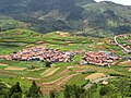
 Fields of Poombarai.jpg 5,584 × 2,272; 2.07 MB
-
 Green paddies,palani,taminadu - panoramio.jpg 2,592 × 1,944; 2.16 MB
-
 Green Valley View (124168939).jpeg 2,048 × 801; 268 KB
-
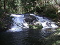
 Gundar Falls.JPG 2,304 × 3,072; 2.57 MB
-
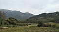
 Hill in Sengurichi near Dindigul, Tamil Nadu.jpg 2,592 × 1,944; 718 KB
-
 Hills near kodaikanal.jpg 1,280 × 960; 227 KB
-
 IMG-20210801-WA0019.jpg 726 × 1,280; 293 KB
-
 Karandhamalai Reserved Forest Road.jpg 1,600 × 1,200; 378 KB
-
 KM-Logging road from Munnar Road to Palavachar Stream and beyond.jpg 360 × 480; 54 KB
-
 KM-Second Trout Stream pools above falls.jpg 360 × 480; 34 KB
-
 Kodai Neptune falls & Pool.JPG 3,072 × 2,304; 3.1 MB
-
 Lowercamp.jpg 4,032 × 2,268; 2.49 MB
-
 Manavannur lake kodaikanal.jpg 4,608 × 2,592; 4.71 MB
-
 Mannavanoor.jpg 5,184 × 3,456; 8.52 MB
-
 Mannavanur Valley 2017.jpg 4,032 × 3,024; 2.07 MB
-
 Monkey enjoying the View.jpg 1,280 × 576; 214 KB
-
 Natural place .jpg 4,160 × 2,340; 2.53 MB
-
 Near Attoor, in the Dindigul District - British Library X432 4(6).jpg 976 × 687; 165 KB
-
 Oddanchatram.jpg 3,840 × 2,160; 2.02 MB
-
 Palani 3716.jpg 6,000 × 4,000; 19.38 MB
-
 Palani 3721.jpg 6,000 × 4,000; 20.88 MB
-
 Palani 3725.jpg 6,000 × 4,000; 21.34 MB
-
 Palani 3748.jpg 6,000 × 4,000; 20.81 MB
-
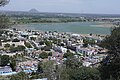
 Palani City View from Hill.JPG 2,592 × 1,944; 2.64 MB
-
 Palani hills,palani TN - panoramio.jpg 2,592 × 1,944; 2.18 MB
-
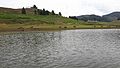
 Palani Lake.JPG 2,592 × 1,944; 1.18 MB
-
 Palani Town view from Hills 1.JPG 2,592 × 1,944; 2.97 MB
-
 Palani Town View from Hills.JPG 2,592 × 1,944; 2.9 MB
-
 Palani Town.jpg 2,560 × 1,440; 972 KB
-
 Palani view 3672.jpg 6,000 × 4,000; 21.69 MB
-
 Palani View from Hill temple.jpg 720 × 481; 92 KB
-
 Pazhani 3668.jpg 6,000 × 4,000; 20.56 MB
-
 Pazhani 3671.jpg 6,000 × 4,000; 19.63 MB
-
 Pazhani 3674.jpg 6,000 × 3,384; 16.28 MB
-
 Pazhani 3699.jpg 6,000 × 4,000; 21.19 MB
-
 Pazhani 3711.jpg 6,000 × 4,000; 19.66 MB
-
 Poombarai Falls named Fairy Falls.JPG 2,304 × 3,072; 2.36 MB
-
 Poombarai Falls unidentified.JPG 2,304 × 3,072; 3.44 MB
-
 Poombarai village woman.jpg 3,456 × 4,493; 8.4 MB
-
 Poombarai Village, Kodaikanal (14342648914).jpg 2,000 × 1,333; 1.77 MB
-
 Poombarai village.jpg 5,184 × 3,456; 12.91 MB
-
 Poombarai.JPG 3,072 × 2,304; 3.05 MB
-
 Poombari village.jpg 5,184 × 3,456; 2.43 MB
-
 Poomparai village.jpg 1,600 × 1,200; 1.26 MB
-
 Poovaipalayam.jpg 4,032 × 1,598; 875 KB
-
 Sheep Research Center (Mannavanur), India.jpg 4,608 × 3,456; 3.65 MB
-
 Silvery lake palani - panoramio.jpg 2,592 × 1,944; 1.73 MB
-
 TAMILNADU .jpg 4,160 × 2,340; 3.88 MB
-
 View of Palani from the steps leading to Muruga temple.jpg 2,568 × 1,773; 1.09 MB
-
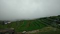 Village covered by mist in Poomparai village in Kodaikanal.jpg 5,344 × 3,006; 4.25 MB
-
 Village love photography.jpg 1,080 × 565; 73 KB


.jpg)


.jpg)


,_India.jpg)


.jpeg)