Category:Kirriemuir (civil parish)
Jump to navigation
Jump to search
Scottish parish in Angus, Scotland, UK | |||||
| Upload media | |||||
| Instance of | |||||
|---|---|---|---|---|---|
| Named after | |||||
| Location |
| ||||
| Population |
| ||||
| Area |
| ||||
 | |||||
Media in category "Kirriemuir (civil parish)"
The following 200 files are in this category, out of 511 total.
(previous page) (next page)-
 A bridge over the wynd - geograph.org.uk - 5049170.jpg 3,189 × 4,251; 1.9 MB
-
 A bridge to Bridges - geograph.org.uk - 5049088.jpg 4,195 × 3,145; 2.09 MB
-
 A passing shower at Ballinshoe - geograph.org.uk - 4804313.jpg 1,024 × 683; 138 KB
-
 A patchy shelter belt - geograph.org.uk - 4425393.jpg 800 × 450; 160 KB
-
 A.P. McIntosh - geograph.org.uk - 4835490.jpg 1,024 × 768; 372 KB
-
 After the storm 2 - geograph.org.uk - 2721437.jpg 640 × 480; 107 KB
-
 Airlie Arms Hotel - geograph.org.uk - 4900435.jpg 1,600 × 1,184; 279 KB
-
 An unlikely pairing in Kirriemuir - geograph.org.uk - 5831219.jpg 1,024 × 768; 221 KB
-
 Approach to West Herdhill - geograph.org.uk - 4804267.jpg 1,024 × 683; 200 KB
-
 Approaching B955 on minor road from Glen Prosen - geograph.org.uk - 5055455.jpg 4,608 × 3,456; 3.05 MB
-
 Arable land at Ballinshoe - geograph.org.uk - 4804291.jpg 1,024 × 683; 220 KB
-
 Arable land, Ballinshoe - geograph.org.uk - 2745622.jpg 640 × 360; 195 KB
-
 Arriving At Loch Of Kinnordy - geograph.org.uk - 5986829.jpg 640 × 450; 150 KB
-
 At RSPB Loch Of Kinnordy - geograph.org.uk - 5986834.jpg 640 × 471; 158 KB
-
 At The Loch Of Kinnordy - geograph.org.uk - 5986847.jpg 640 × 433; 120 KB
-
 Auchlishie Burn at Inverquharity - geograph.org.uk - 1113973.jpg 640 × 427; 121 KB
-
 Auchlishie from the south-east - geograph.org.uk - 6596500.jpg 5,184 × 3,888; 4.6 MB
-
 B957 at Forest Muir - geograph.org.uk - 5336299.jpg 5,184 × 3,888; 6.27 MB
-
 B957 heading to Kirriemuir - geograph.org.uk - 5864347.jpg 5,184 × 3,888; 4.37 MB
-
 Backing onto the churchyard - geograph.org.uk - 5049701.jpg 3,680 × 3,240; 2.91 MB
-
 Bales under brooding skies - geograph.org.uk - 5576053.jpg 5,184 × 3,888; 5.73 MB
-
 Ballinshoe road - geograph.org.uk - 5662357.jpg 5,184 × 3,888; 7.42 MB
-

-
 Ballinshoe Tower - geograph.org.uk - 3410685.jpg 1,024 × 681; 238 KB
-
 Ballinshoe Tower - geograph.org.uk - 4804300.jpg 1,024 × 683; 309 KB
-
 Ballinshoe Tower remains - geograph.org.uk - 5674732.jpg 5,184 × 3,888; 4.98 MB
-
 Balmuckety, Maryton, Kirriemuir - geograph.org.uk - 3410725.jpg 1,024 × 681; 178 KB
-
 Bank Street, Kirriemuir - geograph.org.uk - 4411022.jpg 800 × 533; 151 KB
-
 Barley at East Inch - geograph.org.uk - 3062401.jpg 3,264 × 2,448; 3.77 MB
-
 Barley at Kinnordy - geograph.org.uk - 3062413.jpg 3,264 × 2,448; 4.05 MB
-
 Barley, Plovermuir - geograph.org.uk - 4835495.jpg 1,024 × 768; 289 KB
-
 Barns at East Balloch Farm - geograph.org.uk - 2895960.jpg 640 × 480; 61 KB
-
 Barns, Inverquharity Farm - geograph.org.uk - 3597528.jpg 640 × 480; 74 KB
-
 Barrie`s Birthplace - geograph.org.uk - 5182363.jpg 5,184 × 3,888; 4.97 MB
-
 Bend in the road - geograph.org.uk - 5674730.jpg 5,184 × 3,888; 5.06 MB
-
 Black Burn - geograph.org.uk - 2745613.jpg 640 × 360; 204 KB
-
 Black Burn near Over Bow farm - geograph.org.uk - 1175431.jpg 427 × 640; 244 KB
-

-

-

-
 Boardwalk at RSPB Kinnordy - geograph.org.uk - 2865219.jpg 640 × 480; 164 KB
-
 Bogside near Forfar - geograph.org.uk - 4523456.jpg 1,024 × 680; 116 KB
-
 Bon Scott statue - geograph.org.uk - 5188619.jpg 5,184 × 3,888; 6.1 MB
-
 Bridge on the Kirriemuir to Shielhill road - geograph.org.uk - 5810650.jpg 5,184 × 3,888; 5.29 MB
-
 Bridgend of Balloch - geograph.org.uk - 2895966.jpg 640 × 480; 63 KB
-
 Bridgend of Balloch - geograph.org.uk - 5055518.jpg 4,443 × 3,333; 2.89 MB
-
 Bridgend of Balloch, Pearsie - geograph.org.uk - 1094808.jpg 640 × 427; 57 KB
-
 Bridgend of Pearsie - geograph.org.uk - 2895963.jpg 640 × 480; 73 KB
-
 Burn between Kirriemuir and Kinnordy - geograph.org.uk - 2208813.jpg 534 × 800; 271 KB
-
 Burn, Castle Hill - geograph.org.uk - 1153095.jpg 427 × 640; 295 KB
-
 Buzzard and Crow near Over Bow Farm - geograph.org.uk - 1115643.jpg 640 × 428; 55 KB
-
 Caddam wood - geograph.org.uk - 4093287.jpg 640 × 427; 613 KB
-
 Cairlyew Wood - geograph.org.uk - 4835345.jpg 1,024 × 768; 448 KB
-
 Camera Obscura, Kirriemuir - geograph.org.uk - 5022801.jpg 640 × 480; 70 KB
-
 Car park at Peter Pan playpark - geograph.org.uk - 6826043.jpg 1,600 × 1,200; 374 KB
-
 Carroch Farm - geograph.org.uk - 1119171.jpg 640 × 427; 82 KB
-
 Castle Hill - geograph.org.uk - 1153061.jpg 640 × 427; 113 KB
-
 Cattle at Inverquharity - geograph.org.uk - 5787476.jpg 5,184 × 3,888; 6.59 MB
-
 Cereal crop near Nether Bow - geograph.org.uk - 6707312.jpg 640 × 461; 63 KB
-
 Cereal crop, Over Bow - geograph.org.uk - 1175423.jpg 640 × 427; 221 KB
-
 Checkiefield - geograph.org.uk - 4804279.jpg 1,024 × 683; 138 KB
-
 Checkiefield, Kirriemuir - geograph.org.uk - 3410665.jpg 1,024 × 681; 196 KB
-
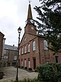
 Church and hall - geograph.org.uk - 5049694.jpg 4,271 × 3,203; 1.5 MB
-
 Clunehill Wood - geograph.org.uk - 2895927.jpg 640 × 480; 77 KB
-
 Clunehill Wood - geograph.org.uk - 2895931.jpg 640 × 480; 77 KB
-

-
 Cock Pheasant (Phasianus colchicus) - geograph.org.uk - 1857774.jpg 640 × 480; 170 KB
-

-
 Confluence on Balloch Moss - geograph.org.uk - 2895958.jpg 640 × 480; 104 KB
-
 Cortachy Road (B955) in Kirriemuir - geograph.org.uk - 4692749.jpg 4,608 × 2,882; 1.81 MB
-

-

-

-
 Cranshade - geograph.org.uk - 2745615.jpg 640 × 360; 194 KB
-
 Cranshade at Ballinshoe - geograph.org.uk - 4804317.jpg 1,024 × 683; 229 KB
-
 Crieff Terrace - geograph.org.uk - 1119284.jpg 640 × 427; 91 KB
-
 Cross-country jumps at Auchlishie - geograph.org.uk - 6599051.jpg 5,184 × 3,888; 6.3 MB
-
 Culhawk - geograph.org.uk - 1102495.jpg 640 × 428; 59 KB
-
 Culhawk and Culhawk Hill - geograph.org.uk - 4835338.jpg 1,024 × 768; 220 KB
-
 Cumberland Close with its Art ^ Craft Centre - geograph.org.uk - 4900378.jpg 1,600 × 1,151; 297 KB
-
 Curious Cattle - geograph.org.uk - 5576124.jpg 5,184 × 3,888; 4.68 MB
-
 Curriemuir cuisine - geograph.org.uk - 4424049.jpg 800 × 533; 207 KB
-
 Curry in Kirrie - geograph.org.uk - 919829.jpg 640 × 480; 77 KB
-
 Date stone - geograph.org.uk - 5049164.jpg 4,095 × 3,071; 2.65 MB
-

-
 Descent to Shielhill Bridge - geograph.org.uk - 3597595.jpg 640 × 480; 74 KB
-
 Dog-walking in Caddam Wood, Kirriemuir - geograph.org.uk - 3410641.jpg 1,024 × 680; 314 KB
-
 Drumclune Farm - geograph.org.uk - 1113579.jpg 640 × 427; 40 KB
-
 Drumshademuir Caravan Park - geograph.org.uk - 1118524.jpg 640 × 427; 59 KB
-
 Drystone wall, Ballinshoe - geograph.org.uk - 3410687.jpg 1,024 × 681; 161 KB
-
 East Balloch Farm - geograph.org.uk - 1119166.jpg 640 × 427; 74 KB
-
 East end of Loch of Kinnordy - geograph.org.uk - 3288991.jpg 1,024 × 681; 263 KB
-

-
 East Hide, Loch of Kinnordy - geograph.org.uk - 3288267.jpg 1,024 × 681; 251 KB
-
 East Inch - geograph.org.uk - 5024364.jpg 640 × 480; 37 KB
-
 East Inch Farm - geograph.org.uk - 5576101.jpg 5,184 × 3,888; 4.85 MB
-

-
 Edge of Kirriemuir - geograph.org.uk - 4409667.jpg 640 × 426; 57 KB
-
 Edge of Kirriemuir - geograph.org.uk - 4409680.jpg 800 × 533; 230 KB
-
 Electricity poles at Prosenhaugh - geograph.org.uk - 2157775.jpg 1,159 × 1,500; 616 KB
-

-
 Entrance to Caddam Wood, Kirriemuir - geograph.org.uk - 3410638.jpg 1,024 × 681; 267 KB
-
 Entrance to Kirriemuir from Cortachy - geograph.org.uk - 4692724.jpg 3,989 × 2,334; 1.42 MB
-

-
 Estate road at Kinnordy Home Farm - geograph.org.uk - 4941571.jpg 640 × 480; 99 KB
-
 Fallen tree, Loch of Kinnordy - geograph.org.uk - 4411041.jpg 800 × 533; 323 KB
-
 Farm at Inverquharity - geograph.org.uk - 3054849.jpg 640 × 480; 318 KB
-
 Farm buildings, Balstard - geograph.org.uk - 1152910.jpg 427 × 640; 199 KB
-
 Farm buildings, Culhawk - geograph.org.uk - 1152935.jpg 640 × 427; 225 KB
-
 Farm buildings, Inverquharity Farm - geograph.org.uk - 3597524.jpg 640 × 480; 79 KB
-
 Farm road to Caddam - geograph.org.uk - 4937150.jpg 640 × 480; 41 KB
-
 Farm road to Pluckerston - geograph.org.uk - 4937047.jpg 640 × 480; 45 KB
-

-
 Farmland at Auchlishie - geograph.org.uk - 3054881.jpg 640 × 450; 233 KB
-
 Farmland at Culhawk - geograph.org.uk - 3968707.jpg 640 × 480; 70 KB
-
 Farmland at Newmill - geograph.org.uk - 5024392.jpg 640 × 480; 50 KB
-
 Farmland east of Caddam - geograph.org.uk - 4093277.jpg 427 × 640; 251 KB
-
 Farmland near Balnagarrow - geograph.org.uk - 4094613.jpg 640 × 444; 321 KB
-
 Farmland near Caddam - geograph.org.uk - 4094624.jpg 640 × 420; 334 KB
-
 Farmland near Caddam - geograph.org.uk - 4940951.jpg 640 × 480; 47 KB
-
 Farmland near Crieff - geograph.org.uk - 3054903.jpg 480 × 640; 84 KB
-
 Farmland near Muirhouses - geograph.org.uk - 3647515.jpg 640 × 480; 328 KB
-
 Farmland west of the A90 - geograph.org.uk - 6155903.jpg 800 × 533; 502 KB
-
 Fence line, Culhawk Hill - geograph.org.uk - 1152952.jpg 427 × 640; 188 KB
-
 Field adjacent to A90 - geograph.org.uk - 5598186.jpg 5,184 × 3,888; 6.3 MB
-
 Field at Ballinshoe - geograph.org.uk - 5662353.jpg 5,184 × 3,888; 6.16 MB
-
 Field at Meams - geograph.org.uk - 5024372.jpg 640 × 480; 48 KB
-
 Field at Woodside - geograph.org.uk - 4937154.jpg 640 × 480; 76 KB
-
 Field beside Loch of Kinnordy - geograph.org.uk - 3288967.jpg 1,024 × 682; 192 KB
-
 Field entrance, Caddam, Kirriemuir - geograph.org.uk - 3410635.jpg 1,024 × 682; 211 KB
-
 Field of barley near Inverquharity - geograph.org.uk - 3597569.jpg 640 × 480; 69 KB
-

-
 Field off Rosewell Road - geograph.org.uk - 4425329.jpg 800 × 533; 182 KB
-
 Field south of Maryton - geograph.org.uk - 6563688.jpg 5,184 × 3,888; 7.31 MB
-
 Field, East Inch - geograph.org.uk - 4835436.jpg 1,024 × 768; 292 KB
-
 Fields and pylon near Inverquharity - geograph.org.uk - 3597556.jpg 640 × 480; 64 KB
-
 Finger post, Northmuir - geograph.org.uk - 1857914.jpg 640 × 480; 144 KB
-
 Fletcherfield - geograph.org.uk - 4425339.jpg 800 × 533; 209 KB
-
 Flooded hollow at Barnsdale - geograph.org.uk - 4804322.jpg 800 × 485; 80 KB
-
 Flooded woodland at Loch of Kinnordy - geograph.org.uk - 3288979.jpg 1,024 × 681; 363 KB
-
 Footpaths on the Kinnordy Estate - geograph.org.uk - 2209512.jpg 800 × 533; 155 KB
-
 Ford warning sign - geograph.org.uk - 5557363.jpg 5,184 × 3,888; 5.75 MB
-
 Fording the Quharity Burn - geograph.org.uk - 2361411.jpg 640 × 446; 150 KB
-
 Forest Muir - geograph.org.uk - 2745605.jpg 640 × 360; 195 KB
-

-
 From The Swamp Hide - geograph.org.uk - 5986861.jpg 640 × 438; 80 KB
-
 Gairie Burn in the centre of Kirriemuir - geograph.org.uk - 2513626.jpg 534 × 800; 305 KB
-
 Gate at Kinnordy Estate - geograph.org.uk - 5576079.jpg 5,184 × 3,888; 7.34 MB
-
 Gate to the walled garden at Kinnordy - geograph.org.uk - 3063494.jpg 3,264 × 2,448; 4.4 MB
-

-
 Glengate - geograph.org.uk - 4411069.jpg 800 × 533; 172 KB
-
 Glengate, Kirriemuir - geograph.org.uk - 2867872.jpg 640 × 480; 73 KB
-
 Gorse in bloom by the roadside - geograph.org.uk - 6561762.jpg 5,184 × 3,888; 7.12 MB
-
 Grassy field near Maryton - geograph.org.uk - 6565854.jpg 5,184 × 3,888; 7 MB
-
 Green pasture by the C25 road - geograph.org.uk - 6610941.jpg 5,184 × 3,888; 6.2 MB
-
 Greylag Geese (Anser anser), Loch of Kinnordy - geograph.org.uk - 3802723.jpg 1,024 × 1,024; 310 KB
-
 Gunnera growing by the Quharity Burn - geograph.org.uk - 3054875.jpg 477 × 640; 114 KB
-
 Harvest Scene - geograph.org.uk - 940058.jpg 640 × 426; 94 KB
-

-
 Harvest Scene near Forfar - geograph.org.uk - 940061.jpg 640 × 426; 84 KB
-

-
 Hay making near Balnagarrow - geograph.org.uk - 3054887.jpg 640 × 478; 358 KB
-
 Head of Kirriemuir Den - geograph.org.uk - 2513618.jpg 640 × 426; 92 KB
-
 Highland cattle, Loch Kinnordy - geograph.org.uk - 1857765.jpg 640 × 480; 173 KB
-
 Hill of Kirriemuir triangulation pillar - geograph.org.uk - 5207316.jpg 5,184 × 3,888; 5 MB
-
 House above Kirriemuir Den - geograph.org.uk - 2513625.jpg 800 × 534; 215 KB
-
 Inside Logie Woods - geograph.org.uk - 6579549.jpg 5,184 × 3,888; 3.93 MB
-
 Inverquharity Castle - geograph.org.uk - 5787480.jpg 5,184 × 3,888; 6.34 MB
-
 Isla Road Houses - geograph.org.uk - 5986926.jpg 640 × 415; 118 KB
-
 J. M. Barrie's birthplace, Kirriemuir - geograph.org.uk - 2513632.jpg 800 × 534; 166 KB
-
 JM Barrie Centrepiece - geograph.org.uk - 2242359.jpg 514 × 768; 70 KB
-
 JM Barrie's birthplace - geograph.org.uk - 4922221.jpg 640 × 481; 73 KB
-
 Junction for Quharity Burn fords - geograph.org.uk - 5055438.jpg 4,569 × 3,427; 3.18 MB
-
 Kilnhill Cottages, by Kirriemuir - geograph.org.uk - 2733257.jpg 640 × 480; 55 KB
-
 Kinnordy Estate Office - geograph.org.uk - 3062422.jpg 3,264 × 2,448; 5.61 MB
-
 Kinnordy Home Farm - geograph.org.uk - 3062391.jpg 3,041 × 2,284; 2.48 MB
-
 Kirk Wynd, Kirriemuir - geograph.org.uk - 4411017.jpg 800 × 533; 201 KB
-

-

-

-

-
 Kirriemuir - geograph.org.uk - 3073184.jpg 2,592 × 1,944; 999 KB
-

-

-
 Kirriemuir - where the roads meet. - geograph.org.uk - 1900655.jpg 640 × 480; 85 KB
-
 Kirriemuir Branch - geograph.org.uk - 4425357.jpg 800 × 533; 241 KB
-
 Kirriemuir Golf Club - geograph.org.uk - 4901269.jpg 1,600 × 1,012; 425 KB
-
 Kirriemuir Golf Course - geograph.org.uk - 5129282.jpg 5,184 × 3,888; 5.03 MB
-
 Kirriemuir Library - geograph.org.uk - 5182313.jpg 5,184 × 3,888; 5.74 MB
-
 Kirriemuir Main Square - geograph.org.uk - 2563470.jpg 4,000 × 3,000; 1.88 MB
-
 Kirriemuir Old Parish Church - geograph.org.uk - 4900386.jpg 900 × 1,200; 227 KB
-
-
 Kirriemuir Thistle JFC - geograph.org.uk - 2010384.jpg 800 × 534; 218 KB
-
 Kirriemuir, "Window in Thrums Cottage" - geograph.org.uk - 4297711.jpg 4,863 × 3,197; 6.71 MB
-
 Kirriemuir, 10th hole, Kate's Wood - geograph.org.uk - 5336167.jpg 5,184 × 3,888; 7.34 MB
-
 Kirriemuir, 11th hole, Catlaw - geograph.org.uk - 5336183.jpg 5,184 × 3,888; 6.75 MB
-
 Kirriemuir, 12th hole, Dell - geograph.org.uk - 5336192.jpg 5,184 × 3,888; 5 MB
-
 Kirriemuir, 13th hole, Ditches - geograph.org.uk - 5336208.jpg 5,184 × 3,888; 7.53 MB
-
 Kirriemuir, 14th hole, Monument - geograph.org.uk - 5336220.jpg 5,184 × 3,888; 4.34 MB
-
 Kirriemuir, 15th hole, Caddam - geograph.org.uk - 5336230.jpg 5,184 × 3,888; 7.02 MB


,_Loch_of_Kinnordy_-_geograph.org.uk_-_4426744.jpg)


_-_geograph.org.uk_-_1857774.jpg)
_with_chicks,_Loch_of_Kinnordy_-_geograph.org.uk_-_1122181.jpg)

_in_Kirriemuir_-_geograph.org.uk_-_4692749.jpg)


,_Loch_of_Kinnordy_-_geograph.org.uk_-_3802723.jpg)


_-_geograph.org.uk_-_937807.jpg)


&filefrom=Kirriemuir%2C+16th+hole%2C+Broomknowe+-+geograph.org.uk+-+5336242.jpg#mw-category-media)