Category:Kilmaurs (civil parish)
Jump to navigation
Jump to search
Scottish parish | |||||
| Upload media | |||||
| Instance of | |||||
|---|---|---|---|---|---|
| Named after | |||||
| Location |
| ||||
| Population |
| ||||
| Area |
| ||||
 | |||||
Media in category "Kilmaurs (civil parish)"
The following 200 files are in this category, out of 463 total.
(previous page) (next page)-

-

-
 A Hericium cirrhatum specimen on a beech stump, Kilmaurs, East Ayrshire.jpg 3,412 × 2,571; 1.78 MB
-
 A Kilmaurs milestone, Gowanbrae, East Ayrshire.jpg 3,761 × 2,495; 3.39 MB
-
 A71 at Crosshouse - geograph.org.uk - 1860436.jpg 640 × 480; 43 KB
-
 A71 eastbound near Muirhouse - geograph.org.uk - 3525183.jpg 640 × 481; 54 KB
-
 A71 Lay-by - geograph.org.uk - 2055496.jpg 3,648 × 2,736; 4.61 MB
-
 A71 Lay-by - geograph.org.uk - 2055505.jpg 2,472 × 1,706; 1.64 MB
-
 A71 Lay-by - geograph.org.uk - 2055521.jpg 3,648 × 2,736; 4.58 MB
-
 A71 south of Hallbarns Farm - geograph.org.uk - 3525179.jpg 640 × 481; 50 KB
-
 A735 north of Kilmaurs - geograph.org.uk - 5486702.jpg 640 × 485; 60 KB
-
 A759, Gatehead - geograph.org.uk - 3706603.jpg 640 × 480; 257 KB
-
 A814, North Ayrshire - geograph.org.uk - 6377416.jpg 800 × 533; 253 KB
-
 Accident ^ Emergency at Crosshouse Hospital - geograph.org.uk - 6103615.jpg 1,600 × 1,067; 998 KB
-
 Allsop Court, Kilmaurs - geograph.org.uk - 4700492.jpg 800 × 600; 407 KB
-
 Altonhill Farm, Kilmaurs, East Ayrshire.jpg 4,896 × 2,752; 2.02 MB
-

-
 An example of pareidolia writing on a slab at the Glencairn Aisle, Kilmaurs, Ayrshire.jpg 5,152 × 3,864; 3.83 MB
-
 Andrew Fisher Memorial Cairn Plaque, Crosshouse - geograph.org.uk - 5538482.jpg 2,592 × 1,728; 2.89 MB
-
 Andrew Fisher Memorial Cairn, Crosshouse - geograph.org.uk - 3663347.jpg 800 × 1,200; 518 KB
-
 Andrew Fisher Memorial Cairn, Crosshouse - geograph.org.uk - 5538479.jpg 2,592 × 1,728; 1.44 MB
-
 Andrew Fisher Memorial Cairn, Crosshouse - geograph.org.uk - 5538485.jpg 2,592 × 1,728; 3.42 MB
-
 Annandale Crescent, Crosshouse - geograph.org.uk - 5538443.jpg 2,592 × 1,728; 990 KB
-
 Annandale Lane, Crosshouse - geograph.org.uk - 5538494.jpg 2,592 × 1,728; 2.17 MB
-
 Approaching Crosshouse - geograph.org.uk - 5538426.jpg 2,592 × 1,728; 554 KB
-
 Approaching Roundabout at Crosshouse Hospital - geograph.org.uk - 5538425.jpg 2,592 × 1,728; 689 KB
-

-
 Arable land, Langmuir - geograph.org.uk - 3690622.jpg 640 × 360; 216 KB
-
 Arriving at Crosshouse - geograph.org.uk - 5538431.jpg 2,592 × 1,728; 809 KB
-
 Ayrshire Autopoint - Kilmarnock - geograph.org.uk - 6139573.jpg 1,600 × 1,067; 1.16 MB
-

-
 B7064 at Kilmarnock - geograph.org.uk - 1847283.jpg 640 × 480; 45 KB
-

-
 B751 approaching Crosshouse - geograph.org.uk - 3663322.jpg 5,184 × 3,456; 6.28 MB
-
 B751 approaching Knockentiber - geograph.org.uk - 3663364.jpg 1,600 × 1,067; 627 KB
-
 B751 bridge over A71 - geograph.org.uk - 3475483.jpg 640 × 371; 37 KB
-
 B751 Crosshouse Road - geograph.org.uk - 5486662.jpg 640 × 457; 61 KB
-
 B751 to Crosshouse - geograph.org.uk - 5283422.jpg 2,592 × 1,728; 2.01 MB
-
 B751 to Gatehead - geograph.org.uk - 5283425.jpg 2,592 × 1,728; 1.82 MB
-
 Barley Straw - geograph.org.uk - 2684462.jpg 3,748 × 2,487; 6.44 MB
-
 Barry Devlin Services - Kilmarnock - geograph.org.uk - 6175697.jpg 1,350 × 900; 610 KB
-
 Bartlings Tea Room, Crosshouse - geograph.org.uk - 5538467.jpg 2,592 × 1,728; 993 KB
-
 Base of cross slab, Glencairn Aisle monument. Kilmaurs, East Ayrshire. Hinge slot.jpg 2,648 × 4,863; 2.37 MB
-
 Bellsland Farm, Kilmaurs, East Ayrshire. View from the west.jpg 4,023 × 2,469; 868 KB
-
 Bend on the River Irvine - geograph.org.uk - 5769072.jpg 640 × 480; 107 KB
-
 Billy Bowie Special Products Ltd - Kilmarnock - geograph.org.uk - 6175706.jpg 1,350 × 900; 257 KB
-
 Bonnyton Road, Kilmarnock - geograph.org.uk - 2684900.jpg 1,600 × 1,200; 1.02 MB
-
 Bracken Burn near Brackenrig Farm, Kilmaurs, East Ayrshire.jpg 4,896 × 2,752; 4.12 MB
-
 Brackenrig Farm, Kilmaurs, East Ayrshire.jpg 4,504 × 1,829; 1.5 MB
-
 Braehead Foods ^ The Cook School Scotland - Kilmarnock - geograph.org.uk - 6132938.jpg 1,600 × 1,066; 1.05 MB
-
 Breedon - Kilmarnock - geograph.org.uk - 6175703.jpg 1,350 × 900; 247 KB
-

-
 Bridges Bar ^ Lounge, Crosshouse - geograph.org.uk - 3663312.jpg 5,184 × 3,456; 7.19 MB
-
 Bridges Bar, Crosshouse - geograph.org.uk - 5538491.jpg 2,592 × 1,728; 2.49 MB
-
 Buistonend Cottage, Kilmaurs, East Ayrshire.jpg 4,478 × 2,251; 1.65 MB
-
 Buistonend Farm, Kilmaurs, East Ayrshire.jpg 4,472 × 1,849; 1.53 MB
-
 Burns Natural Food for Pets - Kilmarnock - geograph.org.uk - 6132933.jpg 1,600 × 1,067; 1.19 MB
-
 Bus Stop at Thorntoun - geograph.org.uk - 2101316.jpg 3,648 × 2,736; 4.87 MB
-
 Bus Stop at Thorntoun - geograph.org.uk - 2101322.jpg 3,351 × 2,331; 2.12 MB
-
 Bus Stop ^ Shelter, Crosshouse - geograph.org.uk - 5538501.jpg 2,592 × 1,728; 2.61 MB
-
 Busbiehill - geograph.org.uk - 3663468.jpg 5,184 × 3,456; 7.38 MB
-
 Byre at West Plann - geograph.org.uk - 3663454.jpg 1,600 × 1,067; 440 KB
-
 Byre ^ Stable, Kirkland, Springside - geograph.org.uk - 3663476.jpg 5,184 × 3,456; 7.09 MB
-
 Candle holders, Glencairn Aisle, Kilmaurs, East Ayrshire.jpg 3,453 × 2,699; 1.71 MB
-
 Capitals, Glencairn Aisle monument. Kilmaurs, East Ayrshire. Right hand side.jpg 2,840 × 2,704; 1.51 MB
-
 Captain Romy's - Crosshouse - geograph.org.uk - 6103513.jpg 1,600 × 1,067; 1.29 MB
-
 Captain Romy's, Crosshouse - geograph.org.uk - 5538466.jpg 2,540 × 1,646; 548 KB
-
 Car Park at Crosshouse Hospital - geograph.org.uk - 5538506.jpg 2,592 × 1,728; 2.97 MB
-
 Carmel Bank - geograph.org.uk - 3663337.jpg 1,600 × 1,067; 554 KB
-
 Carmel Trigpoint - geograph.org.uk - 3304175.jpg 3,456 × 4,608; 5.69 MB
-
 Carmel Water at old millpond site, Bellsland Farm, East Ayrshire.jpg 4,896 × 2,752; 3.7 MB
-
 Carmel Water by Knockintiber - geograph.org.uk - 2686685.jpg 3,748 × 2,811; 6.5 MB
-
 Carmel Water by Knockintiber - geograph.org.uk - 2686695.jpg 2,811 × 3,748; 7.06 MB
-
 Carmel Water, Crosshouse - geograph.org.uk - 3690684.jpg 640 × 480; 351 KB
-
 Carmel Water, Crosshouse - geograph.org.uk - 5538469.jpg 2,592 × 1,728; 1.28 MB
-
 Carmelbank triangulation pillar, Crosshouse - geograph.org.uk - 5482001.jpg 4,000 × 3,000; 4.4 MB
-
 Carved serpent details, Glencairn Aisle, Kilmaurs.jpg 2,906 × 2,749; 1.6 MB
-
 Carved stone, Glencairn Aisle, Kilmaurs, East Ayrshire.jpg 3,780 × 1,857; 1.16 MB
-
 Carving of a tree trunk, Glencairn Aisle, Kilmaurs, East Ayrshire.jpg 4,876 × 2,335; 2.03 MB
-
 Cast iron tombstone, St Columba, Stewarton, East Ayrshire.jpg 3,245 × 2,304; 4.22 MB
-
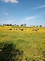 Cattle and buttercups, Kilmaurs, East Ayrshire.jpg 3,456 × 4,608; 6.11 MB
-
 Cauldhame Farm - geograph.org.uk - 2021846.jpg 3,648 × 2,736; 3.98 MB
-
 Centaurea nigra. Kilmaurs, East Ayrshire.jpg 2,697 × 2,284; 1.37 MB
-
 Church Name Sign, Kilmaurs - geograph.org.uk - 6623013.jpg 2,976 × 1,984; 573 KB
-
 Coat of Arms of Alfred Keith Smith Cuninghame, Glencairn Aisle, Kilmaurs.jpg 2,592 × 2,398; 1.3 MB
-
 Cochrane Inn, Gatehead - geograph.org.uk - 3663327.jpg 1,600 × 1,067; 625 KB
-
 Communications Mast - geograph.org.uk - 1959336.jpg 2,272 × 1,704; 893 KB
-
 Corinthian style capital, Glencairn Aisle, Kilmaurs.jpg 3,157 × 2,582; 1.58 MB
-
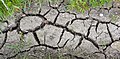 Cracked earth after prolonged drought. 2020.jpg 4,837 × 2,361; 3.23 MB
-
 Crosshouse - geograph.org.uk - 3690679.jpg 640 × 480; 272 KB
-
 Crosshouse Café Fish ^ Chips - geograph.org.uk - 3663315.jpg 5,184 × 3,456; 6.82 MB
-
 Crosshouse Church - geograph.org.uk - 5486648.jpg 640 × 481; 57 KB
-
 Crosshouse Hospital - geograph.org.uk - 2684443.jpg 3,699 × 2,110; 5.75 MB
-
 Crosshouse Hospital - geograph.org.uk - 3737442.jpg 4,608 × 3,456; 5.33 MB
-
 Crosshouse Hospital - geograph.org.uk - 5063717.jpg 640 × 463; 49 KB
-
 Crosshouse Hospital - geograph.org.uk - 5538419.jpg 2,530 × 1,649; 508 KB
-
 Crosshouse Hospital - geograph.org.uk - 5538421.jpg 2,592 × 1,728; 508 KB
-
 Crosshouse Hospital - geograph.org.uk - 5538507.jpg 2,538 × 1,663; 354 KB
-
 Crosshouse Hospital - geograph.org.uk - 6363051.jpg 2,976 × 1,984; 1.73 MB
-
 Crosshouse Hospital c 2004 - geograph.org.uk - 2748202.jpg 1,024 × 730; 123 KB
-
 Crosshouse Hospital Helipad - geograph.org.uk - 3383120.jpg 640 × 355; 53 KB
-
 Crosshouse Parish Church - geograph.org.uk - 2018244.jpg 2,387 × 2,062; 1.7 MB
-
 Crosshouse Parish Church - geograph.org.uk - 3663318.jpg 3,456 × 5,184; 7.32 MB
-
 Crosshouse Parish Church - geograph.org.uk - 5538448.jpg 1,728 × 2,592; 1.39 MB
-
 Crosshouse Parish Church - geograph.org.uk - 5538460.jpg 2,592 × 1,728; 738 KB
-
 Crosshouse Parish Church - geograph.org.uk - 5538461.jpg 1,728 × 2,592; 740 KB
-
 Crosshouse Parish Church - geograph.org.uk - 5538496.jpg 2,592 × 1,728; 2.92 MB
-
 Crosshouse Parish Church - geograph.org.uk - 5538498.jpg 1,728 × 2,592; 2.34 MB
-
 Crosshouse Pharmacy - geograph.org.uk - 3663311.jpg 1,600 × 1,067; 507 KB
-
 Crosshouse Post Office - geograph.org.uk - 3663314.jpg 5,184 × 3,456; 7.72 MB
-

-
 Crosshouse Road, Kilmaurs - geograph.org.uk - 4700479.jpg 800 × 600; 478 KB
-

-
 Crosshouse War Memorial - geograph.org.uk - 3663321.jpg 800 × 1,200; 422 KB
-
 Crosshouse, Birthplace of Andrew Fisher - geograph.org.uk - 5538434.jpg 2,358 × 1,646; 534 KB
-
 Crossing the A71 near Crosshouse - geograph.org.uk - 6585097.jpg 800 × 580; 116 KB
-
 Crossing, Gatehead - geograph.org.uk - 3706599.jpg 640 × 480; 266 KB
-

-
 Cunningham Monument, Glencairn Aisle, Kilmaurs. Blank square and concrete repair.jpg 2,562 × 2,099; 1.05 MB
-

-
 Dalry to Kilmarnock railway - geograph.org.uk - 3690655.jpg 640 × 480; 362 KB
-
 Dark Clouds over Nether Craig - geograph.org.uk - 6144500.jpg 2,976 × 1,984; 1.41 MB
-
 David Robertson, Apocalypse. 1833.jpg 2,083 × 3,451; 1.12 MB
-
 Detail of the Kilmaurs Glencairn Aisle sundial's gnomen. East Ayrshire.jpg 3,008 × 2,588; 1.62 MB
-
 Detail of the Kilmaurs Glencairn Aisle sundial. East Ayrshire.jpg 1,793 × 2,190; 1.18 MB
-
 Detail of VC and JC initials. Glencairn Aisle. Kilmaurs.jpg 3,399 × 2,747; 2.55 MB
-
 Detail of worn lettering, Glencairn Aisle, Kilmaurs.jpg 4,622 × 2,257; 2.79 MB
-
 Dingbro Ltd - Kilmarnock - geograph.org.uk - 6146775.jpg 1,600 × 1,066; 1.01 MB
-
 Diversion in Kilmaurs - geograph.org.uk - 5480692.jpg 1,024 × 682; 159 KB
-
 Dovecote at Tour House, Kilmaurs, East Ayrshire.jpg 3,122 × 2,634; 1.48 MB
-
 Dragon and grape vine on Cross Slab. Glencairn Aisle. Kilmaurs, East Ayrshire.jpg 4,014 × 2,256; 1.65 MB
-
 Drainage works, Glencairn Aisle, Kilmaurs, East Ayrshire.jpg 4,896 × 3,672; 7.45 MB
-
 Emergency Department at University Hospital Crosshouse - geograph.org.uk - 6530106.jpg 2,976 × 1,984; 704 KB
-
 Entering East Ayrshire on A71 - geograph.org.uk - 3475472.jpg 640 × 370; 42 KB
-
 Entrance for Ayrshire Maternity Hospital - geograph.org.uk - 5538429.jpg 2,592 × 1,728; 2.52 MB
-
 Entrance to Kilmaurs Cemetery - geograph.org.uk - 6623070.jpg 2,922 × 1,984; 1.02 MB
-
 Exit from Gatehead Road Car Park - geograph.org.uk - 4922993.jpg 1,920 × 1,280; 1.38 MB
-
 Exit from Kilmaurs Cemetery - geograph.org.uk - 6623102.jpg 2,976 × 1,984; 4.38 MB
-
 Fairlie Cuninghame memorial plaque, Glencairn Aisle, Kilmaurs, East Ayrshire.jpg 3,247 × 2,339; 1.73 MB
-
 Fardalehill Farm, Bonnyton Road - geograph.org.uk - 2685063.jpg 1,600 × 1,097; 846 KB
-
 Fardalehill View, Crosshouse - geograph.org.uk - 5538432.jpg 2,592 × 1,728; 2.07 MB
-
 Farm road to Busbie Holdings, Crosshouse - geograph.org.uk - 5480349.jpg 1,024 × 682; 184 KB
-
 Farmland at Bogside - geograph.org.uk - 5283430.jpg 2,592 × 1,728; 2.25 MB
-
 Farmland at Bogside - geograph.org.uk - 5283434.jpg 2,592 × 1,728; 1.68 MB
-
 Farmland at Moorfield - geograph.org.uk - 5283438.jpg 2,592 × 1,728; 1.76 MB
-
 Farmland east of Knockentiber - geograph.org.uk - 5480686.jpg 1,024 × 682; 193 KB
-
 Farmland near Busbiehill - geograph.org.uk - 2067672.jpg 3,648 × 2,736; 4.84 MB
-
 Farmland near Newhouse - geograph.org.uk - 6144501.jpg 2,976 × 1,984; 2.16 MB
-
 Farmland, Crosshouse - geograph.org.uk - 2018254.jpg 3,254 × 2,117; 2.33 MB
-
 Field on the edge of Kilmaurs - geograph.org.uk - 4700491.jpg 800 × 600; 466 KB
-
 Field, Busbie Mains - geograph.org.uk - 3690637.jpg 640 × 480; 278 KB
-
 Field, Kirkland - geograph.org.uk - 4700472.jpg 800 × 600; 495 KB
-
 Finial, Glencairn Monument, Glencairn Aisle, Kilmaurs, East Ayrshire.jpg 2,126 × 2,508; 1.04 MB
-
 Flames carved on pillar. Glencairn Aisle. Kilmaurs. East Ayrshire. Right hand side.jpg 1,984 × 4,859; 1.64 MB
-
 Flames carved on pillar. Glencairn Aisle. Kilmaurs. East Ayrshire.jpg 2,598 × 4,863; 2.47 MB
-
 Flood Water, Greenhill, by Kilmarnock - geograph.org.uk - 2685013.jpg 1,600 × 1,200; 488 KB
-
 Floors Overbridge, Kilmaurs, East Ayrshire - view towards Kilmaurs.jpg 1,920 × 1,080; 808 KB
-
 Floors Overbridge, Kilmaurs, East Ayrshire - view towards Stewarton.jpg 1,454 × 737; 663 KB
-
 Footbridge to Andrew Fisher Cairn, Crosshouse - geograph.org.uk - 5538473.jpg 2,528 × 1,652; 1.14 MB
-

-
 Foundations of the collegiate college tower, Kilmaurs, East Ayrshire.jpg 4,896 × 2,752; 7.09 MB
-

-
 Garrier Burn - geograph.org.uk - 3688827.jpg 640 × 360; 205 KB
-
 Garrier Burn - geograph.org.uk - 3690668.jpg 640 × 480; 295 KB
-
 Gate Lodge, Thorntoun, near Springside - geograph.org.uk - 3663310.jpg 1,600 × 1,067; 760 KB
-
 Gate, Tour - geograph.org.uk - 4700476.jpg 800 × 600; 565 KB
-
 Gatehead Level Crossing - geograph.org.uk - 3663328.jpg 5,184 × 3,456; 7.56 MB
-
 Gatehead Road, Crosshouse - geograph.org.uk - 4922952.jpg 1,877 × 1,225; 312 KB
-
 Gatehead Road, Crosshouse - geograph.org.uk - 4922988.jpg 1,920 × 1,280; 1.25 MB
-
 Glencairn Aisle blocked upper window, Kilmaurs, East Ayrshire.jpg 2,449 × 2,115; 1.5 MB
-
 Glencairn Aisle windows, Kilmaurs, East Ayrshire.jpg 3,141 × 2,596; 2.08 MB
-

-
 Glencairn Aisle. Ornate fragment of a burial tomb. Kilmaurs, East Ayrshire.jpg 2,774 × 1,816; 986 KB
-
 Glencairn Aisle. Reused masonry. Kilmaurs, East Ayrshire.jpg 4,896 × 2,752; 4.43 MB
-
 Glencairn Aisle. Upper Window inspection. Kilmaurs, East Ayrshire.jpg 3,362 × 2,730; 2.22 MB
-
 Glencairn Monument central inscription. St Maurs-Glencairn Church. Kilmaurs.jpg 3,557 × 2,683; 1.89 MB
-
 Glencairn Monument, 3 daughters, Glencairn Aisle, Kilmaurs, East Ayrshire.jpg 3,524 × 2,291; 1.47 MB
-
 Glencairn Monument, central inscription. Glencairn Aisle, Kilmaurs. East Ayrshire.jpg 4,090 × 1,482; 1.24 MB
-

-
 Glencairn Monument. Worn lettering. Kilmaurs, East Ayrshire.jpg 3,821 × 2,081; 1.59 MB
-
 Glencairn Mural Monument, Kilmaurs, East Ayrshire.jpg 3,734 × 2,518; 1.54 MB
-
 Gowanbrae, Kilmaurs, East Ayrshire, Scotland.jpg 2,653 × 1,682; 760 KB
-

-
 Greenhill Small Holdings, by Kilmarnock - geograph.org.uk - 2685028.jpg 1,600 × 807; 547 KB
-
 Habbieauld Farm from 'The Robin', Kilmaurs, East Ayrshire.jpg 4,896 × 2,752; 3.54 MB
-
 Habbieauld Farm, Kilmaurs, East Ayrshire. View from the east.jpg 4,396 × 2,425; 1.67 MB
-
 Habieauld Farm, Kilmaurs, East Ayrshire. View from the north.jpg 4,436 × 1,874; 1.41 MB
-
 Halo Communications - Kilmarnock - geograph.org.uk - 6175708.jpg 1,350 × 900; 509 KB
-
 Harvest time near Drybridge - geograph.org.uk - 6589085.jpg 800 × 535; 144 KB
-
 Harvested barley field at Drybridge - geograph.org.uk - 6589069.jpg 800 × 559; 155 KB
-
 Hericium cirrhatum - Tiered Tooth. Kilmaurs, East Ayrshire, Scotland. Detail.jpg 4,114 × 2,367; 1.75 MB
-
 Hericium cirrhatum remains on beech, Kilmaurs, East Ayrshire.jpg 2,077 × 1,926; 1.3 MB
-
 Hericium cirrhatum specimen on beech stump, Kilmaurs, East Ayrshire. Spine details.jpg 3,291 × 2,364; 1.51 MB
-
 Hericium cirrhatum specimen on beech stump, Kilmaurs, East Ayrshire. The spine details.jpg 4,303 × 2,711; 2.01 MB
-
 Hericium cirrhatum specimen on beech stump, Kilmaurs, East Ayrshire.jpg 1,951 × 1,615; 710 KB
-
 Hericium cirrhatum. The Tiered Tooth. Kilmaurs, East Ayrshire.jpg 2,761 × 2,133; 1.31 MB
-
 High Langmuir - geograph.org.uk - 3690624.jpg 640 × 360; 222 KB
-
 Hillhouse Quarry - geograph.org.uk - 5139983.jpg 3,264 × 2,448; 4.22 MB
-
 Himalayan Balsam by the River Irvine - geograph.org.uk - 6585073.jpg 604 × 800; 235 KB
-
 History of Andrew Fisher - geograph.org.uk - 5538490.jpg 2,592 × 1,728; 3.51 MB


&filefrom=Horse+Chestnut+%28Aesculus+hippocastanum%29+buds+swelling%2C+Kilmaurs%2C+East+Ayrshire.jpg#mw-category-media)