Category:Kerk van Bourtange, Bourtange
Jump to navigation
Jump to search
| Object location | | View all coordinates using: OpenStreetMap |
|---|
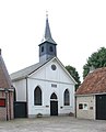
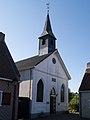
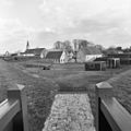
church building in Bourtange, Netherlands  | |||||
| Upload media | |||||
| Instance of | |||||
|---|---|---|---|---|---|
| Location | Bourtange, Vlagtwedde | ||||
| Street address |
| ||||
| Located on street |
| ||||
| Heritage designation |
| ||||
 | |||||
|
This is a category about rijksmonument number 37447
|
| Address |
|
Nederlands: Bourtange, Marktplein 2a - Hervormde Kerk - anno 1869
Media in category "Kerk van Bourtange, Bourtange"
The following 42 files are in this category, out of 42 total.
-
 9545 Bourtange, Netherlands - panoramio (21).jpg 4,896 × 3,264; 3.43 MB
-
 Achtergevel - Bourtange - 20037112 - RCE.jpg 2,220 × 3,318; 1.84 MB
-
 Bourtange, Hervormde kerk.JPG 3,024 × 4,032; 2.08 MB
-
 Bourtange, vestingskerkje foto1 2010-05-17 14.08.JPG 3,456 × 2,592; 4.9 MB
-
 Credobord - Bourtange - 20037108 - RCE.jpg 2,200 × 3,193; 1.44 MB
-
 Exterieur - Bourtange - 20037106 - RCE.jpg 2,415 × 3,253; 1.55 MB
-
 Exterieur - Bourtange - 20037111 - RCE.jpg 2,238 × 3,318; 2.46 MB
-
 Exterieur OVERZICHT NOORDGEVEL - Bourtange - 20260689 - RCE.jpg 1,200 × 792; 210 KB
-
 Exterieur OVERZICHT ZUIDOOST GEVEL - Bourtange - 20260697 - RCE.jpg 1,200 × 769; 157 KB
-
 Exterieur OVERZICHTEN (STADSGEZICHTEN) - Bourtange - 20260605 - RCE.jpg 1,200 × 761; 135 KB
-
 Exterieur OVERZICHTEN (STADSGEZICHTEN) - Bourtange - 20260606 - RCE.jpg 1,200 × 774; 132 KB
-
 Exterieur OVERZICHTEN (STADSGEZICHTEN) - Bourtange - 20260607 - RCE.jpg 1,200 × 767; 140 KB
-
 Exterieur OVERZICHTEN (STADSGEZICHTEN) - Bourtange - 20260608 - RCE.jpg 1,200 × 795; 121 KB
-
 Exterieur OVERZICHTEN (STADSGEZICHTEN) - Bourtange - 20260609 - RCE.jpg 1,200 × 781; 123 KB
-
 Exterieur OVERZICHTEN (STADSGEZICHTEN) - Bourtange - 20260630 - RCE.jpg 1,200 × 748; 132 KB
-
 Exterieur OVERZICHTEN (STADSGEZICHTEN) - Bourtange - 20260640 - RCE.jpg 1,200 × 773; 204 KB
-
 Exterieur OVERZICHTEN (STADSGEZICHTEN) - Bourtange - 20260648 - RCE.jpg 1,200 × 810; 199 KB
-
 Exterieur OVERZICHTEN (STADSGEZICHTEN) - Bourtange - 20260655 - RCE.jpg 1,200 × 790; 184 KB
-
 Exterieur OVERZICHTEN (STADSGEZICHTEN) - Bourtange - 20260670 - RCE.jpg 787 × 1,200; 173 KB
-
 Exterieur OVERZICHTEN (STADSGEZICHTEN) - Bourtange - 20260671 - RCE.jpg 1,200 × 775; 177 KB
-
 Gezicht op het vesting kerkje van Bourtange.JPG 4,608 × 3,456; 2.57 MB
-
 Glas in loodraam - Bourtange - 20037119 - RCE.jpg 948 × 1,200; 142 KB
-
 Interieur naar preekstoel - Bourtange - 20037115 - RCE.jpg 1,200 × 958; 187 KB
-
 Kerk Bourtange.jpg 972 × 1,203; 103 KB
-
 Kerk van Bourtange, Bourtange 1.jpg 2,308 × 1,733; 1.64 MB
-
 Kerk van Bourtange, Bourtange 2.jpg 1,733 × 2,308; 546 KB
-
 Kerk van Bourtange, Bourtange 3.jpg 2,308 × 1,733; 1.08 MB
-
 Kerk van Bourtange, Bourtange 4.jpg 2,308 × 1,733; 1.19 MB
-
 Orgel interieur - Bourtange - 20037116 - RCE.jpg 3,083 × 2,451; 1.58 MB
-
 Overzicht - Bourtange - 20037113 - RCE.jpg 3,095 × 2,451; 1.59 MB
-
 Overzicht Kazernestraat gezien naar de kerk. - Bourtange - 20037035 - RCE.jpg 3,054 × 3,060; 1.78 MB
-
 Overzicht Kazernestraat vanaf het Pastoorsbastion. - Bourtange - 20037034 - RCE.jpg 3,066 × 3,072; 1.78 MB
-
 Overzicht kerk gezien vanuit het zuiden - Bourtange - 20037121 - RCE.jpg 3,030 × 3,036; 1.92 MB
-
 Overzicht kerk vanuit het zuid-westen - Bourtange - 20037120 - RCE.jpg 3,048 × 3,042; 1.99 MB
-
 Overzicht met Ned.Herv.Kerk - Bourtange - 20037104 - RCE.jpg 3,048 × 3,072; 2.19 MB
-
 Overzicht Willem Lodewijkstraat - Bourtange - 20037069 - RCE.jpg 1,185 × 1,200; 294 KB
-

-
 Pastoorsbastion - Bourtange - 20037004 - RCE.jpg 1,200 × 1,195; 252 KB
-
 Preekstoel - Bourtange - 20037117 - RCE.jpg 941 × 1,200; 164 KB
-
 Tekstbord - Bourtange - 20037118 - RCE.jpg 946 × 1,200; 218 KB
-
 Voorgevel - Bourtange - 20037114 - RCE.jpg 940 × 1,200; 182 KB
-
 Wapensteen - Bourtange - 20037107 - RCE.jpg 2,157 × 3,138; 1.26 MB
.jpg)


_-_Bourtange_-_20260605_-_RCE.jpg)
_-_Bourtange_-_20260606_-_RCE.jpg)
_-_Bourtange_-_20260607_-_RCE.jpg)
_-_Bourtange_-_20260608_-_RCE.jpg)
_-_Bourtange_-_20260609_-_RCE.jpg)
_-_Bourtange_-_20260630_-_RCE.jpg)
_-_Bourtange_-_20260640_-_RCE.jpg)
_-_Bourtange_-_20260648_-_RCE.jpg)
_-_Bourtange_-_20260655_-_RCE.jpg)
_-_Bourtange_-_20260670_-_RCE.jpg)
_-_Bourtange_-_20260671_-_RCE.jpg)


