Category:Marktplein Bourtange
Jump to navigation
Jump to search
| Object location | | View all coordinates using: OpenStreetMap |
|---|
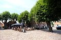
square in Bourtange, the Netherlands  | |||||
| Upload media | |||||
| Instance of | |||||
|---|---|---|---|---|---|
| Location | Bourtange, Vlagtwedde | ||||
| Street address |
| ||||
| Heritage designation |
| ||||
 | |||||
Nederlands: Marktplein met keienbestrating en lindebomen
|
This is a category about rijksmonument number 37444
|
| Address |
|
Subcategories
This category has the following 3 subcategories, out of 3 total.
M
- Marktplein 13, Bourtange (4 F)
- Marktplein 5, Bourtange (12 F)
- Marktplein 7, Bourtange (17 F)
Media in category "Marktplein Bourtange"
The following 20 files are in this category, out of 20 total.
-
 9545 Bourtange, Netherlands - panoramio (11).jpg 4,896 × 3,264; 3.72 MB
-
 Bourtange 08.JPG 2,816 × 2,112; 2.8 MB
-
 Bourtange, Marktplein met keienbestrating en lindebomen.JPG 4,608 × 3,456; 2.97 MB
-
 Exterieur OVERZICHTEN (STADSGEZICHTEN) - Bourtange - 20260654 - RCE.jpg 1,200 × 765; 239 KB
-
 Exterieur OVERZICHTEN (STADSGEZICHTEN) - Bourtange - 20260656 - RCE.jpg 1,200 × 779; 251 KB
-
 Exterieur OVERZICHTEN (STADSGEZICHTEN) - Bourtange - 20260657 - RCE.jpg 1,200 × 781; 253 KB
-
 Exterieur OVERZICHTEN (STADSGEZICHTEN) - Bourtange - 20260659 - RCE.jpg 1,200 × 772; 259 KB
-
 Exterieur OVERZICHTEN (STADSGEZICHTEN) - Bourtange - 20260663 - RCE.jpg 1,200 × 804; 256 KB
-
 Marktplein repro 'Middendorp' nr. 53 - Bourtange - 20446902 - RCE.jpg 1,200 × 900; 192 KB
-
 Marktplein, Bourtange 1.jpg 2,666 × 1,500; 1.36 MB
-
 Marktplein, Bourtange 2.jpg 2,307 × 1,732; 1.72 MB
-
 Overzicht Marktplein - Bourtange - 20037047 - RCE.jpg 1,197 × 1,200; 422 KB
-
 Overzicht Marktplein - Bourtange - 20037048 - RCE.jpg 1,185 × 1,200; 405 KB
-
 Overzicht Marktplein - Bourtange - 20037049 - RCE.jpg 1,200 × 1,200; 420 KB
-
 Overzicht Marktplein - Bourtange - 20037050 - RCE.jpg 1,192 × 1,200; 430 KB
-
 Overzicht Marktplein - Bourtange - 20037051 - RCE.jpg 1,192 × 1,200; 387 KB
-
 Overzicht Marktplein gezien vanuit Kruitstraat - Bourtange - 20037046 - RCE.jpg 1,195 × 1,200; 398 KB
-
 Overzicht Meestraat richting Marktplein - Bourtange - 20037054 - RCE.jpg 1,190 × 1,200; 438 KB
-
 Overzicht van het plein - Bourtange - 20349677 - RCE.jpg 1,200 × 1,200; 396 KB
-
 Straatbeeld - Bourtange - 20349680 - RCE.jpg 1,200 × 1,200; 418 KB
.jpg)

_-_Bourtange_-_20260654_-_RCE.jpg)
_-_Bourtange_-_20260656_-_RCE.jpg)
_-_Bourtange_-_20260657_-_RCE.jpg)
_-_Bourtange_-_20260659_-_RCE.jpg)
_-_Bourtange_-_20260663_-_RCE.jpg)


