Category:July 2016 in Utah
Jump to navigation
Jump to search
English: Images/pictures taken in Utah during July 2016. Note this is not the date of the upload, nor the date a photo was scanned.
States of the United States: Alabama · Alaska · Arizona · California · Colorado · Connecticut · Delaware · Florida · Georgia · Hawaii · Idaho · Illinois · Indiana · Iowa · Kansas · Kentucky · Louisiana · Maine · Maryland · Massachusetts · Michigan · Minnesota · Missouri · Montana · Nebraska · Nevada · New Hampshire · New Jersey · New Mexico · New York · North Carolina · North Dakota · Ohio · Oklahoma · Oregon · Pennsylvania · Rhode Island · South Carolina · South Dakota · Tennessee · Texas · Utah · Vermont · Virginia · Washington · West Virginia · Wisconsin · Wyoming – Washington, D.C.
Guam · Puerto Rico
Guam · Puerto Rico
| July 2015 | ← | July 2016 | → | July 2017 | |||||||||
| Jan | Feb | Mar | Apr | May | Jun | Jul | Aug | Sep | Oct | Nov | Dec | ||
| ← | 113 | 54 | 90 | 425 | 324 | 285 | 157 | 758 | 280 | 747 | 104 | 89 | → |
|---|---|---|---|---|---|---|---|---|---|---|---|---|---|
Subcategories
This category has only the following subcategory.
Media in category "July 2016 in Utah"
The following 156 files are in this category, out of 156 total.
-
 101 South 200 East looking North D Ramey Logan.jpg 3,264 × 1,704; 4.64 MB
-
 13 Lucky Wires - panoramio.jpg 3,264 × 2,448; 1.58 MB
-
 2016.07.02 12.12.17 DSC05113 - Flickr - andrey zharkikh.jpg 4,896 × 3,672; 2.36 MB
-
 2016.07.09 11.49.21 IMG 7208 - Flickr - andrey zharkikh.jpg 5,472 × 3,648; 1.8 MB
-
 2016.07.09 11.49.44 IMG 7209 - Flickr - andrey zharkikh.jpg 3,648 × 5,472; 1.85 MB
-
 2016.07.09 11.50.51 DSC05219 - Flickr - andrey zharkikh.jpg 4,896 × 3,672; 3.91 MB
-
 2016.07.30 10.28.58 DSC05442p - Flickr - andrey zharkikh.jpg 5,827 × 3,590; 2.6 MB
-

-
 777JZ at Heber City Airport 36U Russ McDonald Field Park City Utah by Don Ramey Logan.jpg 3,248 × 1,572; 1.74 MB
-

-

-
-

-

-

-

-
-

-
 A646, Escalante, Utah, United States, 2016.jpg 2,400 × 1,200; 1.51 MB
-
 Across the TRAX tracks at UTA Police Station, Jul 16.jpg 2,592 × 1,944; 2.45 MB
-
 American Fork ambulance A52, American Fork, Utah, Jul 16.jpg 2,592 × 1,944; 2.38 MB
-
 American Fork City Police truck, American Fork, Utah, Jul 16.jpg 2,592 × 1,944; 2.42 MB
-
 American Fork fire engine E51, American Fork, Utah, Jul 16.jpg 2,592 × 1,944; 2.4 MB
-
 Arches National Park - 2016-07-01 A.jpg 4,256 × 2,832; 2.83 MB
-
 Arches National Park Entrance Station, Moab, United States (Unsplash).jpg 7,952 × 5,622; 9.5 MB
-
 Arches National Park, Moab, United States (Unsplash).jpg 5,915 × 3,942; 2.42 MB
-
 Archibald Water Works.jpg 4,000 × 3,000; 2.28 MB
-
 Artwork under University Parkway, Provo, Utah, Jul 16.jpg 2,592 × 1,944; 2.38 MB
-
 Balsam campground sign, Hobble Creek Canyon, Utah, Jul 16.jpg 2,592 × 1,944; 2.47 MB
-
 Bench along Left Fork Maple Canyon Trail, Utah, Jul 16.jpg 2,592 × 1,944; 2.23 MB
-
 Bicycle designated FrontRunner Bombardier BiLevel coach, Jul 16.jpg 2,592 × 1,944; 2.33 MB
-
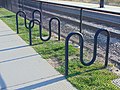 Bicycle racks at Murray North station, Murray, Utah, Aug 16.jpg 2,592 × 1,944; 2.05 MB
-
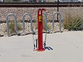 Bicycle repair stand at Murray Central station, Jul 16.jpg 2,592 × 1,944; 2.32 MB
-
 Bombardier BiLevel coaches at South Jordan station, Jul 16.jpg 2,592 × 1,944; 2.26 MB
-
 Break room, UTA Police station, Jul 16.jpg 2,592 × 1,944; 2.3 MB
-
 Bus at Lehi station, Jul 16.jpg 2,592 × 1,944; 2.38 MB
-
 Bus at the Murray Central station, Jul 16.jpg 2,592 × 1,944; 2.44 MB
-
 Capitol Reef - 2016-07-01.jpg 4,256 × 2,832; 3.64 MB
-
 Carl's Jr in north Provo, Utah, Aug 16.jpg 2,592 × 1,944; 2.43 MB
-
 Cattle Guard in middle RIght Fork Hobble Creek Canyon, Utah, Jul 16.jpg 2,592 × 1,944; 2.43 MB
-
 Cattle Guard in upper RIght Fork Hobble Creek Canyon, Utah, Jul 16.jpg 2,592 × 1,944; 2.4 MB
-
 Cattle guard, Road 115 Uinta National Forest, Jul 16.jpg 2,592 × 1,944; 2.19 MB
-
 Central Bank, Pleasant Grove, Utah, Jul 16.jpg 2,592 × 1,944; 2.37 MB
-
 Cherry campground sign, Hobble Creek Canyon, Utah, Jul 16.jpg 2,592 × 1,944; 2.44 MB
-
 Closed north access to Murray Central station, Murray, Utah, Jul 16.jpg 2,592 × 1,944; 2.12 MB
-
 Diamond Fork Guard Station sign, Jul 16.jpg 2,592 × 1,944; 2.42 MB
-
 Direction Signs.jpg 4,000 × 3,000; 5.41 MB
-
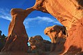
 Double O arch, Arches National Park.jpg 6,000 × 4,000; 6.08 MB
-
 Down Hobble Creek Canyon Rd from fork, Jul 16.jpg 2,592 × 1,944; 2.43 MB
-
 Down lower Maple Canyon, Utah County, Utah, Jul 16.jpg 2,592 × 1,944; 2.39 MB
-
 Down upper Maple Canyon, Utah County, Utah, Jul 16.jpg 2,592 × 1,944; 2.29 MB
-
 East across American Fork at Wasatch Range on southbound FrontRunner, Jul 16.jpg 2,592 × 1,944; 2.34 MB
-

-
 East at Cascade Mountain on FrontRunner, Jul 16.jpg 2,592 × 1,944; 2.2 MB
-
 East on Right Fork Hobble Creek Rd, Hobble Creek Canyon, Utah, Jul 16.jpg 2,592 × 1,944; 2.19 MB
-
 East on SR-265 at 800 E in Orem, Jul 16.jpg 2,592 × 1,944; 2.36 MB
-
 East-southeast on SR-265 in Provo, Jul 16.jpg 2,592 × 1,944; 2.37 MB
-
 Egyptian Theater Park City Utah by D Ramey Logan.jpg 3,260 × 2,252; 3.55 MB
-
 Encountered an antelope at Zion National Park.jpg 4,288 × 2,848; 4.88 MB
-
 Entering Jordan Narrows on northbound FrontRunner, Jul 16.jpg 2,592 × 1,944; 2.37 MB
-
 Entering Jordan Narrows on southbound FrontRunner, Jul 16.jpg 2,592 × 1,944; 2.35 MB
-
 Fire hydrant in northeast Mapleton, Utah, Jul 16.jpg 2,592 × 1,944; 2.37 MB
-
 Flanigan Ditch at Zion National Park.jpg 4,288 × 2,848; 6.05 MB
-
 Forest in Uinta Mountains (Unsplash).jpg 4,928 × 3,264; 13.9 MB
-
 Former Daily Herald building, Provo, Utah, Jul 16.jpg 2,592 × 1,944; 2.36 MB
-
 Front of Diamond Fork Guard Station, Jul 16.jpg 2,592 × 1,944; 2.43 MB
-
 FrontRunner locomotive at Provo station, Jul 16.jpg 2,592 × 1,944; 2.37 MB
-
 FrontRunner No Sunday Service sign, Jul 16.jpg 2,592 × 1,944; 2.33 MB
-
 FrontRunner staging at Provo station (front view), Jul 16.jpg 2,592 × 1,944; 2.33 MB
-
 FrontRunner staging at Provo station (rear view), Jul 16.jpg 2,592 × 1,944; 2.29 MB
-
 Full moon from Maple Canyon, Jul 16.jpg 2,592 × 1,944; 2.3 MB
-
 Great Salt Lake (Unsplash).jpg 2,992 × 3,992; 11.74 MB
-
 Green river canyon.jpg 2,168 × 1,446; 853 KB
-
 Hobble Creek catch basin, Jul 16.jpg 2,592 × 1,944; 2.39 MB
-
 Hobble Creek Golf Course Club House, Jul 16.jpg 2,592 × 1,944; 2.41 MB
-
 Inside Utah State Capitol.jpg 2,397 × 3,942; 8.58 MB
-
 Interstate 15 from FrontRunner, Salt Lake County, Utah, Jun 16.jpg 2,592 × 1,944; 2.3 MB
-
 John Gardiner Cabin.jpg 480 × 360; 49 KB
-
 Jordan Narrows on southbound FrontRunner, Jul 16.jpg 2,592 × 1,944; 2.37 MB
-
 Leaving Jordan Narrows on northbound FrontRunner, Jul 16.jpg 2,592 × 1,944; 2.34 MB
-
 Leaving Jordan Narrows on southbound FrontRunner, Jul 16.jpg 2,592 × 1,944; 2.35 MB
-
 Leaving Uinta National Forest sign, Hobble Creek Canyon, Utah, Jul 16.jpg 2,592 × 1,944; 2.48 MB
-
 Left & front of Dimond Fork Guard Station, Jul 17.jpg 2,592 × 1,944; 2.37 MB
-
 Logan Tabernacle Logan, Utah.jpg 3,264 × 1,836; 2.18 MB
-
 Logan Tabernacle.jpg 1,836 × 3,264; 3.27 MB
-
 Lone Peak - Cherry Canyon Cabin.jpg 2,281 × 2,197; 3.88 MB
-
 Lone Peak from FrontRunner, Jul 16.jpg 2,592 × 1,944; 2.38 MB
-
 Lone Peak South Summit and Question Mark Wall.jpg 3,264 × 2,448; 1.86 MB
-
 Looking down upper Right Fork Hobble Creek Canyon, Jul 16.jpg 2,592 × 1,944; 2.35 MB
-
 Lower upper Right Fork Hobble Creek, Jul 16.jpg 2,592 × 1,944; 2.27 MB
-
 Millar Campus, SLCC, Jul 16.jpg 2,592 × 1,944; 2.35 MB
-
 Mormon Tabernacle Choir conference center in Utah, Salt Lake City SLC.jpg 2,592 × 1,936; 1.25 MB
-
 Mountain meadow near Pumphouse Hill, July 16.jpg 2,592 × 1,944; 2.4 MB
-
 Mountain of the Sun in Zion Canyon.jpg 3,977 × 2,832; 3.41 MB
-
 Next train sign at night, Provo station, Jul 16.jpg 2,592 × 1,944; 2.7 MB
-
 No overnight camping, Hobble Creek Canyon, Jul 16.jpg 2,592 × 1,944; 2.44 MB
-
 North & down from Right Fork Hobble Creek Rd, Jul 16.jpg 2,592 × 1,944; 2.13 MB
-
 North at Springville Crossing, Diamond Fork Canyon, Utah County, Utah. Jul 16.jpg 2,592 × 1,944; 2.31 MB
-
 North at SR-265 over Provo River Parkway, Provo, Utah, Jul 16.jpg 2,592 × 1,944; 2.23 MB
-
 North end of Diamond Fork Rd, Utah County, Utah, Jul 16.jpg 2,592 × 1,944; 2.37 MB
-
 North on Forest Rd 132, Utah County, Utah, Jul 16.jpg 2,592 × 1,944; 2.41 MB
-
 North under SB SR-265 over Provo River Parkway, Provo, Utah, Jul 16.jpg 2,592 × 1,944; 2.38 MB
-
 North-northwest on SR-265 in Provo, Jul 16.jpg 2,592 × 1,944; 2.4 MB
-
 Northwest at 2230 North station site in Provo, Jul 16.jpg 2,592 × 1,944; 2.35 MB
-
 Northwest at SR-265 & 200 W in Provo, Jul 16.jpg 2,592 × 1,944; 2.39 MB
-
 Northwest from Provo River Parkway, northeast of SR-265, Provo, Utah, Jul 16.jpg 2,592 × 1,944; 2.3 MB
-
 Northwest on SR-265 in Provo, Jul 16.jpg 2,592 × 1,944; 2.39 MB
-
 Provo Amtrak station from FrontRunner, Provo, Utah, Jul 16.jpg 2,592 × 1,944; 2.33 MB
-
 Provo River under University Parkway, Provo, Utah, Jul 16.jpg 2,592 × 1,944; 2.34 MB
-
 Public Safety & Education Training Center, SLCC, Jul 16.jpg 2,592 × 1,944; 2.31 MB
-
 Right Fork Maple Canyon Trail, Jul 16.jpg 2,592 × 1,944; 2.35 MB
-
 Riverside Country Club, Provo, United States (Unsplash).jpg 5,376 × 3,025; 10.15 MB
-
 Salt Lake Clock.jpg 960 × 960; 103 KB
-
 Salt Lake Temple, Salt Lake, Utah.jpg 2,383 × 3,178; 1.08 MB
-
 Shooting area, Right Fork Hobble Creek Canyon, Utah County, Utah, Jul 16.jpg 2,592 × 1,944; 2.26 MB
-
 Side road on Forest Rd 058, Utah County, Utah, Jul 16.jpg 2,592 × 1,944; 2.37 MB
-
 Sign at shooting area, Right Fork Hobble Creek Canyon, Utah County, Utah, Jul 16.jpg 2,592 × 1,944; 2.45 MB
-
 Sign at Springville Crossing, Diamond Fork Canyon, Utah County, Utah. Jul 16.jpg 2,592 × 1,944; 2.42 MB
-
 Snow Canyon in Utah - 2016-07-03 A.jpg 4,256 × 2,832; 3.8 MB
-
 South along Provo River from SR-265, Provo, Utah, Jul 16.jpg 2,592 × 1,944; 1.99 MB
-
 South along Provo River Parkway (south of SR-256), Provo, Utah, Jul 16.jpg 2,592 × 1,944; 2.09 MB
-
 South at bus stands at Murray Central station, Murray, Utah, Jul 16.jpg 2,592 × 1,944; 2.34 MB
-
 South at footbridge and SR-265 over Provo River Parkway, Provo, Utah, Jul 16.jpg 2,592 × 1,944; 2.28 MB
-
 South at Springville Crossing, Diamond Fork Canyon, Utah County, Utah. Jul 16.jpg 2,592 × 1,944; 2.33 MB
-
 South at UTA Transit Police station, Murray, Utah, Jul 16.jpg 2,592 × 1,944; 2.32 MB
-
 South canoyn wall, Maple Canyon, Utah, Jul 16.jpg 2,592 × 1,944; 2.52 MB
-
 South-southeast at Carterville Rd overpass on SR-265, Jul 16.jpg 2,592 × 1,944; 2.33 MB
-
 South-southeast on SR-265 in Provo, Jul 16.jpg 2,592 × 1,944; 2.34 MB
-
 Southeast at Lone Peak on FrontRunner, Jul 16.jpg 2,592 × 1,944; 2.36 MB
-
 Southeast at Mount Timpanogos on FrontRunner, Jul 16.jpg 2,592 × 1,944; 2.33 MB
-
 Southeast on SR-265 in Provo, Jul 16.jpg 2,592 × 1,944; 2.4 MB
-
 Springville ambulance 42 in Springville, Utah, Jul 16.jpg 2,592 × 1,944; 2.42 MB
-
 Streetside of Provo Amtrak station, Jul 16.jpg 2,592 × 1,944; 2.34 MB
-
 Sunset over Utah Lake, from Maple Canyon, Jul 16.jpg 2,592 × 1,944; 2.14 MB
-
 The beauty of Utah and their red rocks.jpg 4,096 × 3,072; 3.09 MB
-
 Toilets Cherry campground, Hobble Creek Canyon, Utah, Jul 16.jpg 2,592 × 1,944; 2.41 MB
-
 Trackside of Provo Amtrak station, Jul 16.jpg 2,592 × 1,944; 2.24 MB
-
 Training room, UTA Police station, Jul 16.jpg 2,592 × 1,944; 2.32 MB
-
 Uinta National Forest sign, Hobble Creek Canyon, Utah, Jul 16.jpg 2,592 × 1,944; 2.23 MB
-
 UP ballast regulator in Draper, Utah, Jul 16.jpg 2,592 × 1,944; 2.32 MB
-
 UP ballast tamper in Draper, Utah, Jul 16.jpg 2,592 × 1,944; 2.28 MB
-
 Upper upper Right Fork Hobble Creek, Jul 16.jpg 2,592 × 1,944; 2.43 MB
-
 UTA Tranist Police patch design, Jul 16.jpg 2,592 × 1,944; 2.33 MB
-
 Utah Highway Patrol motorcycle, Provo, Utah, Jul 16.jpg 2,592 × 1,944; 2.36 MB
-
 Utah State Capitol, Salt Lake City, United States (Unsplash s4vuMuapk4Y).jpg 4,031 × 3,024; 1.82 MB
-
 Utah Transit Authority police cars, Jul 16.jpg 2,592 × 1,944; 2.43 MB
-
 View from Forest Rd 058, Utah County, Utah, Jul 16.jpg 2,592 × 1,944; 2.37 MB
-
 View north from Murray North station, Aug 16.jpg 2,592 × 1,944; 2.36 MB
-
 Wardsworth trailhead, Hobble Creek Canyon, Jul 16.jpg 2,592 × 1,944; 2.35 MB
-
 Welcome to Provo sign on SR-265, Provo, Utah, Jul 16.jpg 2,592 × 1,944; 2.34 MB
-
 West along Hobble Creek Canyon Parkway, Utah County, Utah, Jul 16.jpg 2,592 × 1,944; 2.39 MB
-
 West at UTA Transit Police station, Murray, Utah, Jul 16.jpg 2,592 × 1,944; 2.37 MB
-
 West-northwest on SR-265 in Provo, Jul 16.jpg 2,592 × 1,944; 2.33 MB
-
 Whiting campground sign, Maple Canyon, Utah, Jul 16.jpg 2,592 × 1,944; 2.4 MB
-
 Wild river (Unsplash).jpg 6,000 × 3,376; 18.31 MB
-
 Yellow wildflowers at Bryce Canyon (27807151543).jpg 3,306 × 3,818; 3.96 MB


_Russ_McDonald_Field_Park_City_Utah_by_D_Ramey_Logan.jpg)


.jpg)
.jpg)


.jpg)


,_Jul_16.jpg)
,_Jul_16.jpg)

.jpg)


.jpg)


,_Provo,_Utah,_Jul_16.jpg)


.jpg)


.jpg)
.jpg)