Category:April 2016 in Utah
Jump to navigation
Jump to search
English: Images/pictures taken in Utah during April 2016. Note this is not the date of the upload, nor the date a photo was scanned.
States of the United States: Alabama · Alaska · Arizona · Arkansas · California · Colorado · Connecticut · Florida · Georgia · Hawaii · Idaho · Illinois · Indiana · Iowa · Kansas · Kentucky · Louisiana · Maine · Maryland · Massachusetts · Michigan · Minnesota · Mississippi · Missouri · Montana · Nebraska · Nevada · New Hampshire · New Jersey · New Mexico · New York · North Carolina · Ohio · Oregon · Pennsylvania · Rhode Island · South Carolina · South Dakota · Tennessee · Texas · Utah · Virginia · Washington · West Virginia · Wisconsin · Wyoming – Washington, D.C.
Puerto Rico
Puerto Rico
| April 2015 | ← | April 2016 | → | April 2017 | |||||||||
| Jan | Feb | Mar | Apr | May | Jun | Jul | Aug | Sep | Oct | Nov | Dec | ||
| ← | 113 | 54 | 90 | 425 | 324 | 285 | 157 | 758 | 280 | 747 | 104 | 89 | → |
|---|---|---|---|---|---|---|---|---|---|---|---|---|---|
Subcategories
This category has only the following subcategory.
Media in category "April 2016 in Utah"
The following 200 files are in this category, out of 424 total.
(previous page) (next page)-
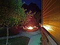
 "House on Fire", South Fork, Mule Canyon, Utah (26022328990).jpg 1,068 × 1,600; 634 KB
-
 1,000,000th passenger sign for Park City Transit in 2008, Apr 16.jpg 2,592 × 1,944; 2.43 MB
-
 1002 S Main St, Springville, Utah (angle), Apr 16.jpg 2,592 × 1,944; 2.41 MB
-
 2,000,000th passenger sign for Park City Transit in 2007, Apr 16.jpg 2,592 × 1,944; 2.34 MB
-
 2002 Winter Olympics sign at Soldier Hollow, Apr 16.jpg 1,944 × 2,592; 1.6 MB
-
 2016.04.21 18.16.03 DSC03451 - Flickr - andrey zharkikh.jpg 4,896 × 3,672; 1.85 MB
-
 2016.04.21 18.23.27 DSC03468 - Flickr - andrey zharkikh.jpg 4,896 × 3,672; 3.11 MB
-
 2016.04.21 18.23.34 DSC03469 - Flickr - andrey zharkikh.jpg 4,896 × 3,672; 1.74 MB
-
 2016.04.21 18.33.35 DSC03486 - Flickr - andrey zharkikh.jpg 4,896 × 3,672; 2.85 MB
-
 2016.04.21 18.47.49 DSC03519 - Flickr - andrey zharkikh.jpg 4,896 × 3,672; 4.02 MB
-
 2016.04.22 07.12.58 IMG 4888 - Flickr - andrey zharkikh.jpg 3,648 × 5,472; 2.73 MB
-
 2016.04.22 14.47.17 DSC03617 - Flickr - andrey zharkikh.jpg 4,896 × 3,672; 3.31 MB
-
 2016.04.25 13.01.27 DSC03840 - Flickr - andrey zharkikh.jpg 4,896 × 3,672; 3.89 MB
-
 2700 W Sugar Factory Rd passenger platform sign, Apr 16.jpg 2,592 × 1,944; 2.19 MB
-
 2700 W Sugar Factory Rd station street sign, Apr 16.jpg 2,592 × 1,944; 2.33 MB
-
 3900 S Wasatch Blvd Park & Ride street sign, Millcreek, Utah, Apr 16.jpg 2,592 × 1,944; 2.44 MB
-
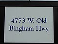 4800 W Old Bingham Hwy station passenger platform sign, Apr 16.jpg 2,592 × 1,944; 2.18 MB
-
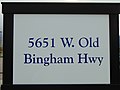
 4800 W Old Bingham Hwy station street sign, Apr 16.jpg 2,592 × 1,944; 2.3 MB
-
 5600 W Old Bingham Hwy station passenger platform sign, Apr 16.jpg 2,592 × 1,944; 2.11 MB
-
 5600 W Old Bingham Hwy station street sign, Apr 16.jpg 2,592 × 1,944; 2.29 MB
-
 7-Eleven on Park Ave in Park City, Utah, Apr 16.jpg 2,592 × 1,944; 2.42 MB
-
 A bus stand at 2700 W Sugar Factory Rd, Apr 16.jpg 2,592 × 1,944; 2.36 MB
-
 A UTA bus at 2700 W Sugar Factory Rd, Apr 16.jpg 2,592 × 1,944; 2.41 MB
-
 Across South State Street at Rio Tinto Stadium, Apr 16.jpg 2,592 × 1,944; 2.34 MB
-
 An east entrance to The Shops at Riverwoods, Provo, Utah, Apr 16.jpg 2,592 × 1,944; 2.42 MB
-
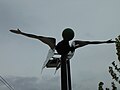 An element of the People in Transit artwork at South Jordan Parkway station, Apr 16.jpg 2,592 × 1,944; 2.11 MB
-
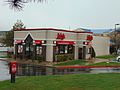 Arby's restaurant in south Provo, Utah, Apr 16.jpg 2,592 × 1,944; 2.35 MB
-
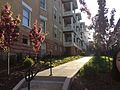 Beautiful site by the apartment.jpg 2,592 × 1,936; 1.69 MB
-
 Benches at 4800 W Old Bingham Hwy, station Apr 16.jpg 2,592 × 1,944; 2.31 MB
-
 Bicycle locker at Jordan Valley station, Apr 16.jpg 2,592 × 1,944; 2.41 MB
-
 Bicycle lockers and rack at South Jordan Parkway station, Apr 16.jpg 2,592 × 1,944; 2.45 MB
-
 Bicycle lockers at 2700 W Sugar Factory Rd, Apr 16.jpg 2,592 × 1,944; 2.41 MB
-
 Bicycle lockers at Daybreak Parkway station, Apr 16.jpg 2,592 × 1,944; 2.41 MB
-
 Bryce.am.L1024.jpg 4,354 × 3,056; 9.74 MB
-
 Bus at Jeremy Ranch Park and Ride bus shelter, Summit Park, Utah, Apr 16.jpg 2,592 × 1,944; 2.31 MB
-
 Bus stands at Jordan Valley station, Apr 16.jpg 2,592 × 1,944; 2.31 MB
-
 Bus stop sign at 3900 S Wasatch Blvd Park & Ride, Millcreek, Utah, Apr 16.jpg 2,592 × 1,944; 2.39 MB
-
 Cable mountain -Zion National Park - 2016.04.22 18.12.20.jpg 4,896 × 3,672; 2.46 MB
-
 Cable Mountain from Observation Point Trail, Zion National Park.jpg 4,896 × 3,672; 2.06 MB
-
 Canyons Resort Transit Hub in Summit County, Utah, Apr 16.jpg 2,592 × 1,944; 2.37 MB
-
 Cañón De Colorado (188030339).jpeg 2,048 × 1,152; 1.12 MB
-
 Cell phone tower tree in north Provo, Utah, Apr 16.jpg 1,944 × 2,592; 1.6 MB
-
 Central exhibit hall, South Towne Exposition Center, Apr 16.jpg 2,592 × 1,944; 2.3 MB
-
 Chevron gas station, Kamas, Utah, Apr 16.jpg 2,592 × 1,944; 2.36 MB
-
 Chinle Trail - Zion National Park (Utah, USA).jpg 4,896 × 3,672; 3.18 MB
-
 Clouds over Utah, Grafton UT, 8-07 (26102053442).jpg 2,800 × 2,732; 2.74 MB
-
 CUP info sign at Jodanelle State Park Overlook, Apr 2016.jpg 2,592 × 1,944; 2.31 MB
-
 Daybreak Parkway station passenger platform sign, Apr 16.jpg 2,592 × 1,944; 2.19 MB
-
 Daybreak Parkway station street sign, Apr 16.jpg 2,592 × 1,944; 2.39 MB
-
 Delicate Arch (26610612596).jpg 1,600 × 1,066; 382 KB
-
 Delicate Arch, Arches National Park.jpg 2,185 × 1,229; 804 KB
-
 Department of Natural Resources law enforcement vehicle, Utah, Apr 16.jpg 2,592 × 1,944; 2.37 MB
-
 East across Daybreak Parkway station Park & Ride lot, Apr 16.jpg 2,592 × 1,944; 2.35 MB
-
 East across Heber Valley from Soldier Hollow, Apr 16.jpg 2,592 × 1,944; 2.38 MB
-
 East across Midway, Utah from SR-222. Apr 16.jpg 2,592 × 1,944; 2.35 MB
-
 East across State Street at Jordon Commons theater & restaurant building, Apr 16.jpg 2,592 × 1,944; 2.35 MB
-
 East along SR-147 from SR-51, Apr 16.jpg 2,592 × 1,944; 2.35 MB
-
 East along SR-222 in Midway, Utah, Apr 16.jpg 2,592 × 1,944; 2.43 MB
-
 East along tracks from Charleston station, Apr 16.jpg 2,592 × 1,944; 2.43 MB
-
 East along walkway from South Jordan Parkway station, Apr 16.jpg 2,592 × 1,944; 2.37 MB
-
 East at 2700 W Sugar Factory Rd passenger platform, Apr 16.jpg 2,592 × 1,944; 2.44 MB
-
 East at a South Jordan Parkway station passenger shelter, Apr 16.jpg 2,592 × 1,944; 2.38 MB
-
 East at bell tower in roundabout in Midway, Utah, Apr 16.jpg 2,592 × 1,944; 2.4 MB
-
 East at Daybreak Parkway station, Apr 16.jpg 2,592 × 1,944; 2.42 MB
-
 East at Deer Mountain development in Wasatch County, Utah, Apr 16.jpg 2,592 × 1,944; 2.41 MB
-
 East at end of pavement on Snake Creek Rd, Apr 16.jpg 2,592 × 1,944; 2.36 MB
-
 East at I-15 & SR-92 interchange, Apr 16.jpg 2,592 × 1,944; 2.39 MB
-
 East at Soldier Hollow station shelter, Apr 16.jpg 2,592 × 1,944; 2.38 MB
-
 East at SR-113 & SR-222 junction, Apr 16.jpg 2,592 × 1,944; 2.46 MB
-
 East at SR-113 & US-40 US-189 junction in Heber City, Utah, Apr 16.jpg 2,592 × 1,944; 2.39 MB
-
 East at SR-147 overpass over I-15, Apr 16.jpg 2,592 × 1,944; 2.42 MB
-
 East at SR-224 & SR-248 junction in Park City, Utah, Apr 16.jpg 2,592 × 1,944; 2.42 MB
-
 East at SR-32 & SR-150 junction, Apr 16.jpg 2,592 × 1,944; 2.39 MB
-
 East at SR-32 & SR-248 junction, Apr 16.jpg 2,592 × 1,944; 2.42 MB
-
 East at the SR-32 & SR-35 junction in Francis, Utah, Apr 16.jpg 2,592 × 1,944; 2.31 MB
-
 East at US-189 & SR-265 junction Provo, Utah, Apr 16.jpg 2,592 × 1,944; 2.37 MB
-
 East at US-189 & SR-52 junction, Apr 16.jpg 2,592 × 1,944; 2.39 MB
-
 East at US-40 & US-189 junction, Apr 16.jpg 2,592 × 1,944; 2.36 MB
-
 East at west end of SR-92 in Lehi, Utah, Apr 16.jpg 2,592 × 1,944; 2.36 MB
-
 East from South Jordan Parkway station, Apr 16.jpg 2,592 × 1,944; 2.39 MB
-
 East on SR-147 under US-6,.jpg 2,592 × 1,944; 2.38 MB
-
 East on SR-319 at Jordanelle State Park-Hailstone sign, Apr 16.jpg 2,592 × 1,944; 2.32 MB
-
 East side of Utah Valley University Wasatch Campus building, Apr 16.jpg 2,592 × 1,944; 2.33 MB
-
 East through the Provo River Legacy Bridge, Apr 16.jpg 2,592 × 1,944; 2.29 MB
-
 East through The Shops at Riverwoods, Apr 16.jpg 2,592 × 1,944; 2.39 MB
-
 East toward junction of SR-115 and SR-147, Apr 16.jpg 2,592 × 1,944; 2.33 MB
-
 East toward SR-115 & SR-156 junction, Apr 16.jpg 2,592 × 1,944; 2.39 MB
-
 East toward SR-147 & SR 156 junction, Apr 16.jpg 2,592 × 1,944; 2.43 MB
-
 East toward US-40 & SR-248 interchange, Apr 16.jpg 2,592 × 1,944; 2.35 MB
-
 Eastbound commuter lane on SR-92, Apr 16.jpg 2,592 × 1,944; 2.29 MB
-
 Elements of the People in Transit artwork at South Jordan Parkway station, Apr 16.jpg 2,592 × 1,944; 2.33 MB
-
 Emergency call box at 2700 W Sugar Factory Rd, Apr 16.jpg 2,592 × 1,944; 2.33 MB
-
 Emergency call box at 4800 W Old Bingham Hwy station, Apr 16.jpg 2,592 × 1,944; 2.42 MB
-
 Emergency call box at 5600 W Old Bingham Hwy station, Apr 16.jpg 2,592 × 1,944; 2.41 MB
-
 Emergency call box at Daybreak Parkway station, Apr 16.jpg 2,592 × 1,944; 2.33 MB
-
 Emergency call box at Jordan Valley station, Apr 16.jpg 2,592 × 1,944; 2.35 MB
-
 Emergency call box at South Jordan Parkway station, Apr 16.jpg 2,592 × 1,944; 2.4 MB
-
 End of the line (Red Line) at Daybreak Parkway station, Apr 16.jpg 2,592 × 1,944; 2.45 MB
-
 Entry road to Zermatt Resort in Midway, Utah, Apr 16.jpg 2,592 × 1,944; 2.38 MB
-
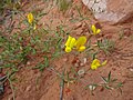
 Fire hydrant and dandelions off State Street in Sandy, Apr 16.jpg 1,944 × 2,592; 1.49 MB
-
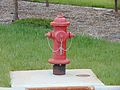 Fire hydrant at 2700 W Sugar Factory Rd station, Apr 16.jpg 2,592 × 1,944; 2.36 MB
-
 Fire station, Kamas, Utah, Apr 16.jpg 2,592 × 1,944; 2.44 MB
-
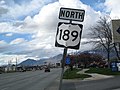 First NB US-189 Shield - panoramio.jpg 1,600 × 1,200; 520 KB
-
 Former Midway Town Hall (angle view), Apr 16.jpg 2,592 × 1,944; 2.4 MB
-
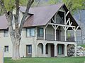
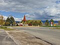
 Former Midway Town Hall, Apr 16.jpg 2,592 × 1,944; 2.35 MB
-
 Francis, Utah welcome sign on SR-32, Apr 16.jpg 2,592 × 1,944; 2.3 MB
-
 Giant outdoor chess, Zermatt Resort, Utah, Apr 16.jpg 2,592 × 1,944; 2.38 MB
-
 Giles Townsite.JPG 3,648 × 2,736; 5.15 MB
-
 Glade's Drive Inn, Spanish Fork, Utah, Apr 16.jpg 2,592 × 1,944; 2.42 MB
-
 Grandview Peak Landslide.jpg 671 × 505; 189 KB
-
 HANKSVILLE AREA, UT - 2016 - 04 -Angel Point (4) (27058402066).jpg 5,050 × 3,356; 17.74 MB
-
 Harmons in Orem, Utah, Apr 16.jpg 2,592 × 1,944; 2.35 MB
-
 Heber Valley Hospital in Heber City, Utah, Apr 16.jpg 2,592 × 1,944; 2.31 MB
-
 Heber Valley Railroad sign on SR-113 in Heber City, Utah, Apr 16.jpg 2,592 × 1,944; 2.35 MB
-
 Hideout Town Limits sign, SR-248, Apr 16.jpg 2,592 × 1,944; 2.7 MB
-
 Hideout Welcome sign on SR-248, Apr 16.jpg 2,592 × 1,944; 2.41 MB
-
 Holiday Inn Express, Springdale, Utah - Flickr - andrey zharkikh.jpg 4,896 × 3,672; 1.56 MB
-
 Horses on a farm at sunset (Unsplash).jpg 4,096 × 2,725; 2.33 MB
-
 I-80 northbound exit on US-40 US-189, Apr 16.jpg 2,592 × 1,944; 2.37 MB
-
 Inside the Jordan Commons theater & restaurant building, Apr 16.jpg 2,592 × 1,944; 2.34 MB
-
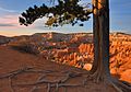
 Inspiration Point (Bryce Canyon National Park 2016).jpg 4,625 × 1,687; 3.18 MB
-
 Interior of ground level of parking garage at Jordan Valley station, Apr 16.jpg 2,592 × 1,944; 2.3 MB
-
 Jeremy Ranch Park and Ride bus shelter, Summit Park, Utah, Apr 16.jpg 2,592 × 1,944; 2.44 MB
-
 Jeremy Ranch Park and Ride, Summit Park, Utah, Apr 16.jpg 2,592 × 1,944; 2.33 MB
-
 Jim's Diner on South State Street, Apr 16.jpg 2,592 × 1,944; 2.33 MB
-
 Jordan Commons office tower, Apr 16.jpg 2,592 × 1,944; 2.24 MB
-
 Jordan Commons sign, Apr 16.jpg 2,592 × 1,944; 2.35 MB
-
 Jordan High School tribute wall at Jordan Commons, Apr 16.jpg 2,592 × 1,944; 2.31 MB
-
 Jordan Valley Medical Center, West Jordan, Utah, Apr 16.jpg 2,592 × 1,944; 2.32 MB
-
 Jordan Valley Station housing under construction, Apr 16.jpg 2,592 × 1,944; 2.3 MB
-
 Jordan Valley station main parking garage closer up, Apr 16.jpg 2,592 × 1,944; 2.41 MB
-
 Jordan Valley station platform close up, Apr 16.jpg 2,592 × 1,944; 2.41 MB
-
 Jordan Valley station secondary parking garage, Apr 16.jpg 2,592 × 1,944; 2.39 MB
-
 Jordan Valley station sign on passenger platform, Apr 16.jpg 2,592 × 1,944; 2.1 MB
-
 Jordanelle Dam & Reservoir info sign at Jordanelle State Park Overlook, Apr 16.jpg 2,592 × 1,944; 2.32 MB
-
 Jordanelle Reservoir info sign at Jordanelle State Park Overlook, Apr 16.jpg 2,592 × 1,944; 2.37 MB
-
 Jordanelle State Park-Hailstone section sign, Apr 16.jpg 2,592 × 1,944; 2.43 MB
-
 Juniperus osteosperma - Flickr - andrey zharkikh.jpg 4,896 × 3,672; 2.23 MB
-
 K-9 Police car West Valley City, Utah, Apr 16.jpg 2,592 × 1,944; 2.42 MB
-
 Kingdom Hall in northwest Wasatch County, Apr 16.jpg 2,592 × 1,944; 2.46 MB
-
 LDS church in southern Midway, Utah, Apr 16.jpg 2,592 × 1,944; 2.35 MB
-
 LDS temple square north gate slc utah.jpg 3,072 × 2,304; 1.96 MB
-
 Looking northwest at Wallsburg turnoff from US-189, Apr 16.jpg 2,592 × 1,944; 2.38 MB
-
 Looking south along SR-222 from its northern end, Apr 16.jpg 2,592 × 1,944; 2.39 MB
-
 Lower Interior of parking garage at Jordan Valley station, Apr 16.jpg 2,592 × 1,944; 2.29 MB
-
 Lumberjack's break (Unsplash).jpg 5,459 × 3,639; 2.73 MB
-
 Macey's store in Orem, Utah, Apr 16.jpg 2,592 × 1,944; 2.32 MB
-
 Median trees & SR-52 parkway, Orem, Utah, Apr 16.jpg 2,592 × 1,944; 2.43 MB
-
 Midway City sign in Midway City Park on SR-113, Apr 16.jpg 2,592 × 1,944; 2.32 MB
-
 Montage & Empire Canyon bus stop shelter, Park City, Utah, Apr 16.jpg 2,592 × 1,944; 2.39 MB
-
 NB Red Line TRAX train at Jordan Valley station, Apr 16.jpg 2,592 × 1,944; 2.4 MB
-
 NFL Draft Town, Chicago 2016 (33601001531).jpg 4,000 × 3,000; 4.66 MB
-
 North across Jordanelle Reservoir from Jordanelle State Park Overlook, Apr 16.jpg 2,592 × 1,944; 2.37 MB
-
 North across junction of SR-147 & SR-51 in Spanish Fork, Utah, Apr 16.jpg 2,592 × 1,944; 2.33 MB
-
 North along Pine Canyon Road in Midway, Utah, Apr 16.jpg 2,592 × 1,944; 2.38 MB
-
 North along South Main Street, Springville, Utah Apr 16.jpg 2,592 × 1,944; 2.38 MB
-
 North along South State Street, Apr 16.jpg 2,592 × 1,944; 2.33 MB
-
 North along SR-224 at mm 11 in Snyderville, Utah Apr 16.jpg 2,592 × 1,944; 2.68 MB
-
 North along SR-224 from Cutter Ln in Snyderville, Utah Apr 16.jpg 2,592 × 1,944; 2.4 MB
-
 North along tracks from South Jordan Parkway station, Apr 16.jpg 2,592 × 1,944; 2.45 MB
-
 North along US-189 at border of Utah & Wasatch counties, Apr 16.jpg 2,592 × 1,944; 2.39 MB
-
 North along walkway to South Jordan Parkway station, Apr 16.jpg 2,592 × 1,944; 2.41 MB
-
 North at bus stands at 3900 S Wasatch Blvd Park & Ride, Millcreek, Utah, Apr 16.jpg 2,592 × 1,944; 2.31 MB
-
 North at Daybreak Parkway station, Apr 16.jpg 2,592 × 1,944; 2.37 MB
-
 North at Deer Creek State Park turnoff from US-189, Apr 16.jpg 2,592 × 1,944; 2.37 MB
-
 North at Evergreen Dr & SR-51, Springville, Utah, Apr 16.jpg 2,592 × 1,944; 2.37 MB
-
 North at Greyhound bus stop in Snyderville, Utah, Apr 16.jpg 2,592 × 1,944; 2.34 MB
-
 North at Heber Valley Railroad's Heber City station, Apr 16.jpg 2,592 × 1,944; 2.34 MB
-
 North at intersection of SR-51 & Expressway Ln, Apr 16.jpg 2,592 × 1,944; 2.43 MB
-
 North at Kimball Junction (SR-224 & I-80 interchange), Apr 16.jpg 2,592 × 1,944; 2.31 MB
-
 North at northern end of SR-222 in Wasatch Mountain State Park, Apr 16.jpg 2,592 × 1,944; 2.32 MB
-
 North at parking area at 3900 S Wasatch Blvd Park & Ride, Millcreek, Utah, Apr 16.jpg 2,592 × 1,944; 2.41 MB
-
 North at South Main St & US-89 in Springville, Utah, Apr 16.jpg 2,592 × 1,944; 2.36 MB
-
 North at Spanish Fork Pkwy & SR-51, Spanish Fork, Utah, Apr 16.jpg 2,592 × 1,944; 2.37 MB
-
 North at SR-113 & SR-222 junction, Apr 16.jpg 2,592 × 1,944; 2.43 MB
-
 North at SR-113 & US-40 US-189 junction in Heber City, Utah, Apr 16.jpg 2,592 × 1,944; 2.41 MB
-
 North at SR-147 & SR-141 junction, Apr 16.jpg 2,592 × 1,944; 2.33 MB
-
 North at SR-32 & SR-150 junction, Apr 16.jpg 2,592 × 1,944; 2.4 MB
-
 North at SR-32 & SR-248 junction, Apr 16.jpg 2,592 × 1,944; 2.38 MB
-
 North at SR-51 & E 800 N Spanish Fork, Apr 16.jpg 2,592 × 1,944; 2.3 MB
-
 North at US-189 & SR 113 junction, Apr 16.jpg 2,592 × 1,944; 2.4 MB
-
 North at US-189 & SR-52 junction, Apr 16.jpg 2,592 × 1,944; 2.38 MB
-
 North at US-189 & SR-92 junction, Apr 16.jpg 2,592 × 1,944; 2.37 MB
-
 North at US-89 & SR-52 junction in Orem, Utah Apr 16.jpg 2,592 × 1,944; 2.32 MB
-
 North from Midway to Donkey Ridge in Interlaken, Apr 2015.jpg 2,592 × 1,944; 2.42 MB
-
 North from US-189 & SR 113 junction, Apr 16.jpg 2,592 × 1,944; 2.42 MB
-
 North in at PC-SLC Connect bus stop, Park City, Apr 16.jpg 2,592 × 1,944; 2.34 MB
-
 North in Old Town Transit Center, Park City, Utah Apr 16.jpg 2,592 × 1,944; 2.22 MB
-
 North on SR-65 and up Mountain Dell Canyon, Apr 16.jpg 2,592 × 1,944; 2.36 MB
-
 North on US-189 at Deer Creek Dam, Apr 16.jpg 2,592 × 1,944; 2.43 MB
-
 North toward junction of SR-115 and SR-147, Apr 16.jpg 2,592 × 1,944; 2.4 MB
-
 North toward junction of SR-77 and SR-147, Apr 16.jpg 2,592 × 1,944; 2.28 MB
-
 North toward merge of US-89 and SR-51, Apr 16.jpg 2,592 × 1,944; 2.44 MB
-
 North toward SR-115 & SR-156 junction, Apr 16.jpg 2,592 × 1,944; 2.39 MB
-
 North toward SR-147 & SR 156 junction, Apr 16.jpg 2,592 × 1,944; 2.4 MB
-
 North toward SR-156 & SR-198 junction, Apr 16.jpg 2,592 × 1,944; 2.31 MB
-
 North US-189 (University Ave) with a Covered Shield - panoramio.jpg 1,600 × 1,200; 527 KB
-
 North US-189 With a Yet-to-be-Numbered Route Shield - panoramio.jpg 1,600 × 1,200; 668 KB
-
 North-northwest at Park City, Utah City Hall, Apr 16.jpg 2,592 × 1,944; 2.41 MB
-
Northbound Red Line approaching South Jordan Parkway station, Apr 16.webm 23 s, 1,280 × 720; 10.99 MB
.jpg)
,_Apr_16.jpg)


.jpeg)


.jpg)
.jpg)


.jpg)


_at_Daybreak_Parkway_station,_Apr_16.jpg)


,_Apr_16.jpg)


_(27058402066).jpg)


.jpg)


.jpg)


.jpg)


,_Apr_16.jpg)


_with_a_Covered_Shield_-_panoramio.jpg)


.jpg)