Category:July 2009 in Herefordshire
Jump to navigation
Jump to search
Ok
Deutsch: Bilder, die im Juli 2009 in Herefordshire aufgenommen worden sind. Bitte beachten Sie, dass dies weder das Datum des Uploads noch das Datum des Scannens eines Fotos ist.
English: Images/pictures taken in Herefordshire during July 2009. Note this is not the date of the upload, nor the date a photo was scanned.
Español: Fotografías o imágenes tomadas en Herefordshire durante julio 2009. No es la fecha de subida ni escaneo, sino la fecha en que las fotografías o imágenes se crearon.
Esperanto: Bildoj faritaj en Herefordshire en julio 2009. Tio ne estas la dato, kiam la bildoj estis alŝutitaj aŭ skanitaj.
Français : Photographies ou images prises en Herefordshire durant juillet 2009. Ce n'est pas la date du téléchargement ou du scan.
Galego: Fotografías ou imaxes tomadas en Herefordshire durante xullo 2009. Non é a data de subida nin escaneamento, senón a data na que se crearon as fotografías ou imaxes.
Italiano: Fotografie o immagini scattate a Herefordshire nel luglio 2009. Nota bene: la data non si riferisce né a quella di upload né a quella in cui la foto è stata digitalizzata.
Norsk bokmål: Bilder tatt i Herefordshire i løpet av juli 2009. Merk at dette ikke er datoen for opplasting, eller når et bilde har blitt skannet.
Norsk nynorsk: Bilete teke i Herefordshire i løpet av juli 2009. Merk at dette ikkje er datoen for opplasting, eller når eit bilete har vorte skanna.
Русский: Изображения, сделанные в Herefordshire в течение июль 2009 (не дата загрузки изображения).
Українська: Зображення, зроблені в Herefordshire протягом липень 2009. Зауважте, що це не дата завантаження чи дата сканування фотографії.
| July 2008 | ← | July 2009 | → | July 2010 | |||||||
| Jan | Feb | Mar | Apr | May | Jun | Jul | Aug | Sep | Oct | Nov | Dec |
| 144 | 111 | 158 | 173 | 64 | 180 | 61 | 133 | 63 | 66 | 43 | 53 |
|---|---|---|---|---|---|---|---|---|---|---|---|
Media in category "July 2009 in Herefordshire"
The following 61 files are in this category, out of 61 total.
-

-
 A closed shop, Leominster - geograph.org.uk - 1424505.jpg 640 × 480; 87 KB
-
 A determined walker - geograph.org.uk - 1419350.jpg 640 × 480; 162 KB
-
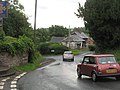 A4112, Stocktons Cross - geograph.org.uk - 1612733.jpg 640 × 480; 94 KB
-
 Approaching Walford - geograph.org.uk - 1498636.jpg 640 × 480; 97 KB
-
 Berrington Hall fence - geograph.org.uk - 1611383.jpg 640 × 480; 101 KB
-
 Broad Street car park - geograph.org.uk - 1421640.jpg 640 × 480; 69 KB
-
 Car park at "Labels" - geograph.org.uk - 1379828.jpg 640 × 480; 210 KB
-
 Fenced off - geograph.org.uk - 1397091.jpg 640 × 480; 79 KB
-
 Footpath and farm road - geograph.org.uk - 1399813.jpg 640 × 480; 203 KB
-
 Ganarew - geograph.org.uk - 1397852.jpg 640 × 480; 231 KB
-
 Gazebo Tower, Ross - geograph.org.uk - 1418054.jpg 480 × 640; 136 KB
-
 Hildersley roundabout, Ross-on-Wye - geograph.org.uk - 1397774.jpg 640 × 481; 228 KB
-
 Lane north-east of Welsh Newton - geograph.org.uk - 1399860.jpg 640 × 480; 240 KB
-
 Lane to Lewstone - geograph.org.uk - 1397823.jpg 640 × 480; 230 KB
-
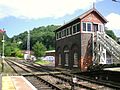 Ledbury Signal Box 2009.JPG 3,072 × 2,304; 1.63 MB
-
 Leominster Canal - geograph.org.uk - 1422418.jpg 640 × 480; 127 KB
-
 Long Wood - geograph.org.uk - 1422380.jpg 640 × 480; 108 KB
-
 Mallow, Lavatera olbia 'Rosea' - detail - geograph.org.uk - 1397834.jpg 640 × 640; 346 KB
-
 Mallow, Lavatera olbia 'Rosea' - geograph.org.uk - 1397833.jpg 640 × 480; 276 KB
-
 Orchard, Stockton Cross - geograph.org.uk - 1422369.jpg 640 × 480; 133 KB
-

-
 Poplar trees next to the Wye - geograph.org.uk - 1419331.jpg 640 × 480; 182 KB
-
 Potato crop east of Bromsash - geograph.org.uk - 1408549.jpg 640 × 480; 237 KB
-
 Private farm track - geograph.org.uk - 1404200.jpg 640 × 480; 233 KB
-
 Rabbit's eye view of the A40 - geograph.org.uk - 1397835.jpg 640 × 480; 267 KB
-
 Railway trackbed - geograph.org.uk - 1389397.jpg 640 × 480; 235 KB
-
 Recent Landslip - geograph.org.uk - 203971.jpg 640 × 480; 66 KB
-
 Red sandstone cliff - geograph.org.uk - 1387589.jpg 448 × 640; 106 KB
-
 River Wye - geograph.org.uk - 1419319.jpg 640 × 480; 181 KB
-

-
 Sheep Grazing At Berrington Hall - geograph.org.uk - 1401306.jpg 640 × 480; 171 KB
-
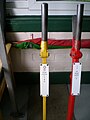 Signal Levers 0 & 1 at Ledbury Signal Box.JPG 2,304 × 3,072; 1.72 MB
-
 Signs outside Stockton Cross Inn - geograph.org.uk - 1424485.jpg 640 × 480; 105 KB
-
 Slip road off the A40 - geograph.org.uk - 1397841.jpg 640 × 480; 222 KB
-
 Small piece of pasture - geograph.org.uk - 1419685.jpg 640 × 480; 259 KB
-
 Springetts Lane - geograph.org.uk - 1389389.jpg 640 × 480; 250 KB
-
 St. Swithin's church, Ganarew - geograph.org.uk - 1397846.jpg 640 × 481; 251 KB
-
 St. Swithin's church, Ganarew - geograph.org.uk - 1397847.jpg 640 × 480; 272 KB
-

-
 Stockton Cross - geograph.org.uk - 1422376.jpg 640 × 480; 101 KB
-
 Sun Inn, Leintwardine - geograph.org.uk - 1746008.jpg 1,600 × 1,200; 624 KB
-
 Sun Inn, Leintwardine - geograph.org.uk - 1746012.jpg 1,600 × 1,200; 606 KB
-
 The Falcon Hotel, Bromyard - geograph.org.uk - 1419246.jpg 640 × 427; 92 KB
-
 The Homend, Ledbury - geograph.org.uk - 1497035.jpg 640 × 472; 94 KB
-
 Through the round window.JPG 3,072 × 2,304; 1.97 MB
-
 Track into fields - geograph.org.uk - 1404116.jpg 640 × 480; 247 KB
-
 Trees in Churchill Gardens - geograph.org.uk - 1420437.jpg 640 × 480; 174 KB
-
 Trolley station - geograph.org.uk - 1397858.jpg 640 × 480; 84 KB
-
 Tumbledown barn - geograph.org.uk - 1404140.jpg 640 × 481; 244 KB
-
 View from The Great Doward 1 - geograph.org.uk - 1397853.jpg 640 × 480; 259 KB
-
 View from The Great Doward 3 - geograph.org.uk - 1397857.jpg 640 × 480; 249 KB
-
 View north-west of Dam Wood - geograph.org.uk - 1419672.jpg 640 × 480; 270 KB
-
 View to St. Wolstan's Wood - geograph.org.uk - 1404156.jpg 640 × 480; 259 KB
-
 Wilton Bridge - geograph.org.uk - 1387578.jpg 640 × 480; 89 KB
-
 B4361 At Eyton Turning - geograph.org.uk - 1401254.jpg 640 × 480; 191 KB
-
 Bridleway to Monmouth - geograph.org.uk - 1404193.jpg 640 × 480; 251 KB
-
 Cattle, Portley Moor - geograph.org.uk - 1422394.jpg 640 × 480; 64 KB
-
 Cottage By The B4361 - geograph.org.uk - 1401283.jpg 640 × 480; 170 KB
-
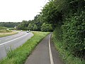
 Direction Indicator near Broad Down - geograph.org.uk - 1417434.jpg 640 × 377; 249 KB
-
 Wellington Brook - geograph.org.uk - 203148.jpg 640 × 480; 89 KB


