Category:January 2009 in Herefordshire
Jump to navigation
Jump to search
Deutsch: Bilder, die im Januar 2009 in Herefordshire aufgenommen worden sind. Bitte beachten Sie, dass dies weder das Datum des Uploads noch das Datum des Scannens eines Fotos ist.
English: Images/pictures taken in Herefordshire during January 2009. Note this is not the date of the upload, nor the date a photo was scanned.
Español: Fotografías o imágenes tomadas en Herefordshire durante enero 2009. No es la fecha de subida ni escaneo, sino la fecha en que las fotografías o imágenes se crearon.
Esperanto: Bildoj faritaj en Herefordshire en januaro 2009. Tio ne estas la dato, kiam la bildoj estis alŝutitaj aŭ skanitaj.
Français : Photographies ou images prises en Herefordshire durant janvier 2009. Ce n'est pas la date du téléchargement ou du scan.
Galego: Fotografías ou imaxes tomadas en Herefordshire durante xaneiro 2009. Non é a data de subida nin escaneamento, senón a data na que se crearon as fotografías ou imaxes.
Italiano: Fotografie o immagini scattate a Herefordshire nel gennaio 2009. Nota bene: la data non si riferisce né a quella di upload né a quella in cui la foto è stata digitalizzata.
Norsk bokmål: Bilder tatt i Herefordshire i løpet av januar 2009. Merk at dette ikke er datoen for opplasting, eller når et bilde har blitt skannet.
Norsk nynorsk: Bilete teke i Herefordshire i løpet av januar 2009. Merk at dette ikkje er datoen for opplasting, eller når eit bilete har vorte skanna.
Русский: Изображения, сделанные в Herefordshire в течение январь 2009 (не дата загрузки изображения).
Українська: Зображення, зроблені в Herefordshire протягом січень 2009. Зауважте, що це не дата завантаження чи дата сканування фотографії.
| January 2008 | ← | January 2009 | → | January 2010 | |||||||
| Jan | Feb | Mar | Apr | May | Jun | Jul | Aug | Sep | Oct | Nov | Dec |
| 144 | 111 | 158 | 173 | 64 | 180 | 61 | 133 | 63 | 66 | 43 | 53 |
|---|---|---|---|---|---|---|---|---|---|---|---|
Media in category "January 2009 in Herefordshire"
The following 144 files are in this category, out of 144 total.
-
 Road to Burton Farm - geograph.org.uk - 1121295.jpg 640 × 480; 203 KB
-
 Arriva train pulls out of Hereford - geograph.org.uk - 1139989.jpg 640 × 426; 96 KB
-
 Asparagus crop below the Penyard - geograph.org.uk - 1116388.jpg 640 × 441; 146 KB
-
 B4164 at Symonds Yat West - geograph.org.uk - 1117437.jpg 640 × 480; 239 KB
-
 Bales behind barns - geograph.org.uk - 1135432.jpg 480 × 640; 101 KB
-
 Birches Barn - geograph.org.uk - 1116358.jpg 640 × 480; 170 KB
-
 Bridge over the Preston Brook - geograph.org.uk - 1108262.jpg 640 × 427; 367 KB
-

-
 Caravan Park, Symonds Yat (West) - geograph.org.uk - 1113248.jpg 640 × 480; 114 KB
-
 Cleeve Lane, Ross-on-Wye - geograph.org.uk - 1133133.jpg 640 × 480; 210 KB
-
 Coppet Hill - geograph.org.uk - 1100704.jpg 640 × 481; 101 KB
-
 Coppet Hill - geograph.org.uk - 1100795.jpg 640 × 481; 241 KB
-
 Coppet Hill - geograph.org.uk - 1100806.jpg 640 × 466; 168 KB
-
 CoppetHill.jpg 640 × 481; 176 KB
-
 Country lane, Goodrich - geograph.org.uk - 1110601.jpg 640 × 480; 129 KB
-
 Crop fields below the Penyard - geograph.org.uk - 1116368.jpg 480 × 640; 132 KB
-
 Deserted Wye Street - geograph.org.uk - 1127313.jpg 480 × 640; 88 KB
-
 East end, Hereford Cathedral - geograph.org.uk - 1138969.jpg 426 × 640; 59 KB
-

-
 Field at Bogmarsh - geograph.org.uk - 1135308.jpg 640 × 426; 81 KB
-
 Field behind Old Gloucester Road - geograph.org.uk - 1111048.jpg 640 × 427; 78 KB
-
 Fields north of the Penyard - geograph.org.uk - 1132560.jpg 480 × 640; 200 KB
-
 Footpath junction - geograph.org.uk - 1135314.jpg 640 × 460; 117 KB
-
 Footpath junction near Dinedor - geograph.org.uk - 1132603.jpg 640 × 426; 97 KB
-
 Footpath on Coppet Hill - geograph.org.uk - 1100768.jpg 640 × 481; 160 KB
-
 Footpath on Coppet Hill - geograph.org.uk - 1100987.jpg 640 × 481; 150 KB
-
 Footpath on Coppet Hill - geograph.org.uk - 1100998.jpg 640 × 481; 180 KB
-
 Footpath on Coppet Hill - geograph.org.uk - 1101009.jpg 640 × 481; 215 KB
-
 Footpath skirting the Penyard - geograph.org.uk - 1116363.jpg 640 × 480; 180 KB
-

-
 Footpath to Dinedor - geograph.org.uk - 1132477.jpg 640 × 426; 92 KB
-
 Footpath to Linton - geograph.org.uk - 1135315.jpg 640 × 440; 97 KB
-
 Footpath to Merrivale Woods - geograph.org.uk - 1132994.jpg 640 × 480; 199 KB
-
 Footpath west of Ross-on-Wye - geograph.org.uk - 1133194.jpg 640 × 480; 221 KB
-
 Fork in the road at Symonds Yat West - geograph.org.uk - 1117423.jpg 640 × 480; 247 KB
-
 Frost on the hills - geograph.org.uk - 1100720.jpg 640 × 427; 301 KB
-
 Frosty Holly - geograph.org.uk - 1100701.jpg 640 × 427; 359 KB
-
 Frosty Jubilee Drive - geograph.org.uk - 1345359.jpg 640 × 480; 105 KB
-
 Frosty pastures 1 - geograph.org.uk - 1121465.jpg 640 × 480; 203 KB
-
 Frosty pastures 3 - geograph.org.uk - 1121467.jpg 640 × 480; 184 KB
-
 Frosty trees on Coppet Hill - geograph.org.uk - 1100746.jpg 640 × 481; 158 KB
-
 Frosty trees on Coppet Hill - geograph.org.uk - 1100920.jpg 640 × 481; 161 KB
-
 Frosty trees on Coppet Hill - geograph.org.uk - 1100949.jpg 640 × 481; 168 KB
-
 Goodrich to Welsh Bicknor road - geograph.org.uk - 1100725.jpg 640 × 481; 212 KB
-
 Heading Southwest from Aston Crews - geograph.org.uk - 1135363.jpg 640 × 480; 101 KB
-
-
 Heading up towards the Penyard - geograph.org.uk - 1116334.jpg 640 × 480; 157 KB
-
 Heading West along Cut Throat Lane - geograph.org.uk - 1135424.jpg 480 × 640; 138 KB
-
 Hereford Cathedral - geograph.org.uk - 1138973.jpg 426 × 640; 81 KB
-
 Hereford Cathedral - geograph.org.uk - 1138975.jpg 426 × 640; 66 KB
-
 Hereford Livestock Market - geograph.org.uk - 1137925.jpg 640 × 426; 49 KB
-
 Hereford Livestock Market - geograph.org.uk - 1137929.jpg 640 × 426; 48 KB
-
 Hereford Livestock Market - geograph.org.uk - 1137933.jpg 426 × 640; 60 KB
-
 Hereford Livestock Market - geograph.org.uk - 1137936.jpg 640 × 426; 90 KB
-
 Hereford Livestock Market - geograph.org.uk - 1137938.jpg 426 × 640; 85 KB
-
 Hereford Livestock Market - geograph.org.uk - 1138102.jpg 640 × 426; 44 KB
-
 Hereford Station - geograph.org.uk - 1139882.jpg 640 × 426; 86 KB
-
 Hereford United Football Ground - geograph.org.uk - 1143912.jpg 640 × 426; 49 KB
-
 Hereford Utd Football Ground - geograph.org.uk - 1143753.jpg 640 × 426; 68 KB
-
 High Street, Hereford - geograph.org.uk - 1138119.jpg 640 × 426; 75 KB
-
 High Street, Ross - geograph.org.uk - 1109690.jpg 640 × 427; 73 KB
-
 Hoar Frost covered trees - geograph.org.uk - 1100790.jpg 640 × 427; 265 KB
-
 Houses on Alton Street - geograph.org.uk - 1110927.jpg 640 × 427; 85 KB
-
 Icy frozen cricket pitch - geograph.org.uk - 1133234.jpg 640 × 480; 182 KB
-

-
 Lake below Linton Hill - geograph.org.uk - 1135414.jpg 640 × 480; 127 KB
-
 Land Rovers in News Wood, Eastnor - geograph.org.uk - 1134113.jpg 640 × 427; 342 KB
-
 Lichen, Eastnor - geograph.org.uk - 1134248.jpg 640 × 623; 357 KB
-
 Lighting pylon, Edgar Street - geograph.org.uk - 1143752.jpg 426 × 640; 54 KB
-
 Lillands Farm - geograph.org.uk - 1104785.jpg 640 × 429; 294 KB
-
 Little Marcle - geograph.org.uk - 1104460.jpg 640 × 427; 253 KB
-
 Meeks Well Lane - geograph.org.uk - 1117444.jpg 640 × 480; 248 KB
-

-
 Minor crossroads - geograph.org.uk - 1135323.jpg 640 × 480; 102 KB
-
 Mistletoe-laden old fruit trees - geograph.org.uk - 1133163.jpg 640 × 480; 219 KB
-
 Much Marcle Garage - geograph.org.uk - 1123137.jpg 640 × 480; 58 KB
-
 New business premises in Ross-on-Wye - geograph.org.uk - 1132527.jpg 640 × 480; 212 KB
-
 Newly widened Rudhall Brook - geograph.org.uk - 1127168.jpg 640 × 480; 134 KB
-
 Old Pumping Station pond - geograph.org.uk - 1132655.jpg 640 × 480; 219 KB
-
 On the Cat's Back - geograph.org.uk - 1142757.jpg 640 × 480; 69 KB
-
 Overlooking Colwall Stone - geograph.org.uk - 1344368.jpg 640 × 480; 106 KB
-
 Overlooking Upper Colwall - geograph.org.uk - 1345378.jpg 640 × 480; 98 KB
-
 Path to the pond, Little Marcle - geograph.org.uk - 1105472.jpg 640 × 427; 270 KB
-
 Path to Tudorville - geograph.org.uk - 1133094.jpg 480 × 640; 195 KB
-
 Pedestrian warning on the A449 - geograph.org.uk - 1135982.jpg 640 × 427; 281 KB
-
 Penyard in winter - geograph.org.uk - 1135350.jpg 640 × 480; 162 KB
-
 Reflective path, Eastnor - geograph.org.uk - 1134194.jpg 640 × 427; 334 KB
-
 Remains of a rusty milepost, Ryeford - geograph.org.uk - 1116418.jpg 480 × 640; 195 KB
-
 River island in the Wye - geograph.org.uk - 1131097.jpg 640 × 405; 73 KB
-
 River Wye from Coppet Hill - geograph.org.uk - 1100940.jpg 640 × 447; 119 KB
-
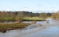
 River Wye in flood - geograph.org.uk - 1131089.jpg 640 × 447; 105 KB
-
 Road junction, Pontshill - geograph.org.uk - 1116405.jpg 640 × 480; 81 KB
-
 Seat on the hills - geograph.org.uk - 1100747.jpg 640 × 427; 274 KB
-
 Seven rebuilds - geograph.org.uk - 1111053.jpg 640 × 425; 100 KB
-
 Shallow brook, Pontshill - geograph.org.uk - 1116409.jpg 480 × 640; 162 KB
-
 Sheep in winter pasture - geograph.org.uk - 1116424.jpg 640 × 480; 107 KB
-
 Short footpath to the B4224 - geograph.org.uk - 1135317.jpg 640 × 425; 92 KB
-
 Signs of recent rain - geograph.org.uk - 1135372.jpg 480 × 640; 118 KB
-

-
 Sodden ground - geograph.org.uk - 1135420.jpg 640 × 480; 111 KB
-
 St Peter's church, Hereford - geograph.org.uk - 1138967.jpg 426 × 640; 50 KB
-
 St. Michael and All Angels - geograph.org.uk - 1108400.jpg 427 × 640; 253 KB
-
 Stile near Coldwell Rocks - geograph.org.uk - 1101035.jpg 640 × 481; 219 KB
-
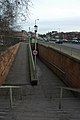 Subway under Wall Street, Hereford - geograph.org.uk - 1138105.jpg 426 × 640; 62 KB
-
 Subway under Wall Street, Hereford - geograph.org.uk - 1138108.jpg 426 × 640; 65 KB
-
 The B4399 at Dinedor - geograph.org.uk - 1136759.jpg 640 × 426; 62 KB
-
 The end of Lakeside Drive, Ross-on-Wye - geograph.org.uk - 1132968.jpg 640 × 480; 234 KB
-
 The Lady Chapel, Hereford Cathedral - geograph.org.uk - 1138977.jpg 426 × 640; 70 KB
-

-
 The phone box at Bromsash - geograph.org.uk - 1121257.jpg 640 × 480; 229 KB
-
 The Preston Brook - geograph.org.uk - 1108269.jpg 640 × 427; 293 KB
-
 The Royal Oak Inn - geograph.org.uk - 1108231.jpg 640 × 450; 264 KB
-
 The steep section of Wye Street - geograph.org.uk - 1127303.jpg 640 × 446; 74 KB
-
 They're chopping down trees - geograph.org.uk - 1135411.jpg 640 × 480; 193 KB
-
 Three Trees, Little Marcle - geograph.org.uk - 1105502.jpg 640 × 459; 287 KB
-
 Towards Coldwell Rocks - geograph.org.uk - 1101047.jpg 640 × 479; 187 KB
-
 Town and Country Trail, Ross-on-Wye - geograph.org.uk - 1133008.jpg 640 × 480; 231 KB
-
 Town and Country Trail, Ross-on-Wye - geograph.org.uk - 1133022.jpg 640 × 480; 224 KB
-
 Trees at Rotherwas - geograph.org.uk - 1136519.jpg 640 × 426; 95 KB
-
 Trees on Coppet Hill - geograph.org.uk - 1101020.jpg 640 × 481; 240 KB
-
 Triangulation pillar, Coppet Hill - geograph.org.uk - 1100904.jpg 640 × 481; 128 KB
-
 Turn right for Howle Hill - geograph.org.uk - 1128524.jpg 640 × 481; 99 KB
-
 View across the Rudhall Valley - geograph.org.uk - 1135318.jpg 640 × 464; 85 KB
-
 View of Aston Crews in muted tones - geograph.org.uk - 1127376.jpg 640 × 444; 68 KB
-
 View of Goodrich from Coppett Hill - geograph.org.uk - 1047912.jpg 640 × 441; 187 KB
-
 View of the Penyard - geograph.org.uk - 1116411.jpg 640 × 480; 156 KB
-
 View of the Penyard - geograph.org.uk - 1116421.jpg 640 × 480; 121 KB
-
 View over farmland to Aston Crews - geograph.org.uk - 1135321.jpg 640 × 401; 130 KB
-
 View over Symonds Yat West - geograph.org.uk - 1117516.jpg 640 × 480; 175 KB
-
 View to the Penyard - geograph.org.uk - 1132460.jpg 640 × 480; 199 KB
-
 View towards The Skirrid - geograph.org.uk - 1128304.jpg 640 × 480; 175 KB
-
-
 View West towards the Penyard - geograph.org.uk - 1135377.jpg 640 × 454; 86 KB
-
 Wall on Gloucester Road - geograph.org.uk - 1109627.jpg 640 × 427; 94 KB
-
 Warren Farm from Aston Crews - geograph.org.uk - 1135367.jpg 640 × 480; 141 KB
-
 West End Cottage, Pembridge - geograph.org.uk - 1105063.jpg 640 × 383; 59 KB
-

-
 Wharton Farm - geograph.org.uk - 1124539.jpg 640 × 436; 81 KB
-
 Widemarsh Brook - geograph.org.uk - 1143908.jpg 426 × 640; 109 KB
-

-
 Wye Street, Ross-on-Wye - geograph.org.uk - 1133542.jpg 640 × 480; 206 KB
-
 Wye Valley Walk - geograph.org.uk - 1128803.jpg 640 × 481; 155 KB
-
 Arable land beside Brick Kiln Wood - geograph.org.uk - 1132637.jpg 640 × 426; 89 KB
-
 Flaming birches - geograph.org.uk - 1127369.jpg 480 × 640; 119 KB


_-_geograph.org.uk_-_1113248.jpg)


