Category:Japanese-language maps of Japan
Jump to navigation
Jump to search
Countries of Asia: People's Republic of China · Japan · Mongolia · Russia‡ · South Korea
‡: partly located in Asia
‡: partly located in Asia
日本語: 日本語で表記された日本の地図
한국어: 일본의 지도 (일본어)
中文(繁體):日語日本地圖
中文(简体):日语日本地图
Subcategories
This category has the following 11 subcategories, out of 11 total.
Media in category "Japanese-language maps of Japan"
The following 200 files are in this category, out of 289 total.
(previous page) (next page)-
-

-

-
 Chikyu zenzu.JPG 326 × 326; 70 KB
-
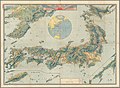
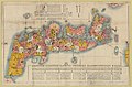
 Illustrated general route map of three countries (14590511136).jpg 2,500 × 1,764; 1.2 MB
-

-
-

-
 1849 Japanese Map of Edo or Tokyo, Japan - Geographicus - Edo-tokyo-1849.jpg 6,000 × 4,892; 9.26 MB
-
 1850 Edo Period Woodcut Map of Edo or Tokyo, Japan - Geographicus - EdoSm-japan-1850.jpg 4,000 × 3,523; 3.07 MB
-
 1871 (Meiji 4) Woodblock Map of Japan - Geographicus - Japan-meiji4-1871.jpg 5,000 × 4,322; 3.53 MB
-

-
 1880s Meiji Japanese Folding Map of Japan - Geographicus - Japan-meiji-1880.jpg 3,580 × 5,000; 5.56 MB
-

-
 1901 Japanese View and Map of Nikko, Japan - Geographicus - Nikko-japan-1901.jpg 4,000 × 2,872; 4.54 MB
-
 1925 Taisho 14 Japanese Panoramic Map of Nikko - Geographicus - Nikko-taisho14-1925.jpg 3,500 × 1,299; 836 KB
-

-
 23Tokyo.png 2,293 × 2,084; 252 KB
-
 Akashi Honmachi 明石本町 DSCF2139.jpg 2,048 × 1,360; 631 KB
-
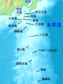
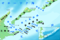
 Amami Islands-ja.png 1,500 × 1,540; 376 KB
-
 Battle of Shiroyama map.jpg 1,200 × 910; 357 KB
-
 Bungen Edo ōezu (14131877845).jpg 2,336 × 2,000; 2.47 MB
-
 Bungen kaiho On'edo ezu (14212962163).jpg 2,309 × 2,000; 2.15 MB
-
 Chūō Shinkansen map ja.png 1,070 × 320; 95 KB
-
 Daito islands ja.png 1,458 × 884; 304 KB
-
 Daito-shoto.png 489 × 507; 543 KB
-
 Delta01.png 455 × 323; 8 KB
-
 Delta02.PNG 455 × 323; 27 KB
-
 Dochu Mitte.jpg 6,748 × 1,484; 4.5 MB
-
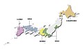
 Eight regions of Japan (ja).svg 1,397 × 1,593; 466 KB
-
 Eight regions of japan2 tohoku.png 500 × 600; 19 KB
-
 Eight regions of japan3 kanto.png 500 × 400; 22 KB
-
 Eight regions of japan4 chubu.png 500 × 500; 27 KB
-
 Eight regions of japan5 kinki.png 500 × 300; 23 KB
-
 Eight regions of japan6 chugoku.png 500 × 400; 16 KB
-
 Eight regions of japan7 shikoku.png 500 × 300; 17 KB
-
 Eight regions of japan8 kyusyu.png 500 × 600; 27 KB
-
 Empire-of-Japan-Topographic-Map-大日本帝国の地形図-1918.jpg 8,922 × 6,522; 23.47 MB
-
 Engelbert Kaempfer, Het Koninkryk Japan verdeelt in acht en zestig Provintien (FL37251715 2469306).jpg 15,902 × 13,214; 279.04 MB
-
 Engelbert Kaempfer, Imperium Iaponicum In Sexaginta Et Octo Provincias Divisum (FL37098963 2469349).jpg 14,494 × 11,766; 230.49 MB
-
 Eniwa gold mine Map.jpg 2,621 × 1,577; 401 KB
-
 ENIWA Park orienteering map.jpg 4,819 × 6,874; 3.07 MB
-
 Explanation of the earthquake (14942869109).jpg 1,466 × 2,000; 1.33 MB
-
 Fukuoka and hakata.png 604 × 284; 40 KB
-
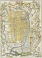
 General map of Yamashiro (14419871653).jpg 2,500 × 1,762; 1.17 MB
-
 Geofeatures map of Chubu Japan ja.svg 1,080 × 1,200; 4.26 MB
-
 Geofeatures map of Chugoku Japan ja.svg 1,500 × 900; 3.76 MB
-
 Geofeatures map of Hokkaido Japan ja.svg 1,720 × 1,593; 1.83 MB
-
 Geofeatures map of Japan ja.svg 2,322 × 2,107; 3.7 MB
-
 Geofeatures map of Kansai Japan ja.svg 1,100 × 1,100; 3.86 MB
-
 Geofeatures map of Kanto Japan ja.svg 700 × 700; 1.94 MB
-
 Geofeatures map of Kyushu Japan ja.svg 701 × 882; 2.47 MB
-
 Geofeatures map of Shikoku Japan ja.svg 1,246 × 960; 2.95 MB
-
 Geofeatures map of Tohoku Japan ja.svg 1,000 × 1,400; 4.05 MB
-
 Gulf Miyako 02.jpg 1,244 × 758; 489 KB
-
 GunmaMapCurrent ja.png 1,081 × 901; 44 KB
-
 Hakone Ekiden Course Map jp.jpg 3,072 × 2,304; 860 KB
-
 Hankyu Arashiyama sta. Bus Stops.png 413 × 469; 14 KB
-
 Hanshinkan.png 1,040 × 780; 23 KB
-
 HirosimakitaJCT Setumei.PNG 402 × 336; 6 KB
-
 HirosimakitaJCT Setumei2.PNG 402 × 336; 7 KB
-
 Hokkaidomap-jp.png 774 × 643; 340 KB
-
 Horikawabus yokoyamalinemap.jpg 568 × 618; 33 KB
-
 Houjouheiya and nadate and sima.jpg 1,738 × 1,385; 955 KB
-
 Ishinomaki mizuosi.jpg 1,100 × 683; 131 KB
-
 Itinerary map of Pilgrimage to Saikoku's 33 temples (14775442787).jpg 2,236 × 2,000; 2.1 MB
-

-
 Iwaionsenline after 800.jpg 800 × 500; 223 KB
-
 Iwaionsenline befor 800.jpg 800 × 457; 164 KB
-
 Iwakigawa-river-basin-outline.jpg 888 × 887; 354 KB
-
 Iwakigawa-river-downstream-outline.jpg 300 × 439; 116 KB
-
 Iwakigawa-river-Hirakawa-basin-outline.jpg 300 × 199; 61 KB
-
 Iwakigawa-river-upstream-outline.jpg 300 × 230; 67 KB
-
 Izu islands.png 300 × 400; 30 KB
-
 Izu-Islands-Japanese-Map.png 1,257 × 1,409; 655 KB
-
 Ja-map-ja.png 329 × 353; 37 KB
-
 Japan (FL37251688 2469225).jpg 28,425 × 10,005; 426.85 MB
-
 Japan glaciation.png 1,003 × 1,129; 248 KB
-
 JapanluteranDiocese.jpg 700 × 417; 85 KB
-
 JONF-TV Analog TV Area 1960.jpg 289 × 354; 55 KB
-
 Kaisei Nagasaki zu (IA kaiseinagasakizu00hass).pdf 264 × 393, 3 pages; 730 KB
-
 Kameido.png 600 × 645; 51 KB
-
 Kaminogeeki mosikizu 300pt.png 300 × 200; 2 KB
-
 Kamo 20220702174824 (52268744788).jpg 4,032 × 3,024; 3.41 MB
-
 KanagawaMapCurrent ja.png 1,281 × 801; 147 KB
-
 Kanitamachi junkanbus rosenzu.jpg 2,049 × 1,476; 214 KB
-
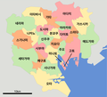
 Kantomap-jp.png 585 × 554; 307 KB
-
 Karamatu-dake.jpg 500 × 576; 339 KB
-
 Karatsushinaisen.png 640 × 480; 23 KB
-
 Kashiwa Airfield.png 1,164 × 958; 300 KB
-
 Kashiwa airfield.png 963 × 586; 150 KB
-
 Kawaguchiko-Fujiyoshida.png 175 × 136; 3 KB
-
 Keio map japanese version.png 1,536 × 460; 396 KB
-
 Kerama Islands map.jpg 872 × 551; 191 KB
-
 Kinki-jp.png 642 × 463; 268 KB
-
 Kita-Kinki-Map.PNG 443 × 314; 11 KB
-
 KitaOsakaCycleLineMap.png 559 × 501; 49 KB
-
 KoBandai-old1.jpg 529 × 784; 216 KB
-
 KoutsuSeisakuShigikai198 Tokyo.png 3,937 × 3,325; 726 KB
-
 Kume-jima map.jpg 724 × 392; 115 KB
-
 Kuni rebus 2.jpg 3,497 × 2,492; 2.25 MB
-
 Kyoto Prefecture-Bureau.PNG 432 × 390; 10 KB
-
 Kyushu-jp.png 631 × 1,120; 385 KB
-
 Labeled administrative map of Hokkaido prefecture.svg 1,080 × 920; 727 KB
-
 Licence plates area in Mie prefecture.png 647 × 941; 60 KB
-
 Licence plates area in Osaka prefecture.png 489 × 679; 42 KB
-
 License plates area in Mie prefecture ver. 2020.png 2,020 × 2,940; 253 KB
-
 Location of Kyobashi Bridge.png 600 × 454; 101 KB
-
 Location of Tosu Jct ja.png 600 × 765; 35 KB
-
 Location-of-Awaji-island-ja.png 640 × 480; 96 KB
-
 Location-of-Liancourt-rocks-ja.png 640 × 320; 59 KB
-
 Location-of-Sadogashima-island-ja.png 400 × 400; 15 KB
-
 LocMap of WH Ancient Nara 2.png 369 × 398; 10 KB
-
 LocMap of WH Kii Mountain Range 2.png 369 × 398; 10 KB
-
 LocMap of WH Kii Mountain Range.png 369 × 398; 12 KB
-
 LocMap of WH Shirakami-Sanchi (2).png 369 × 398; 10 KB
-
 LocMap of WH Shiretoko.png 369 × 398; 4 KB
-
 LocMap of WH Shrines and Temples of Nikko.png 369 × 398; 10 KB
-
 Map Chiba ja.png 981 × 801; 38 KB
-
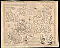
 Map of all the provinces of Great Japan, enlarged in Kaei period (14961993135).jpg 2,500 × 1,242; 1.45 MB
-
 Map of Edo (15206523500).jpg 2,500 × 1,811; 2.24 MB
-
 Map of Edo (15206622438).jpg 2,500 × 1,978; 2.22 MB
-
 Map of Japan (14330134144).jpg 2,500 × 1,649; 1.36 MB
-
 Map of Japan without place names (15206523720).jpg 2,500 × 1,291; 831 KB
-
 Map of license plates in Aichi Japan.svg 539 × 484; 177 KB
-
 Map of license plates in Akita Japan.svg 500 × 780; 25 KB
-
 Map of license plates in Aomori Japan.svg 800 × 770; 91 KB
-
 Map of license plates in Chiba Japan.svg 446 × 570; 192 KB
-
 Map of license plates in Ehime Japan.svg 725 × 725; 35 KB
-
 Map of license plates in Fukui Japan.svg 680 × 580; 23 KB
-
 Map of license plates in Fukuoka Japan.svg 498 × 526; 136 KB
-
 Map of license plates in Fukushima Japan.svg 640 × 512; 139 KB
-
 Map of license plates in Gifu Japan.svg 660 × 780; 36 KB
-
 Map of license plates in Gunma Japan.svg 501 × 523; 34 KB
-
 Map of license plates in Hiroshima Japan.svg 780 × 700; 29 KB
-
 Map of license plates in Hokkaido Japan.svg 800 × 500; 85 KB
-
 Map of license plates in Hyogo Japan.svg 520 × 770; 35 KB
-
 Map of license plates in Ibaraki Japan.svg 560 × 700; 30 KB
-
 Map of license plates in Ishikawa Japan.svg 550 × 850; 27 KB
-
 Map of license plates in Iwate Japan.svg 400 × 604; 62 KB
-
 Map of license plates in Kagawa Japan.svg 615 × 455; 19 KB
-
 Map of license plates in Kagoshima Japan.svg 395 × 777; 58 KB
-
 Map of license plates in Kanagawa Japan.svg 582 × 431; 90 KB
-
 Map of license plates in Kochi Japan.svg 785 × 625; 25 KB
-
 Map of license plates in Kumamoto Japan.svg 527 × 497; 25 KB
-
 Map of license plates in Kyoto Japan.svg 590 × 640; 31 KB
-
 Map of license plates in Mie Japan.svg 460 × 720; 35 KB
-
 Map of license plates in Miyagi Japan.svg 600 × 680; 27 KB
-
 Map of license plates in Miyazaki Japan.svg 411 × 596; 17 KB
-
 Map of license plates in Nagano Japan.svg 393 × 608; 138 KB
-
 Map of license plates in Nagasaki Japan.svg 543 × 499; 84 KB
-
 Map of license plates in Nara Japan.svg 440 × 700; 30 KB
-
 Map of license plates in Niigata Japan.svg 509 × 515; 80 KB
-
 Map of license plates in Oita Japan.svg 555 × 550; 19 KB
-
 Map of license plates in Okayama Japan.svg 450 × 490; 45 KB
-
 Map of license plates in Okinawa Japan.svg 800 × 579; 29 KB
-
 Map of license plates in Osaka Japan.svg 490 × 690; 34 KB
-
 Map of license plates in Saga Japan.svg 515 × 520; 25 KB
-
 Map of license plates in Saitama Japan.svg 628 × 360; 207 KB
-
 Map of license plates in Shiga Japan.svg 390 × 610; 20 KB
-
 Map of license plates in Shimane Japan.svg 610 × 580; 61 KB
-
 Map of license plates in Shizuoka Japan.svg 571 × 446; 146 KB
-
 Map of license plates in Tochigi Japan.svg 460 × 560; 72 KB
-
 Map of license plates in Tokushima Japan.svg 715 × 530; 22 KB
-
 Map of license plates in Tokyo Japan.svg 800 × 610; 54 KB
-
 Map of license plates in Tottori Japan.svg 740 × 380; 22 KB
-
 Map of license plates in Toyama Japan.svg 560 × 600; 19 KB
-
 Map of license plates in Wakayama Japan.svg 565 × 630; 29 KB
-
 Map of license plates in Yamagata Japan.svg 460 × 760; 26 KB
-
 Map of license plates in Yamaguchi Japan.svg 572 × 444; 30 KB
-
 Map of license plates in Yamanashi Japan.svg 503 × 521; 34 KB
-
 Map of Nemuro-Kunashiri Strait ja.svg 960 × 640; 538 KB
-
 Map of ogasawara islands ja.png 1,011 × 798; 246 KB
-
 Map of Ryūkyū Kingdom from Chūzan Seifu.jpg 1,280 × 1,054; 141 KB
-
 Map of Toba Port, Mie.jpg 1,007 × 964; 133 KB
-
 Map tokyo 3tama p01-01.png 360 × 180; 4 KB
-
 Megu.png 924 × 845; 125 KB
-
 Megu2.png 1,007 × 846; 142 KB
-
 Megumino douro.JPG 738 × 643; 77 KB
-
 Megumino ichi.JPG 577 × 620; 41 KB
-
 Megumino kukaku.jpg 740 × 639; 121 KB
-
 Megumino.JPG 771 × 595; 55 KB
-
 Megumino1975.JPG 687 × 661; 61 KB
-
 Miyuki Road Map 2013.png 544 × 863; 117 KB
-
 Ms-Languages-of-India-600w-01.jpg 600 × 680; 71 KB
-
 Mushima Island in Japan.png 2,220 × 776; 27 KB
-
 Nagasaki Hashima map ja.png 2,400 × 2,400; 279 KB
-
 Nagasaki1801.jpg 637 × 447; 273 KB
-
 Nagoya 20160816A.png 3,322 × 3,218; 297 KB
-
 Nagoya Shiden Route Map 01.PNG 910 × 960; 58 KB
-
 Nagoya Shiden Route Map 02.png 910 × 960; 64 KB
-
 Nakayama tunnel first route change map ja.png 1,926 × 948; 152 KB
-
 Nakayama tunnel second route change map ja.png 1,931 × 758; 176 KB
-
 Nakayama tunnel Shihougi division detour tunnel map ja.png 1,242 × 407; 66 KB
-
 NihonSankei.png 894 × 767; 354 KB
-
 Nishinezeki.jpg 1,233 × 819; 113 KB
-
 Nishitetsu bus Kurume Yoshii branch route map.png 1,376 × 453; 72 KB
-
 NishitetsuBusKurume-3-2.svg 336 × 821; 41 KB
-
 NishitetsuBusKurumeHonsha-3.jpg 323 × 557; 26 KB
-
 Nobu3withfoxy IMG 1151 (21866201160).jpg 2,738 × 1,825; 3.49 MB
_Japanese_Map_of_Kyoto,_Japan_-_Geographicus_-_Kyoto-genroku9-1696.jpg)
_-_Viro_Perillustri..._-_btv1b8492400j.jpg)
,_NG-501-87.jpg)

.jpg)

_-_Geographicus_-_IsuIslands-japanese-1730.jpg)


_Woodblock_Map_of_Japan_-_Geographicus_-_Japan-meiji4-1871.jpg)


_-_Geographicus_-_Kyoto4Maps2-yoshida-1928.jpg)


.jpg)
.jpg)


.svg)


.jpg)
.jpg)


.jpg)

.jpg)


.jpg)
.jpg)


.jpg)


.png)


.jpg)
.jpg)
.jpg)
.jpg)
.jpg)


.jpg)
.jpg)